

Excessive Rainfall Possible for the Gulf Coast and Florida; October Heat Wave in California

A slow moving front will be the focus area for heavy to excessive rainfall and a threat for flash/urban flooding across parts of the Gulf Coast into central/northern Florida early this week. Abnormally hot, potentially record-breaking, temperatures will continue for southern California and stretch north toward the Bay Area and Central Valley this week. Read More >

Current conditions at

Delta Junction/Ft Greely, Allen Army Airfield (PABI)

Lat: 64°NLon: 145.73°WElev: 1276ft.
Mostly Cloudy

39°F

4°C

Humidity 76%
Wind Speed E 14 G 23 mph
Barometer 29.19 in (990.0 mb)
Dewpoint 32°F (0°C)
Visibility 10.00 mi
Wind Chill31°F (-1°C)
Last update 5 Oct 4:53 am AKDT
Extended Forecast for

10 Miles S Donnelly AK

  • Overnight

    Overnight: Rain and snow.  Low around 34. South wind around 15 mph.  Chance of precipitation is 80%. Little or no snow accumulation expected.

    Low: 34 °F

    Rain/Snow

  • Monday

    Monday: Rain and snow, becoming all rain after 4pm.  High near 38. South wind around 15 mph, with gusts as high as 30 mph.  Chance of precipitation is 80%. Little or no snow accumulation expected.

    High: 38 °F

    Rain/Snow

  • Monday Night

    Monday Night: Rain before 10pm, then rain and snow likely.  Low around 32. South wind 10 to 15 mph.  Chance of precipitation is 80%. New snow accumulation of less than a half inch possible.

    Low: 32 °F

    Rain/Snow

  • Tuesday

    Tuesday: Snow likely before 1pm, then rain and snow likely.  Mostly cloudy, with a high near 38. South wind around 5 mph.  Chance of precipitation is 60%. New snow accumulation of less than a half inch possible.

    High: 38 °F

    Snow Likely
    then
    Rain/Snow
    Likely

  • Tuesday Night

    Tuesday Night: Rain and snow likely, becoming all snow after 7pm.  Mostly cloudy, with a low around 31. South wind around 5 mph becoming calm.  Chance of precipitation is 70%. New snow accumulation of less than a half inch possible.

    Low: 31 °F

    Rain/Snow
    Likely then
    Snow Likely

  • Wednesday

    Wednesday: Snow.  High near 37. Chance of precipitation is 80%. New snow accumulation of less than one inch possible.

    High: 37 °F

    Snow

  • Wednesday Night

    Wednesday Night: Snow likely, mainly before 7pm.  Mostly cloudy, with a low around 28. Chance of precipitation is 60%.

    Low: 28 °F

    Snow Likely

  • Thursday

    Thursday: Partly sunny, with a high near 34.

    High: 34 °F

    Partly Sunny

  • Thursday Night

    Thursday Night: Mostly cloudy, with a low around 23.

    Low: 23 °F

    Mostly Cloudy

Detailed Forecast

Overnight
Rain and snow. Low around 34. South wind around 15 mph. Chance of precipitation is 80%. Little or no snow accumulation expected.
Monday
Rain and snow, becoming all rain after 4pm. High near 38. South wind around 15 mph, with gusts as high as 30 mph. Chance of precipitation is 80%. Little or no snow accumulation expected.
Monday Night
Rain before 10pm, then rain and snow likely. Low around 32. South wind 10 to 15 mph. Chance of precipitation is 80%. New snow accumulation of less than a half inch possible.
Tuesday
Snow likely before 1pm, then rain and snow likely. Mostly cloudy, with a high near 38. South wind around 5 mph. Chance of precipitation is 60%. New snow accumulation of less than a half inch possible.
Tuesday Night
Rain and snow likely, becoming all snow after 7pm. Mostly cloudy, with a low around 31. South wind around 5 mph becoming calm. Chance of precipitation is 70%. New snow accumulation of less than a half inch possible.
Wednesday
Snow. High near 37. Chance of precipitation is 80%. New snow accumulation of less than one inch possible.
Wednesday Night
Snow likely, mainly before 7pm. Mostly cloudy, with a low around 28. Chance of precipitation is 60%.
Thursday
Partly sunny, with a high near 34.
Thursday Night
Mostly cloudy, with a low around 23.
Friday
Mostly sunny, with a high near 32.
Friday Night
Areas of blowing snow. Partly cloudy, with a low around 26.
Saturday
A chance of snow. Areas of blowing snow. Partly sunny, with a high near 36.
Saturday Night
A chance of snow. Areas of blowing snow. Mostly cloudy, with a low around 32.
Sunday
A chance of rain and snow. Mostly cloudy, with a high near 40.
Basemap Options
Click map to change the forecast location
Loading map...

ABOUT THIS FORECAST

 
Point Forecast:
10 Miles S Donnelly AK
 63.53°N 145.85°W (Elev. 2382 ft)
5:16 am AKDT Oct 5, 2026
5am AKDT Oct 5, 2026-6pm AKDT Oct 11, 2026
 
Get as KML Get as XML

Additional Resources

Radar & Satellite Image
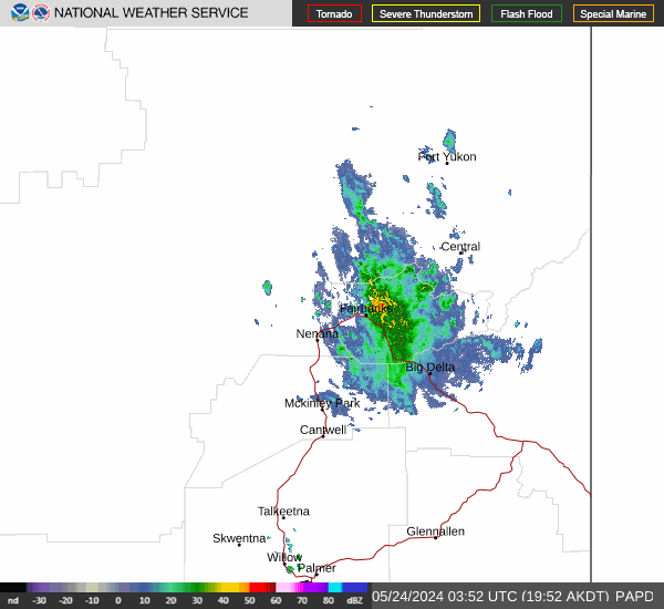
Link to Local Radar Data Link to Satellite Data

Hourly Weather Forecast

National Digital Forecast Database



