

Extreme Heat Across the Southern U.S.; Severe Thunderstorms and Heavy Rain in the Plains and Mississippi Valley

A heat wave over the Southwest will intensify late week, peaking and expanding into the Intermountain West and northern High Plains this weekend. Severe thunderstorms and heavy rain are expected over portions of the Plains and Mississippi Valley tonight, which will shift to parts of the Upper Midwest and mid-Mississippi Valley Friday. Monsoonal showers and flooding persist in the Desert Southwest. Read More >

Current conditions at

Ralph Wien Memorial Airport (PAOT)

Lat: 66.89°NLon: 162.61°WElev: 16ft.

A Few Clouds

58°F

14°C

Humidity 81%
Wind Speed E 10 mph
Barometer 29.91 in (1012.8 mb)
Dewpoint 52°F (11°C)
Visibility 10.00 mi
Last update 30 Jul 9:53 pm AKDT
Extended Forecast for

14 Miles WNW Sheshalik AK

  • Tonight

    Tonight: Showers likely, mainly after 1am.  Cloudy, with a low around 54. Southeast wind around 10 mph.  Chance of precipitation is 60%.

    Low: 54 °F

    Showers
    Likely

  • Friday

    Friday: Showers likely, mainly after 4pm.  Cloudy, with a high near 65. South wind around 10 mph.  Chance of precipitation is 60%.

    High: 65 °F

    Showers
    Likely

  • Friday Night

    Friday Night: Showers likely, mainly before 7pm.  Cloudy, with a low around 54. Southeast wind around 5 mph becoming calm  in the evening.  Chance of precipitation is 60%.

    Low: 54 °F

    Showers
    Likely

  • Saturday

    Saturday: Scattered showers.  Cloudy, with a high near 64. Southwest wind around 5 mph.  Chance of precipitation is 40%.

    High: 64 °F

    Scattered
    Showers

  • Saturday Night

    Saturday Night: Scattered showers.  Mostly cloudy, with a low around 54. Southwest wind around 5 mph becoming calm  in the evening.  Chance of precipitation is 30%.

    Low: 54 °F

    Scattered
    Showers

  • Sunday

    Sunday: Isolated showers.  Mostly cloudy, with a high near 67. Chance of precipitation is 20%.

    High: 67 °F

    Isolated
    Showers

  • Sunday Night

    Sunday Night: Scattered showers.  Cloudy, with a low around 56. Chance of precipitation is 40%.

    Low: 56 °F

    Scattered
    Showers

  • Monday

    Monday: Showers likely, mainly after 4pm.  Cloudy, with a high near 70.

    High: 70 °F

    Showers
    Likely

  • Monday Night

    Monday Night: Showers likely, mainly before 10pm.  Cloudy, with a low around 57.

    Low: 57 °F

    Showers
    Likely

Detailed Forecast

Tonight
Showers likely, mainly after 1am. Cloudy, with a low around 54. Southeast wind around 10 mph. Chance of precipitation is 60%.
Friday
Showers likely, mainly after 4pm. Cloudy, with a high near 65. South wind around 10 mph. Chance of precipitation is 60%.
Friday Night
Showers likely, mainly before 7pm. Cloudy, with a low around 54. Southeast wind around 5 mph becoming calm in the evening. Chance of precipitation is 60%.
Saturday
Scattered showers. Cloudy, with a high near 64. Southwest wind around 5 mph. Chance of precipitation is 40%.
Saturday Night
Scattered showers. Mostly cloudy, with a low around 54. Southwest wind around 5 mph becoming calm in the evening. Chance of precipitation is 30%.
Sunday
Isolated showers. Mostly cloudy, with a high near 67. Chance of precipitation is 20%.
Sunday Night
Scattered showers. Cloudy, with a low around 56. Chance of precipitation is 40%.
Monday
Showers likely, mainly after 4pm. Cloudy, with a high near 70.
Monday Night
Showers likely, mainly before 10pm. Cloudy, with a low around 57.
Tuesday
Scattered showers. Cloudy, with a high near 70.
Tuesday Night
Scattered showers. Mostly cloudy, with a low around 57.
Wednesday
Isolated showers. Partly sunny, with a high near 69.
Wednesday Night
A chance of showers. Mostly cloudy, with a low around 52.
Thursday
A chance of showers. Mostly cloudy, with a high near 64.
Basemap Options
Click map to change the forecast location
Loading map...

ABOUT THIS FORECAST

 
Point Forecast:
14 Miles WNW Sheshalik AK
 67.08°N 163.28°W (Elev. 3 ft)
10:16 pm AKDT Jul 30, 2026
10pm AKDT Jul 30, 2026-6pm AKDT Aug 6, 2026
 
Get as KML Get as XML

Additional Resources

Radar & Satellite Image
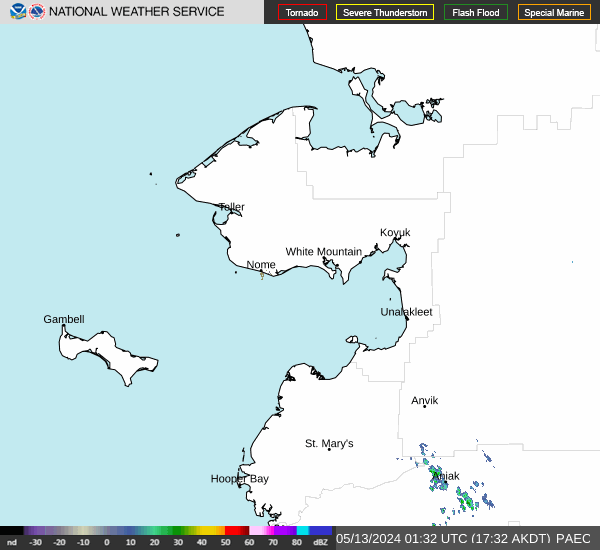
Link to Local Radar Data Link to Satellite Data

Hourly Weather Forecast

National Digital Forecast Database



