

Significant Coastal Impacts from Nor'Easter; Hurricane Nolo Bring Gusty Winds and Heavy Rain to Hawaii

A nor'easter will continue to bring significant coastal impacts to the Mid-Atlantic and New England into Monday. Moderate to major coastal flooding, heavy rain, strong winds, and high surf are expected. Hurricane Nolo will remain south of the Big Island of Hawaii with gusty winds and heavy rainfall that may bring significant, life-threatening flooding and mudslides through the weekend. Read More >

Current conditions at

Page, Page Municipal Airport (KPGA)

Lat: 36.92056°NLon: 111.44806°WElev: 4311.0ft.

Clear

81°F

27°C

Humidity 21%
Wind Speed SSW 3 MPH
Barometer 30.03 in (1016.93 mb)
Dewpoint 37°F (3°C)
Visibility 10.00 mi
Heat Index79°F (26°C)
Last update 26 Sep 07:20 PM MST
Extended Forecast for

16 Miles SW Glen Canyon UT

Flood Watch September 27, 11:00pm until September 29, 11:00pm
Click here for hazard details and duration
Flood Watch
  • Tonight

    Tonight: Mostly cloudy, with a low around 57. West wind 3 to 6 mph.

    Low: 57 °F

    Mostly Cloudy

  • Sunday

    Sunday: Mostly cloudy, with a high near 77. Calm wind becoming southwest 5 to 8 mph in the afternoon.

    High: 77 °F

    Mostly Cloudy

  • Sunday Night

    Sunday Night: A 20 percent chance of showers after 11pm.  Mostly cloudy, with a low around 53. South wind 5 to 8 mph.

    Low: 53 °F

    Slight Chance
    Showers

  • Monday

    Monday: Showers likely, then showers and possibly a thunderstorm after 11am.  High near 65. Southeast wind around 7 mph.  Chance of precipitation is 90%.

    High: 65 °F

    Showers

  • Monday Night

    Monday Night: Showers and possibly a thunderstorm before 2am, then showers likely.  Low around 49. Southwest wind around 6 mph becoming northeast after midnight.  Chance of precipitation is 90%.

    Low: 49 °F

    Showers

  • Tuesday

    Tuesday: Showers likely, with thunderstorms also possible after 8am.  Mostly cloudy, with a high near 64. Northeast wind 6 to 8 mph.  Chance of precipitation is 70%.

    High: 64 °F

    Showers
    Likely

  • Tuesday Night

    Tuesday Night: A 50 percent chance of showers and thunderstorms.  Mostly cloudy, with a low around 48. Light and variable wind becoming northwest around 6 mph in the evening.

    Low: 48 °F

    Chance
    T-storms then
    Chance
    Showers

  • Wednesday

    Wednesday: A 20 percent chance of showers before 11am.  Mostly sunny, with a high near 71. West wind 5 to 7 mph becoming calm  in the morning.

    High: 71 °F

    Slight Chance
    Showers then
    Sunny

  • Wednesday Night

    Wednesday Night: Clear, with a low around 50. Light west wind.

    Low: 50 °F

    Clear

Detailed Forecast

Tonight
Mostly cloudy, with a low around 57. West wind 3 to 6 mph.
Sunday
Mostly cloudy, with a high near 77. Calm wind becoming southwest 5 to 8 mph in the afternoon.
Sunday Night
A 20 percent chance of showers after 11pm. Mostly cloudy, with a low around 53. South wind 5 to 8 mph.
Monday
Showers likely, then showers and possibly a thunderstorm after 11am. High near 65. Southeast wind around 7 mph. Chance of precipitation is 90%.
Monday Night
Showers and possibly a thunderstorm before 2am, then showers likely. Low around 49. Southwest wind around 6 mph becoming northeast after midnight. Chance of precipitation is 90%.
Tuesday
Showers likely, with thunderstorms also possible after 8am. Mostly cloudy, with a high near 64. Northeast wind 6 to 8 mph. Chance of precipitation is 70%.
Tuesday Night
A 50 percent chance of showers and thunderstorms. Mostly cloudy, with a low around 48. Light and variable wind becoming northwest around 6 mph in the evening.
Wednesday
A 20 percent chance of showers before 11am. Mostly sunny, with a high near 71. West wind 5 to 7 mph becoming calm in the morning.
Wednesday Night
Clear, with a low around 50. Light west wind.
Thursday
Sunny, with a high near 76. West wind 3 to 5 mph.
Thursday Night
Clear, with a low around 51. Light southwest wind.
Friday
Sunny, with a high near 76. Southwest wind 3 to 5 mph.
Friday Night
Mostly clear, with a low around 52. Light west wind.
Saturday
Sunny, with a high near 77. Calm wind becoming northwest around 5 mph in the afternoon.
Basemap Options
Click map to change the forecast location
Loading map...

ABOUT THIS FORECAST

 
Point Forecast:
16 Miles SW Glen Canyon UT
 36.89°N 111.85°W (Elev. 6076 ft)
3:15 pm MST Sep 26, 2026
7pm MST Sep 26, 2026-6pm MST Oct 3, 2026
 
Get as KML Get as XML

Additional Resources

Radar & Satellite Image
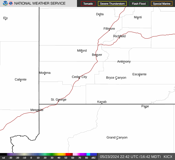
Link to Local Radar Data Link to Satellite Data

Hourly Weather Forecast

National Digital Forecast Database


