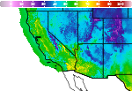
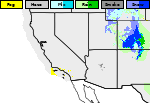
Multi-Day Heavy Rain Event in the Four Corners; Soggy Sunday Expected in Florida

A series of Pacific storm systems will bring widespread showers, heavy rain, and a flash flooding threat across the Four Corners region this weekend. Ex-Typhoon Champi will approach the Alaskan West Coast bringing localized gusty winds and heavy precipitation. A wet and unsettled weekend is expected across southern Florida with rain expected across the entire peninsula by Sunday. Read More >

Current conditions at

Reno, Reno Tahoe International Airport (KRNO)

Lat: 39.50776°NLon: 119.76819°WElev: 4403.0ft.

Overcast

48°F

9°C

Humidity 70%
Wind Speed N 0 MPH
Barometer 29.95 in (1014.22 mb)
Dewpoint 39°F (4°C)
Visibility 10.00 mi
Last update 31 Oct 11:00 AM PDT
Extended Forecast for

2 Miles SSE Reno Tahoe International Airport NV

  • Today

    Today: A chance of rain, then showers and possibly a thunderstorm after 2pm.  High near 54. South wind around 5 mph.  Chance of precipitation is 80%.

    High: 54 °F

    Showers

  • Tonight

    Tonight: Rain and possibly a thunderstorm before 2am, then a chance of rain.  Snow level 7700 feet lowering to 6200 feet after midnight . Low around 34. Calm wind.  Chance of precipitation is 90%.

    Low: 34 °F

    Rain

  • Sunday

    Sunday: A 20 percent chance of rain before 8am.  Snow level 5700 feet rising to 6400 feet in the afternoon. Partly sunny, then gradually becoming sunny, with a high near 54. Calm wind becoming north around 5 mph in the afternoon.

    High: 54 °F

    Slight Chance
    Rain then
    Sunny

  • Sunday Night

    Sunday Night: Mostly clear, with a low around 29. North wind around 5 mph becoming calm  in the evening.

    Low: 29 °F

    Mostly Clear

  • Monday

    Monday: Increasing clouds, with a high near 59. Calm wind becoming east around 5 mph.

    High: 59 °F

    Increasing
    Clouds

  • Monday Night

    Monday Night: Mostly cloudy, with a low around 33. East wind around 5 mph becoming calm.

    Low: 33 °F

    Mostly Cloudy

  • Tuesday

    Tuesday: Mostly sunny, with a high near 59.

    High: 59 °F

    Mostly Sunny

  • Tuesday Night

    Tuesday Night: Partly cloudy, with a low around 33.

    Low: 33 °F

    Partly Cloudy

  • Wednesday

    Wednesday: Mostly sunny, with a high near 59.

    High: 59 °F

    Mostly Sunny

Detailed Forecast

Today
A chance of rain, then showers and possibly a thunderstorm after 2pm. High near 54. South wind around 5 mph. Chance of precipitation is 80%.
Tonight
Rain and possibly a thunderstorm before 2am, then a chance of rain. Snow level 7700 feet lowering to 6200 feet after midnight . Low around 34. Calm wind. Chance of precipitation is 90%.
Sunday
A 20 percent chance of rain before 8am. Snow level 5700 feet rising to 6400 feet in the afternoon. Partly sunny, then gradually becoming sunny, with a high near 54. Calm wind becoming north around 5 mph in the afternoon.
Sunday Night
Mostly clear, with a low around 29. North wind around 5 mph becoming calm in the evening.
Monday
Increasing clouds, with a high near 59. Calm wind becoming east around 5 mph.
Monday Night
Mostly cloudy, with a low around 33. East wind around 5 mph becoming calm.
Tuesday
Mostly sunny, with a high near 59.
Tuesday Night
Partly cloudy, with a low around 33.
Wednesday
Mostly sunny, with a high near 59.
Wednesday Night
Partly cloudy, with a low around 32.
Thursday
Mostly sunny, with a high near 60.
Thursday Night
Partly cloudy, with a low around 32.
Friday
Mostly sunny, with a high near 61.
Basemap Options
Click map to change the forecast location
Loading map...

ABOUT THIS FORECAST

 
Point Forecast:
2 Miles SSE Reno Tahoe International Airport NV
 39.48°N 119.77°W (Elev. 4413 ft)
11:11 am PDT Oct 31, 2026
11am PDT Oct 31, 2026-6pm PST Nov 6, 2026
 
Get as KML Get as XML

Additional Resources

Radar & Satellite Image
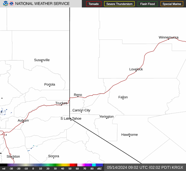
Link to Local Radar Data Link to Satellite Data

Hourly Weather Forecast

National Digital Forecast Database