


Areas of Extreme Heat and Excessive Rainfall Potential
Dangerous and extreme heat will remain across portions of the central U.S. this week, persisting across the mid to lower Mississippi Valley, Gulf Coast, southern Plains and portions of Texas. A heat wave over the Southwest U.S. will peak this weekend. Heavy to excessive rainfall may produce flash flooding from the Delmarva Peninsula north into the Hudson Valley today and tonight. Read More >
Hazardous Weather Conditions

Current conditions at
Schriever AFB (KSHM)
Lat: 38.8° N Lon: 104.52° W Elev: 6234 ft.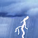
Thunderstorm in Vicinity and Breezy
88°F
31°C
| Humidity | 34% |
| Wind Speed | NE 21 G 25 mph |
| Barometer | 30.12 in (1010.2 mb) |
| Dewpoint | 56°F (13°C) |
| Visibility | 10.00 mi |
| Heat Index | 86°F (30°C) |
| Last update | 28 Jul 2:55 pm MDT |
Detailed forecast for
Colorado Springs Vicinity/Southern El Paso County/Rampart Range Below 7400 Ft
Rest Of Today
Mostly sunny with thunderstorms likely. Highs 88 to 94. Southeast winds around 10 mph. Chance of precipitation 70 percent.
Tonight
Cloudy. Thunderstorms likely until midnight, then slight chance of thunderstorms after midnight. Lows near 60. North winds around 10 mph. Chance of precipitation 70 percent.
Wednesday
Partly sunny in the morning, then cloudy with a 10 percent chance of thunderstorms in the afternoon. Highs 84 to 89. Southeast winds around 10 mph.
Wednesday Night
Cloudy. A 50 percent chance of thunderstorms until midnight. Lows near 60. Northwest winds up to 10 mph.
Thursday
Partly sunny. A 50 percent chance of thunderstorms in the afternoon. Highs 87 to 93. North winds around 10 mph.
Thursday Night
Mostly cloudy. Lows near 60.
Friday
Mostly sunny. Highs 87 to 93.
Friday Night
Partly cloudy with a 30 percent chance of thunderstorms. Lows near 60.
Saturday Through Sunday
Mostly clear. Highs 88 to 98. Lows near 60.
Sunday Night
Partly cloudy. Lows in the lower to mid 60s.
Monday
Sunny. Highs 93 to 100.
Additional Forecasts and Information
Basemap Options
Click map to change the forecast location
Loading map...
Additional Resources
Radar & Satellite Image


Hourly Weather Forecast


