Coastal Flood Warnings Extended through Tuesday and Wednesday - Updated Briefing

Strong northeasterly winds will persist at coastal locations this week. These strong winds will combine with high astronomical tides associated with the full moon to create moderate flooding during times of high tide. Coastal Flood Warnings have been extended through at least Tuesday for the Atlantic coastal counties and within the Intracoastal Waterway and the entire St. Johns River basin. Read More >

Current conditions at

Jacksonville Naval Air Station (KNIP)

Lat: 30.23°NLon: 81.67°WElev: 10ft.

Fair

65°F

18°C

Humidity 84%
Wind Speed N 12 mph
Barometer 30.16 in (1020.8 mb)
Dewpoint 60°F (16°C)
Visibility 10.00 mi
Last update 27 Oct 1:53 am EDT
Extended Forecast for

Orange Park FL

Coastal Flood Warning October 27, 02:57am until October 29, 02:00am
Click here for hazard details and duration
Coastal Flood Warning
  •  
    Coastal Flood Warning October 27, 02:57am until October 29, 02:00am

    NOW until 2:00am Thu

    Coastal Flood Warning

  • Overnight

    Low: 64 °F

    Partly Cloudy

  • Tuesday

    Tuesday: Mostly sunny, with a high near 77. Breezy, with a north wind 13 to 17 mph, with gusts as high as 26 mph.

    High: 77 °F

    Mostly Sunny
    and Breezy

  • Tuesday Night

    Tuesday Night: Partly cloudy, with a low around 67. Breezy, with a northeast wind 10 to 16 mph, with gusts as high as 24 mph.

    Low: 67 °F

    Mostly Cloudy
    and Breezy
    then Partly
    Cloudy

  • Wednesday

    Wednesday: A 20 percent chance of showers between 2pm and 3pm.  Partly sunny, with a high near 78. Windy, with a northeast wind 18 to 23 mph, with gusts as high as 28 mph.

    High: 78 °F

    Slight Chance
    Showers and
    Windy

  • Wednesday Night

    Wednesday Night: Mostly cloudy, with a low around 70. Windy, with a northeast wind 17 to 23 mph, with gusts as high as 33 mph.

    Low: 70 °F

    Mostly Cloudy
    and Windy

  • Thursday

    Thursday: A 20 percent chance of showers before 2pm.  Partly sunny, with a high near 79. Windy.

    High: 79 °F

    Slight Chance
    Showers and
    Windy

  • Thursday Night

    Thursday Night: Mostly cloudy, with a low around 70. Windy.

    Low: 70 °F

    Mostly Cloudy
    and Windy

  • Friday

    Friday: Mostly sunny, with a high near 79. Windy.

    High: 79 °F

    Mostly Sunny
    and Windy

Detailed Forecast

Overnight
Partly cloudy, with a low around 64. North wind around 11 mph, with gusts as high as 20 mph.
Tuesday
Mostly sunny, with a high near 77. Breezy, with a north wind 13 to 17 mph, with gusts as high as 26 mph.
Tuesday Night
Partly cloudy, with a low around 67. Breezy, with a northeast wind 10 to 16 mph, with gusts as high as 24 mph.
Wednesday
A 20 percent chance of showers between 2pm and 3pm. Partly sunny, with a high near 78. Windy, with a northeast wind 18 to 23 mph, with gusts as high as 28 mph.
Wednesday Night
Mostly cloudy, with a low around 70. Windy, with a northeast wind 17 to 23 mph, with gusts as high as 33 mph.
Thursday
A 20 percent chance of showers before 2pm. Partly sunny, with a high near 79. Windy.
Thursday Night
Mostly cloudy, with a low around 70. Windy.
Friday
Mostly sunny, with a high near 79. Windy.
Friday Night
Partly cloudy, with a low around 68.
Saturday
A slight chance of showers and thunderstorms, then a chance of showers after 2pm. Partly sunny, with a high near 81. Breezy. Chance of precipitation is 30%.
Saturday Night
A 30 percent chance of showers. Mostly cloudy, with a low around 68.
Sunday
A 50 percent chance of showers and thunderstorms. Partly sunny, with a high near 80.
Sunday Night
A 20 percent chance of showers and thunderstorms. Mostly cloudy, with a low around 65.
Monday
Mostly sunny, with a high near 80.
Basemap Options
Click map to change the forecast location
Loading map...

ABOUT THIS FORECAST

 
Point Forecast:
Orange Park FL
 30.16°N 81.69°W
2:21 am EDT Oct 27, 2026
2am EDT Oct 27, 2026-6pm EST Nov 2, 2026
 
Get as KML Get as XML

Additional Resources

Radar & Satellite Image
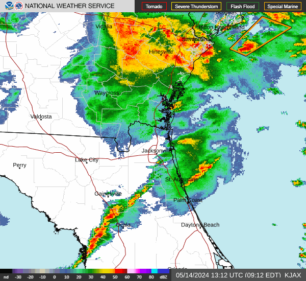
Link to Local Radar Data Link to Satellite Data

Hourly Weather Forecast

National Digital Forecast Database