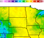
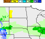
Showers and Thunderstorms from the Southern Plains into the Ohio Valley; Record Warmth in the Central U.S.

Heavy rain and widely scattered severe storms are expected over portions of the central and southern Plains into the Ohio Valley. Unseasonable warmth will continue for a few more days across the Midwest, Southeast, and Mid-Atlantic where several daily record highs could fall. Read More >

Current conditions at

Wheaton Municipal Airport (KETH)

Lat: 45.78°NLon: 96.55°WElev: 1011ft.

Overcast

48°F

9°C

Humidity 71%
Wind Speed Calm
Barometer 30.24 in
Dewpoint 39°F (4°C)
Visibility 10.00 mi
Last update 14 Oct 1:53 pm CDT
Extended Forecast for

Tintah MN

  • This Afternoon

    This Afternoon: Cloudy, with a steady temperature around 51. Calm wind.

    High: 51 °F

    Cloudy

  • Tonight

    Tonight: A slight chance of showers after 3am.  Cloudy, with a low around 41. Light east southeast wind.  Chance of precipitation is 20%.

    Low: 41 °F

    Cloudy then
    Slight Chance
    Showers

  • Thursday

    Thursday: Patchy fog before 9am.  Otherwise, cloudy, then gradually becoming mostly sunny, with a high near 59. Breezy, with a south wind 5 to 10 mph becoming northwest 18 to 23 mph in the afternoon. Winds could gust as high as 31 mph.

    High: 59 °F

    Patchy Fog
    then Partly
    Sunny and
    Breezy

  • Thursday Night

    Thursday Night: A chance of showers between 1am and 3am.  Mostly cloudy, with a low around 35. Breezy, with a northwest wind 21 to 26 mph, with gusts as high as 40 mph.  Chance of precipitation is 40%.

    Low: 35 °F

    Chance
    Showers and
    Breezy

  • Friday

    Friday: Mostly sunny, with a high near 52. Breezy, with a north northwest wind 20 to 25 mph decreasing to 11 to 16 mph in the afternoon. Winds could gust as high as 37 mph.

    High: 52 °F

    Partly Sunny
    and Breezy
    then Sunny

  • Friday Night

    Friday Night: Clear, with a low around 31. Light and variable wind becoming south 5 to 10 mph after midnight.

    Low: 31 °F

    Clear

  • Saturday

    Saturday: Sunny, with a high near 66. South wind 11 to 18 mph, with gusts as high as 26 mph.

    High: 66 °F

    Sunny

  • Saturday Night

    Saturday Night: Clear, with a low around 41. South wind 10 to 14 mph, with gusts as high as 24 mph.

    Low: 41 °F

    Clear

  • Sunday

    Sunday: Mostly sunny, with a high near 70. South wind 8 to 10 mph becoming west northwest in the afternoon.

    High: 70 °F

    Mostly Sunny

Detailed Forecast

This Afternoon
Cloudy, with a steady temperature around 51. Calm wind.
Tonight
A slight chance of showers after 3am. Cloudy, with a low around 41. Light east southeast wind. Chance of precipitation is 20%.
Thursday
Patchy fog before 9am. Otherwise, cloudy, then gradually becoming mostly sunny, with a high near 59. Breezy, with a south wind 5 to 10 mph becoming northwest 18 to 23 mph in the afternoon. Winds could gust as high as 31 mph.
Thursday Night
A chance of showers between 1am and 3am. Mostly cloudy, with a low around 35. Breezy, with a northwest wind 21 to 26 mph, with gusts as high as 40 mph. Chance of precipitation is 40%.
Friday
Mostly sunny, with a high near 52. Breezy, with a north northwest wind 20 to 25 mph decreasing to 11 to 16 mph in the afternoon. Winds could gust as high as 37 mph.
Friday Night
Clear, with a low around 31. Light and variable wind becoming south 5 to 10 mph after midnight.
Saturday
Sunny, with a high near 66. South wind 11 to 18 mph, with gusts as high as 26 mph.
Saturday Night
Clear, with a low around 41. South wind 10 to 14 mph, with gusts as high as 24 mph.
Sunday
Mostly sunny, with a high near 70. South wind 8 to 10 mph becoming west northwest in the afternoon.
Sunday Night
Mostly clear, with a low around 38.
Monday
Sunny, with a high near 67.
Monday Night
Clear, with a low around 42.
Tuesday
Sunny, with a high near 70.
Basemap Options
Click map to change the forecast location
Loading map...

ABOUT THIS FORECAST

 
Point Forecast:
Tintah MN
 46.02°N 96.31°W (Elev. 1001 ft)
1:31 pm CDT Oct 14, 2026
2pm CDT Oct 14, 2026-6pm CDT Oct 20, 2026
 
Get as KML Get as XML

Additional Resources

Radar & Satellite Image
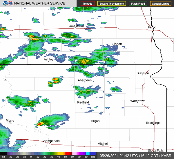
Link to Local Radar Data Link to Satellite Data

Hourly Weather Forecast

National Digital Forecast Database