



Severe Thunderstorms in West Texas; Heavy Rainfall in the Southeast U.S.
Scattered strong to severe storms capable of sporadic large hail and severe winds are expected this afternoon and evening across portions of western Texas. Widespread showers and thunderstorms may produce isolated flash flooding across the Ozarks today and the Southeast into next week. Read More >

Hazardous Weather Conditions
Current conditions at
RONAN (RONM8)
Lat: 47.53639°NLon: 114.09889°WElev: 3068.0ft.NA
49°F
9°C
| Humidity | 100% |
| Wind Speed | SE 0 MPH |
| Barometer | NA |
| Dewpoint | 49°F (9°C) |
| Visibility | NA |
| Last update | 30 May 04:31 AM MDT |
Extended Forecast for
Ronan MT
Flood Watch May 30, 06:00pm until June 1, 12:00pm
Today

High: 63 °F
Rain Likely
Tonight

Low: 45 °F
Rain Likely
Sunday

High: 60 °F
Chance Rain
Sunday Night

Low: 43 °F
Chance Rain
Monday

High: 63 °F
Chance
ShowersMonday Night

Low: 42 °F
Chance Rain
Tuesday

High: 66 °F
Chance
ShowersTuesday Night

Low: 43 °F
Mostly Cloudy
Wednesday

High: 73 °F
Mostly Sunny
Detailed Forecast
Today
Rain likely, mainly between 9am and 10am. Cloudy, with a high near 63. Calm wind becoming west around 5 mph in the afternoon. Chance of precipitation is 60%. New precipitation amounts between a tenth and quarter of an inch possible.
Tonight
Rain likely, mainly before 5am. Cloudy, with a low around 45. South southeast wind 3 to 6 mph. Chance of precipitation is 60%. New precipitation amounts between a quarter and half of an inch possible.
Sunday
A chance of rain before 10am, then a chance of rain after noon. Cloudy, with a high near 60. South southeast wind around 5 mph becoming west southwest in the afternoon. Chance of precipitation is 50%. New precipitation amounts between a tenth and quarter of an inch possible.
Sunday Night
A 50 percent chance of rain. Mostly cloudy, with a low around 43. West wind around 5 mph becoming calm in the evening. New precipitation amounts of less than a tenth of an inch possible.
Monday
A chance of rain before 3pm, then a chance of showers and thunderstorms after 3pm. Mostly cloudy, with a high near 63. Calm wind becoming northwest around 5 mph in the afternoon. Chance of precipitation is 50%.
Monday Night
A 30 percent chance of rain, mainly before midnight. Mostly cloudy, with a low around 42.
Tuesday
A slight chance of rain, then a chance of showers and thunderstorms after noon. Partly sunny, with a high near 66. Chance of precipitation is 30%.
Tuesday Night
Mostly cloudy, with a low around 43.
Wednesday
Mostly sunny, with a high near 73.
Wednesday Night
A chance of showers and thunderstorms before midnight, then a chance of rain after midnight. Mostly cloudy, with a low around 47.
Thursday
A chance of rain. Partly sunny, with a high near 69.
Thursday Night
Partly cloudy, with a low around 45.
Friday
Sunny, with a high near 76.
Basemap Options
Click map to change the forecast location
Loading map...
 Forecast Area
ABOUT THIS FORECAST
Point Forecast:
Ronan MT
47.52°N 114.1°W (Elev. 3081 ft)
47.52°N 114.1°W (Elev. 3081 ft)
2:26 am MDT May 30, 2026
5am MDT May 30, 2026-6pm MDT Jun 5, 2026


Additional Resources
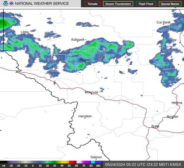
Radar & Satellite Image

Hourly Weather Forecast


