Heat Across the Center of the Nation; Severe Thunderstorms Across the Great Lakes and Ohio Valley

Heat expands across the Desert Southwest, Plains, Mississippi Valley and Midwest into Monday. Fire weather concerns continue for portions of the Intermountain West. Active monsoonal moisture fuels thunderstorms over the Southwest with possible flash flooding. Tropical cyclone Fausto in the Pacific, should weaken as it approaches Hawaii; Dangerous surf, swells and rip currents are expected. Read More >

Current conditions at

Brewster Field Airport (KHDE)

Lat: 40.45°NLon: 99.33°WElev: 2310ft.

Fair

93°F

34°C

Humidity 63%
Wind Speed S 7 mph
Barometer 29.88 in
Dewpoint 79°F (26°C)
Visibility 10.00 mi
Heat Index110°F (43°C)
Last update 26 Jul 1:55 pm CDT
Extended Forecast for

Funk NE

Heat Advisory July 26, 09:00pm until July 27, 10:00pm
Extreme Heat Warning July 26, 02:10pm until July 26, 09:00pm
Click here for hazard details and duration
Heat Advisory
Extreme Heat Warning
  •  
    Extreme Heat Warning July 26, 02:10pm until July 26, 09:00pm

    NOW until 9:00pm Sun

    Extreme Heat Warning

  • This Afternoon

    High: 101 °F

    Hot

  • Tonight

    Tonight: A slight chance of showers and thunderstorms between 11pm and midnight.  Mostly clear, with a low around 74. South wind 5 to 10 mph becoming west after midnight.  Chance of precipitation is 20%.

    Low: 74 °F

    Slight Chance
    T-storms then
    Mostly Clear

  • Monday

    Monday: Mostly sunny and hot, with a high near 99. Heat index values as high as 107. North wind 5 to 15 mph becoming east northeast in the afternoon. Winds could gust as high as 20 mph.

    High: 99 °F

    Hot

  • Monday Night

    Monday Night: A 40 percent chance of showers and thunderstorms, mainly after 2am.  Increasing clouds, with a low around 71. East northeast wind 5 to 15 mph, with gusts as high as 20 mph.  New rainfall amounts of less than a tenth of an inch, except higher amounts possible in thunderstorms.

    Low: 71 °F

    Chance
    T-storms

  • Tuesday

    Tuesday: A 30 percent chance of showers before 1pm.  Mostly cloudy, with a high near 89. North northeast wind 5 to 10 mph becoming southeast in the afternoon.  New precipitation amounts of less than a tenth of an inch possible.

    High: 89 °F

    Chance
    Showers

  • Tuesday Night

    Tuesday Night: A 30 percent chance of showers and thunderstorms after 1am.  Mostly cloudy, with a low around 68.

    Low: 68 °F

    Mostly Cloudy
    then Chance
    Showers

  • Wednesday

    Wednesday: Mostly sunny, with a high near 91.

    High: 91 °F

    Mostly Sunny

  • Wednesday Night

    Wednesday Night: A 40 percent chance of showers and thunderstorms after 1am.  Partly cloudy, with a low around 69.

    Low: 69 °F

    Partly Cloudy
    then Chance
    T-storms

Detailed Forecast

This Afternoon
Sunny and hot, with a high near 101. Heat index values as high as 110. South wind around 15 mph, with gusts as high as 25 mph.
Tonight
A slight chance of showers and thunderstorms between 11pm and midnight. Mostly clear, with a low around 74. South wind 5 to 10 mph becoming west after midnight. Chance of precipitation is 20%.
Monday
Mostly sunny and hot, with a high near 99. Heat index values as high as 107. North wind 5 to 15 mph becoming east northeast in the afternoon. Winds could gust as high as 20 mph.
Monday Night
A 40 percent chance of showers and thunderstorms, mainly after 2am. Increasing clouds, with a low around 71. East northeast wind 5 to 15 mph, with gusts as high as 20 mph. New rainfall amounts of less than a tenth of an inch, except higher amounts possible in thunderstorms.
Tuesday
A 30 percent chance of showers before 1pm. Mostly cloudy, with a high near 89. North northeast wind 5 to 10 mph becoming southeast in the afternoon. New precipitation amounts of less than a tenth of an inch possible.
Tuesday Night
A 30 percent chance of showers and thunderstorms after 1am. Mostly cloudy, with a low around 68.
Wednesday
Mostly sunny, with a high near 91.
Wednesday Night
A 40 percent chance of showers and thunderstorms after 1am. Partly cloudy, with a low around 69.
Thursday
A 20 percent chance of showers before 1pm. Mostly sunny, with a high near 92.
Thursday Night
A 40 percent chance of showers and thunderstorms, mainly before 1am. Mostly clear, with a low around 67.
Friday
Sunny, with a high near 89.
Friday Night
Mostly clear, with a low around 64.
Saturday
Mostly sunny, with a high near 88.
Basemap Options
Click map to change the forecast location
Loading map...

ABOUT THIS FORECAST

 
Point Forecast:
Funk NE
 40.47°N 99.25°W (Elev. 2244 ft)
1:30 pm CDT Jul 26, 2026
2pm CDT Jul 26, 2026-6pm CDT Aug 1, 2026
 
Get as KML Get as XML

Additional Resources

Radar & Satellite Image
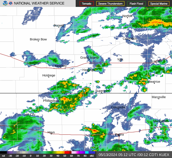
Link to Local Radar Data Link to Satellite Data

Hourly Weather Forecast

National Digital Forecast Database