

Severe Thunderstorms; Excessive Rainfall; Dangerous Heat; Air Quality Concerns

Canadian wildfire smoke will push into the Midwest, worsening air quality. A frontal system brings severe storms from the Northern Plains to the Mid‑Atlantic the next few days. Heavy Gulf Coast rain is possible as we closely monitor tropical development, while monsoonal storms persist in the Southwest with heavy rainfall. Hazardous heat expands from the Plains into the Lower Mississippi Valley. Read More >

Current conditions at

Augusta, Bush Field (KAGS)

Lat: 33.36°NLon: 81.96°WElev: 144ft.

Fair

76°F

24°C

Humidity 91%
Wind Speed NW 3 mph
Barometer 29.95 in (1013.8 mb)
Dewpoint 73°F (23°C)
Visibility 10.00 mi
Heat Index76°F (24°C)
Last update 19 Jul 6:53 am EDT
Extended Forecast for

Waynesboro GA

  • Today

    Today: Sunny, with a high near 94. Heat index values as high as 101. Southwest wind 5 to 9 mph.

    High: 94 °F

    Sunny

  • Tonight

    Tonight: Mostly clear, with a low around 74. Light south wind.

    Low: 74 °F

    Mostly Clear

  • Monday

    Monday: Sunny, with a high near 94. Heat index values as high as 102. Calm wind becoming south 5 to 7 mph in the morning.

    High: 94 °F

    Sunny

  • Monday Night

    Monday Night: Mostly clear, with a low around 74. South wind 3 to 5 mph.

    Low: 74 °F

    Mostly Clear

  • Tuesday

    Tuesday: A chance of showers and thunderstorms after 2pm.  Mostly sunny, with a high near 93. Light south wind increasing to 5 to 10 mph in the morning.  Chance of precipitation is 30%.

    High: 93 °F

    Sunny then
    Chance
    T-storms

  • Tuesday Night

    Tuesday Night: A chance of showers and thunderstorms before 8pm.  Partly cloudy, with a low around 75. Chance of precipitation is 30%.

    Low: 75 °F

    Chance
    T-storms then
    Partly Cloudy

  • Wednesday

    Wednesday: A chance of showers and thunderstorms after 2pm.  Mostly sunny, with a high near 93. Chance of precipitation is 30%.

    High: 93 °F

    Mostly Sunny
    then Chance
    T-storms

  • Wednesday Night

    Wednesday Night: A chance of showers and thunderstorms.  Mostly cloudy, with a low around 74. Chance of precipitation is 50%.

    Low: 74 °F

    Chance
    T-storms

  • Thursday

    Thursday: A chance of showers, with thunderstorms also possible after 2pm.  Partly sunny, with a high near 92. Chance of precipitation is 50%.

    High: 92 °F

    Chance
    Showers then
    Chance
    T-storms

Detailed Forecast

Today
Sunny, with a high near 94. Heat index values as high as 101. Southwest wind 5 to 9 mph.
Tonight
Mostly clear, with a low around 74. Light south wind.
Monday
Sunny, with a high near 94. Heat index values as high as 102. Calm wind becoming south 5 to 7 mph in the morning.
Monday Night
Mostly clear, with a low around 74. South wind 3 to 5 mph.
Tuesday
A chance of showers and thunderstorms after 2pm. Mostly sunny, with a high near 93. Light south wind increasing to 5 to 10 mph in the morning. Chance of precipitation is 30%.
Tuesday Night
A chance of showers and thunderstorms before 8pm. Partly cloudy, with a low around 75. Chance of precipitation is 30%.
Wednesday
A chance of showers and thunderstorms after 2pm. Mostly sunny, with a high near 93. Chance of precipitation is 30%.
Wednesday Night
A chance of showers and thunderstorms. Mostly cloudy, with a low around 74. Chance of precipitation is 50%.
Thursday
A chance of showers, with thunderstorms also possible after 2pm. Partly sunny, with a high near 92. Chance of precipitation is 50%.
Thursday Night
A chance of showers and thunderstorms before 8pm, then a chance of showers between 8pm and 2am. Mostly cloudy, with a low around 72. Chance of precipitation is 30%.
Friday
A chance of showers and thunderstorms. Mostly sunny, with a high near 89. Chance of precipitation is 40%.
Friday Night
A chance of showers and thunderstorms. Mostly cloudy, with a low around 72. Chance of precipitation is 40%.
Saturday
A chance of showers and thunderstorms. Partly sunny, with a high near 89. Chance of precipitation is 50%.
Basemap Options
Click map to change the forecast location
Loading map...

ABOUT THIS FORECAST

 
Point Forecast:
Waynesboro GA
 33.08°N 82°W (Elev. 249 ft)
2:21 am EDT Jul 19, 2026
7am EDT Jul 19, 2026-6pm EDT Jul 25, 2026
 
Get as KML Get as XML

Additional Resources

Radar & Satellite Image
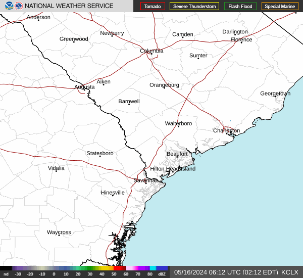
Link to Local Radar Data Link to Satellite Data

Hourly Weather Forecast

National Digital Forecast Database


