


News Headlines
- Another round of intense wind, thick blowing dust and critical fire weather (March 18th)
- Historic wind, thick blowing dust and critical fire weather (March 14th)
- Heavy snow targets the southern Texas Panhandle & northern Rolling Plains (March 8th)
- Intense wind, critical fire weather, blowing dust & rain/snow blast West Texas (March 2nd - 4th)

Hazardous Weather Conditions
Current conditions at
Lubbock, Lubbock International Airport (KLBB)
Lat: 33.67°NLon: 101.82°WElev: 3281ft.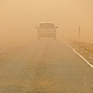
Blowing Dust and Breezy
83°F
28°C
| Humidity | 12% |
| Wind Speed | SW 25 G 43 mph |
| Barometer | 29.57 in (996.5 mb) |
| Dewpoint | 25°F (-4°C) |
| Visibility | 6.00 mi |
| Heat Index | 80°F (27°C) |
| Last update | 1 Apr 12:53 pm CDT |
Extended Forecast for
Slaton TX
Wind Advisory until April 1, 10:00pm
Blowing Dust Advisory until April 1, 10:00pm
Red Flag Warning until April 1, 10:00pm
NOW: Multiple hazards in effect

Click HERE for Details
This Afternoon
High: 87 °F
Blowing Dust
and WindyTonight
Low: 49 °F
Patchy
Blowing Dust
and Windy
then Partly
CloudyWednesday

High: 75 °F
Mostly Sunny
Wednesday Night

Low: 52 °F
Chance
ShowersThursday

High: 73 °F
Partly Sunny
Thursday Night
Low: 47 °F
Chance
Showers then
ShowersFriday

High: 65 °F
Showers
LikelyFriday Night

Low: 42 °F
Showers
Detailed Forecast
This Afternoon
Widespread blowing dust. Sunny, with a high near 87. Windy, with a southwest wind 25 to 30 mph, with gusts as high as 40 mph.
Tonight
Patchy blowing dust before 10pm. Partly cloudy, with a low around 49. Windy, with a southwest wind 25 to 30 mph decreasing to 15 to 20 mph after midnight.
Wednesday
Mostly sunny, with a high near 75. West southwest wind 15 to 20 mph.
Wednesday Night
A 40 percent chance of showers. Cloudy, with a low around 52. West southwest wind 15 to 20 mph decreasing to 5 to 10 mph after midnight.
Thursday
Partly sunny, with a high near 73. Southwest wind 10 to 15 mph.
Thursday Night
A chance of showers and thunderstorms, then showers and possibly a thunderstorm after 1am. Low around 47. Southwest wind 10 to 15 mph becoming north after midnight. Chance of precipitation is 80%.
Friday
Showers likely and possibly a thunderstorm. Mostly cloudy, with a high near 65. North northeast wind 10 to 15 mph. Chance of precipitation is 70%.
Friday Night
Showers and possibly a thunderstorm. Low around 42. North wind around 15 mph. Chance of precipitation is 80%.
Saturday
Showers likely and possibly a thunderstorm. Partly sunny, with a high near 55. North wind 15 to 20 mph. Chance of precipitation is 70%.
Saturday Night
A 30 percent chance of showers before 1am. Mostly cloudy, with a low around 31.
Sunday
Mostly sunny, with a high near 56.
Sunday Night
Partly cloudy, with a low around 31.
Monday
Sunny, with a high near 65.
Additional Forecasts and Information
ABOUT THIS FORECAST
Point Forecast:
Slaton TX
33.44°N 101.66°W
33.44°N 101.66°W
1:31 pm CDT Apr 1, 2025
1pm CDT Apr 1, 2025-6pm CDT Apr 7, 2025
Additional Resources
Radar & Satellite Image


Hourly Weather Forecast


