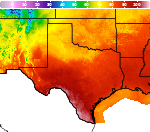
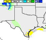
Extreme Heat and Excessive Rainfall This Week
A significant heat wave continues for the Rockies, Northern Plains, and Great Lakes into the Mid-Atlantic, peaking in intensity through midweek and lingering across parts of the Northern Plains and Midwest until this weekend. Excessive rainfall my bring life-threatening and locally catastrophic flash and urban flooding across portions of southwestern Texas through early Friday. Read More >

Current conditions at
Lampasas, Lampasas Airport (KLZZ)
Lat: 31.11° N Lon: 98.2° W Elev: 1214 ft.
Fog/Mist
72°F
22°C
| Humidity | 94% |
| Wind Speed | E 8 mph |
| Barometer | 30.10 in |
| Dewpoint | 70°F (21°C) |
| Visibility | 5.00 mi |
| Last update | 15 Jul 12:55 am CDT |
Detailed forecast for
Lampasas County
Rest Of Tonight
Mostly cloudy with a chance of showers with a slight chance of thunderstorms. Lows in the upper 60s. Southeast winds around 5 mph. Chance of rain 40 percent.
Wednesday
Mostly cloudy with showers likely. A slight chance of thunderstorms in the morning, then a chance of thunderstorms in the afternoon. Highs in the lower 80s. Southeast winds 5 to 10 mph. Chance of rain 70 percent.
Wednesday Night
Mostly cloudy. A chance of showers in the evening, then a chance of showers with a slight chance of thunderstorms after midnight. Lows around 70. Southeast winds around 5 mph. Chance of rain 50 percent.
Thursday
Mostly cloudy in the morning, then becoming partly sunny. A chance of showers. A slight chance of thunderstorms in the afternoon. Humid with highs in the mid 80s. South winds 5 to 10 mph. Chance of rain 50 percent.
Thursday Night
Mostly cloudy. A slight chance of showers in the evening, then a chance of showers after midnight. Humid with lows in the lower 70s. Southeast winds 5 to 10 mph. Chance of rain 30 percent.
Friday
Partly sunny. A 20 percent chance of showers in the morning. Highs around 90.
Friday Night
Partly cloudy in the evening, then becoming mostly cloudy. Lows in the lower 70s.
Saturday
Mostly sunny. Highs in the lower 90s.
Saturday Night
Mostly clear. Lows in the lower 70s.
Sunday
Sunny. Highs in the lower 90s.
Sunday Night
Clear. Lows in the lower 70s.
Monday
Sunny. Highs in the mid 90s.
Monday Night
Clear. Lows in the lower 70s.
Tuesday
Sunny. Highs in the mid 90s.
Additional Forecasts and Information
Basemap Options
Click map to change the forecast location
Loading map...
 Forecast Area
Additional Resources
Radar & Satellite Image

Hourly Weather Forecast