


Hazardous Weather Conditions

Current conditions at
Beverly, Beverly Municipal Airport (KBVY)
Lat: 42.58° N Lon: 70.92° W Elev: 108 ft.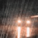
Rain Fog/Mist
34°F
1°C
| Humidity | 92% |
| Wind Speed | NE 13 mph |
| Barometer | 30.40 in (1029.1 mb) |
| Dewpoint | 32°F (0°C) |
| Visibility | 5.00 mi |
| Wind Chill | 25°F (-4°C) |
| Last update | 6 Mar 1:53 am EST |
Detailed forecast for
Eastern Essex
Rest Of Tonight
Snow and freezing rain. Snow accumulation of 2 to 4 inches. Near steady temperature in the lower 30s. Northeast winds 15 to 20 mph with gusts up to 30 mph. Chance of precipitation near 100 percent.
Friday
Rain showers with possible snow, drizzle, freezing rain and freezing drizzle in the morning, then a chance of rain showers and drizzle in the afternoon. Areas of fog in the afternoon. Total snow accumulation of 3 to 5 inches. Ice accumulation around a trace. Cold. Near steady temperature in the mid 30s. Northeast winds 15 to 20 mph with gusts up to 30 mph. Chance of precipitation near 100 percent.
Friday Night
Cloudy with a chance of drizzle. Areas of fog. Near steady temperature in the mid 30s. East winds 5 to 10 mph with gusts up to 20 mph, becoming southeast after midnight.
Saturday
Mostly cloudy. Not as cool with highs in the mid 40s. South winds 5 to 10 mph. Gusts up to 20 mph in the afternoon.
Saturday Night
Mostly cloudy with a 50 percent chance of rain. Lows in the lower 40s. Southwest winds 5 to 10 mph with gusts up to 25 mph.
Sunday
Partly sunny. Highs in the lower 50s.
Sunday Night And Monday
Mostly clear. Lows in the mid 30s. Highs in the mid 50s.
Monday Night And Tuesday
Mostly clear. Lows in the lower 40s. Highs in the upper 50s.
Tuesday Night
Partly cloudy. Lows in the upper 30s.
Wednesday
Mostly cloudy with a 40 percent chance of showers. Highs in the upper 50s.
Wednesday Night And Thursday
Mostly cloudy with a 50 percent chance of showers. Lows in the upper 30s. Highs around 50.
Additional Forecasts and Information
Basemap Options
Click map to change the forecast location
Loading map...
Additional Resources
Radar & Satellite Image


Hourly Weather Forecast


