


News Headlines
Hazardous Weather Conditions

Current conditions at
Toledo - Toledo Express Airport (KTOL)
Lat: 41.59° N Lon: 83.81° W Elev: 673 ft.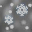
Light Snow
23°F
-5°C
| Humidity | 68% |
| Wind Speed | NW 16 G 24 mph |
| Barometer | 30.05 in (1018.4 mb) |
| Dewpoint | 14°F (-10°C) |
| Visibility | 7.00 mi |
| Wind Chill | 10°F (-12°C) |
| Last update | 30 Dec 4:52 am EST |
Detailed forecast for
Lucas County
Rest Of Tonight
Mostly cloudy. Near steady temperature in the lower 20s. West winds 15 to 20 mph with gusts up to 30 mph.
Tuesday
Partly sunny with a slight chance of snow in the morning, then mostly cloudy with a chance of snow in the afternoon. Little or no snow accumulation. Highs in the upper 20s. West winds 15 to 20 mph with gusts up to 30 mph. Chance of snow 40 percent.
Tuesday Night
Mostly cloudy. Snow, mainly in the evening. Snow accumulation up to 1 inch. Lows in the lower 20s. West winds 10 to 15 mph with gusts up to 30 mph. Chance of snow 90 percent.
Wednesday
Mostly cloudy. Snow likely in the afternoon. Light snow accumulation possible. Highs around 30. West winds 15 to 20 mph with gusts up to 30 mph. Chance of snow 60 percent.
Wednesday Night
Mostly cloudy with a chance of snow in the evening, then mostly clear after midnight. Little or no additional snow accumulation. Colder with lows around 11. Northwest winds 10 to 15 mph. Gusts up to 30 mph in the evening. Chance of snow 50 percent. Wind chill values as low as zero.
New Years Day
Partly sunny. Highs in the lower 20s. Wind chill values as low as zero.
Thursday Night
Mostly cloudy. Lows 15 to 20.
Friday
Partly sunny. Highs in the upper 20s.
Friday Night
Mostly cloudy. Lows 15 to 20.
Saturday
Partly sunny. Highs in the upper 20s.
Saturday Night
Partly cloudy in the evening, then becoming mostly cloudy. Lows around 20.
Sunday
Mostly cloudy. Highs in the lower 30s.
Sunday Night
Mostly cloudy. Lows in the mid 20s.
Monday
Mostly cloudy. Highs in the mid 30s.
Basemap Options
Click map to change the forecast location
Loading map...
Additional Resources
Radar & Satellite Image


Hourly Weather Forecast


