Multi-Day Heavy Rain Event in the Four Corners; Soggy Sunday Expected in Florida

A series of Pacific storm systems will bring widespread showers, heavy rain, and a flash flooding threat across the Four Corners region this weekend. Ex-Typhoon Champi will approach the Alaskan West Coast bringing localized gusty winds and heavy precipitation. A wet and unsettled weekend is expected across southern Florida with rain expected across the entire peninsula by Sunday. Read More >

Hazardous Weather Conditions

Current conditions at

Lake Elmo Airport (K21D)

Lat: 45°NLon: 92.85°WElev: 925ft.

Overcast

54°F

12°C

Humidity 88%
Wind Speed SE 3 mph
Barometer 30.24 in
Dewpoint 50°F (10°C)
Visibility 10.00 mi
Last update 31 Oct 2:55 pm CDT
Extended Forecast for

Mahtomedi MN

  • This Afternoon

    This Afternoon: A 20 percent chance of showers.  Cloudy, with a high near 57. Southeast wind around 5 mph.

    High: 57 °F

    Slight Chance
    Showers

  • Tonight

    Tonight: A slight chance of drizzle after midnight.  Cloudy, with a low around 52. South wind around 5 mph.

    Low: 52 °F

    Cloudy then
    Slight Chance
    Drizzle

  • Sunday

    Sunday: Cloudy, then gradually becoming mostly sunny, with a high near 65. South southeast wind 5 to 10 mph.

    High: 65 °F

    Decreasing
    Clouds

  • Sunday Night

    Sunday Night: A 10 percent chance of rain after 5am.  Mostly cloudy, with a low around 54. South southeast wind 5 to 10 mph.

    Low: 54 °F

    Mostly Cloudy
    then Slight
    Chance Rain

  • Monday

    Monday: Rain, mainly after 7am.  High near 61. Southeast wind 10 to 15 mph, with gusts as high as 30 mph.  Chance of precipitation is 100%. New precipitation amounts between a half and three quarters of an inch possible.

    High: 61 °F

    Rain

  • Monday Night

    Monday Night: Rain before 10pm, then rain and possibly a thunderstorm between 10pm and 1am, then rain after 1am.  Low around 54. Breezy, with a south southeast wind 15 to 20 mph, with gusts as high as 30 mph.  Chance of precipitation is 100%. New rainfall amounts between a quarter and half of an inch possible.

    Low: 54 °F

    Rain and
    Breezy

  • Tuesday

    Tuesday: Rain.  High near 60. West wind around 15 mph.  Chance of precipitation is 80%. New precipitation amounts between a tenth and quarter of an inch possible.

    High: 60 °F

    Rain

  • Tuesday Night

    Tuesday Night: A 40 percent chance of rain.  Mostly cloudy, with a low around 46. West wind around 10 mph.

    Low: 46 °F

    Chance Rain

  • Wednesday

    Wednesday: A 40 percent chance of rain.  Mostly cloudy, with a high near 54. Northwest wind around 10 mph.

    High: 54 °F

    Chance Rain

Detailed Forecast

This Afternoon
A 20 percent chance of showers. Cloudy, with a high near 57. Southeast wind around 5 mph.
Tonight
A slight chance of drizzle after midnight. Cloudy, with a low around 52. South wind around 5 mph.
Sunday
Cloudy, then gradually becoming mostly sunny, with a high near 65. South southeast wind 5 to 10 mph.
Sunday Night
A 10 percent chance of rain after 5am. Mostly cloudy, with a low around 54. South southeast wind 5 to 10 mph.
Monday
Rain, mainly after 7am. High near 61. Southeast wind 10 to 15 mph, with gusts as high as 30 mph. Chance of precipitation is 100%. New precipitation amounts between a half and three quarters of an inch possible.
Monday Night
Rain before 10pm, then rain and possibly a thunderstorm between 10pm and 1am, then rain after 1am. Low around 54. Breezy, with a south southeast wind 15 to 20 mph, with gusts as high as 30 mph. Chance of precipitation is 100%. New rainfall amounts between a quarter and half of an inch possible.
Tuesday
Rain. High near 60. West wind around 15 mph. Chance of precipitation is 80%. New precipitation amounts between a tenth and quarter of an inch possible.
Tuesday Night
A 40 percent chance of rain. Mostly cloudy, with a low around 46. West wind around 10 mph.
Wednesday
A 40 percent chance of rain. Mostly cloudy, with a high near 54. Northwest wind around 10 mph.
Wednesday Night
A 20 percent chance of rain before 1am. Mostly cloudy, with a low around 45. North wind around 5 mph.
Thursday
A 20 percent chance of rain. Partly sunny, with a high near 55. North northeast wind around 5 mph.
Thursday Night
Mostly cloudy, with a low around 42. Northeast wind around 5 mph.
Friday
Partly sunny, with a high near 53. Northeast wind around 5 mph.
Basemap Options
Click map to change the forecast location
Loading map...

ABOUT THIS FORECAST

 
Point Forecast:
Mahtomedi MN
 45.06°N 92.97°W (Elev. 928 ft)
1:26 pm CDT Oct 31, 2026
3pm CDT Oct 31, 2026-6pm CST Nov 6, 2026
 
Get as KML Get as XML

Additional Resources

Radar & Satellite Image
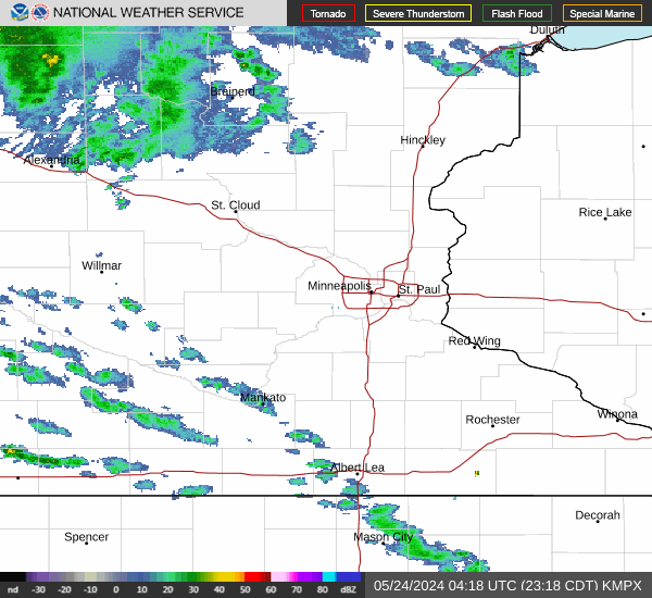
Link to Local Radar Data Link to Satellite Data

Hourly Weather Forecast

National Digital Forecast Database