Hurricane and Storm Surge Watches Issued for the Northern Gulf Coast for Strengthening Tropical Storm Isaias
Tropical Storm Isaias is forecast to track toward the central Gulf Coast while strengthening into a hurricane on Thursday. There is an increasing risk of damaging hurricane-force winds and life-threatening storm surge impacts along portions of the northern Gulf Coast Friday into Saturday. Isaias will bring heavy rainfall to the central Gulf Coast and much of the Southeast Friday into the weekend. Read More >

Waco, Waco Regional Airport (KACT)
Lat: 31.62°NLon: 97.23°WElev: 515ft.
Fair
89°F
32°C
| Humidity | 29% |
| Wind Speed | NE 10 mph |
| Barometer | 29.93 in (1012.9 mb) |
| Dewpoint | 53°F (12°C) |
| Visibility | 10.00 mi |
| Heat Index | 87°F (31°C) |
| Last update | 7 Oct 3:51 pm CDT |
3 Miles SW West TX
Tonight

Low: 61 °F
Clear
Thursday

High: 89 °F
Sunny
Thursday Night

Low: 64 °F
Mostly Clear
Friday
High: 87 °F
Sunny
Friday Night
Low: 64 °F
Mostly Clear
Saturday
High: 88 °F
Sunny
Saturday Night
Low: 65 °F
Clear
Sunday
High: 86 °F
Sunny
Sunday Night
Low: 69 °F
Mostly Clear
Detailed Forecast
Additional Forecasts and Information
 Forecast Area
ABOUT THIS FORECAST
31.78°N 97.13°W (Elev. 548 ft)


Additional Resources
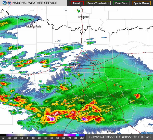
Radar & Satellite Image

Hourly Weather Forecast