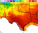
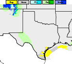
Areas of Excessive Rainfall and Severe Thunderstorms; Typhoon Watch for Guam/CNMI

Heavy to excessive rainfall will continue today from the Texas Big Bend region into southern Oklahoma. Locally considerable flash and urban flooding is possible, and river flooding will continue in central Oklahoma. Scattered severe thunderstorms are possible in parts of the Mid-Atlantic Friday. A Typhoon Watch has been issued for Guam and CNMI. Read More >

Current conditions at

Fort Worth, Fort Worth Alliance Airport (KAFW)

Lat: 32.97°NLon: 97.32°WElev: 722ft.

Mostly Cloudy

78°F

26°C

Humidity 79%
Wind Speed N 17 mph
Barometer 29.97 in (1013.5 mb)
Dewpoint 71°F (22°C)
Visibility 10.00 mi
Heat Index80°F (27°C)
Last update 15 Oct 4:53 pm CDT
Extended Forecast for

Justin TX

Wind Advisory October 16, 04:00am until October 16, 07:00pm
Click here for hazard details and duration
Wind Advisory
  • This Afternoon

    This Afternoon: A 50 percent chance of showers and thunderstorms.  Mostly sunny, with a high near 85. North northwest wind around 5 mph.  New rainfall amounts of less than a tenth of an inch, except higher amounts possible in thunderstorms.

    High: 85 °F

    Chance
    T-storms

  • Tonight

    Tonight: Showers and thunderstorms likely.  Increasing clouds, with a low around 53. North wind 10 to 20 mph, with gusts as high as 30 mph.  Chance of precipitation is 60%. New rainfall amounts between a quarter and half of an inch possible.

    Low: 53 °F

    Showers
    Likely

  • Friday

    Friday: A 30 percent chance of showers before 7am.  Cloudy through mid morning, then gradual clearing, with a high near 62. Breezy, with a north wind around 25 mph, with gusts as high as 40 mph.

    High: 62 °F

    Breezy.
    Chance
    Showers then
    Sunny

  • Friday Night

    Friday Night: Mostly clear, with a low around 44. North wind 10 to 20 mph, with gusts as high as 35 mph.

    Low: 44 °F

    Mostly Clear

  • Saturday

    Saturday: Sunny, with a high near 63. North northeast wind 5 to 10 mph.

    High: 63 °F

    Sunny

  • Saturday Night

    Saturday Night: Clear, with a low around 42. North wind around 5 mph becoming calm.

    Low: 42 °F

    Clear

  • Sunday

    Sunday: Sunny, with a high near 68. Calm wind becoming south southeast around 5 mph.

    High: 68 °F

    Sunny

  • Sunday Night

    Sunday Night: Mostly clear, with a low around 48. East southeast wind around 5 mph becoming calm.

    Low: 48 °F

    Mostly Clear

  • Monday

    Monday: Sunny, with a high near 75. Calm wind becoming south southeast around 5 mph.

    High: 75 °F

    Sunny

Detailed Forecast

This Afternoon
A 50 percent chance of showers and thunderstorms. Mostly sunny, with a high near 85. North northwest wind around 5 mph. New rainfall amounts of less than a tenth of an inch, except higher amounts possible in thunderstorms.
Tonight
Showers and thunderstorms likely. Increasing clouds, with a low around 53. North wind 10 to 20 mph, with gusts as high as 30 mph. Chance of precipitation is 60%. New rainfall amounts between a quarter and half of an inch possible.
Friday
A 30 percent chance of showers before 7am. Cloudy through mid morning, then gradual clearing, with a high near 62. Breezy, with a north wind around 25 mph, with gusts as high as 40 mph.
Friday Night
Mostly clear, with a low around 44. North wind 10 to 20 mph, with gusts as high as 35 mph.
Saturday
Sunny, with a high near 63. North northeast wind 5 to 10 mph.
Saturday Night
Clear, with a low around 42. North wind around 5 mph becoming calm.
Sunday
Sunny, with a high near 68. Calm wind becoming south southeast around 5 mph.
Sunday Night
Mostly clear, with a low around 48. East southeast wind around 5 mph becoming calm.
Monday
Sunny, with a high near 75. Calm wind becoming south southeast around 5 mph.
Monday Night
Mostly clear, with a low around 53.
Tuesday
Sunny, with a high near 80.
Tuesday Night
Mostly clear, with a low around 60.
Wednesday
Sunny, with a high near 84.
Wednesday Night
Mostly clear, with a low around 64.
Thursday
Sunny, with a high near 86.
Basemap Options
Click map to change the forecast location
Loading map...

ABOUT THIS FORECAST

 
Point Forecast:
Justin TX
 33.09°N 97.32°W (Elev. 735 ft)
1:26 pm CDT Oct 15, 2026
5pm CDT Oct 15, 2026-6pm CDT Oct 22, 2026
 
Get as KML Get as XML

Additional Resources

Radar & Satellite Image
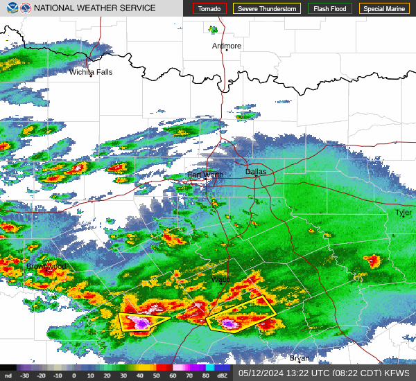
Link to Local Radar Data Link to Satellite Data

Hourly Weather Forecast

National Digital Forecast Database