

Thunderstorms and Heavy Rain in the Mid-South; Heat Continues in the Southeast and Southwest

Severe thunderstorms and heavy rain are expected across portions of the mid-Mississippi Valley into the Ohio Valley and portions of Arizona. Dangerous heat persists in the South and Southeast while building into the Southwest. Overnight lows will be so warm that, when combined with oppressive dew points, little-to-no relief from the scorching daytime highs will be available. Read More >

Current conditions at

Cleveland Regional Jetport (KRZR)

Lat: 35.21°NLon: 84.8°WElev: 860ft.

Fair

88°F

31°C

Humidity 52%
Wind Speed Vrbl 7 mph
Barometer 30.02 in
Dewpoint 68°F (20°C)
Visibility 10.00 mi
Heat Index92°F (33°C)
Last update 19 Aug 1:55 pm EDT
Extended Forecast for

5 Miles SE Mc Donald TN

  • This Afternoon

    This Afternoon: Sunny and hot, with a high near 92. Calm wind.

    High: 92 °F

    Hot

  • Tonight

    Tonight: Partly cloudy, with a low around 71. Calm wind.

    Low: 71 °F

    Partly Cloudy

  • Thursday

    Thursday: A 30 percent chance of showers and thunderstorms, mainly before 9am.  Mostly sunny and hot, with a high near 92. Heat index values as high as 98. North wind around 5 mph becoming southwest in the afternoon.

    High: 92 °F

    Chance
    T-storms then
    Mostly Sunny

  • Thursday Night

    Thursday Night: A chance of showers and thunderstorms before 4am, then a slight chance of showers and thunderstorms after 5am.  Increasing clouds, with a low around 71. Calm wind.  Chance of precipitation is 40%.

    Low: 71 °F

    Chance
    T-storms

  • Friday

    Friday: A chance of showers and thunderstorms before 8am, then showers likely between 8am and 11am, then showers likely and possibly a thunderstorm after 11am.  Mostly sunny and hot, with a high near 90. Calm wind becoming west around 5 mph.  Chance of precipitation is 60%.

    High: 90 °F

    Showers
    Likely

  • Friday Night

    Friday Night: A chance of thunderstorms before 8pm.  Partly cloudy, with a low around 69. Calm wind.  Chance of precipitation is 30%.

    Low: 69 °F

    Chance
    T-storms then
    Partly Cloudy

  • Saturday

    Saturday: Sunny and hot, with a high near 91. Calm wind becoming northwest around 5 mph in the afternoon.

    High: 91 °F

    Hot

  • Saturday Night

    Saturday Night: Mostly clear, with a low around 67.

    Low: 67 °F

    Mostly Clear

  • Sunday

    Sunday: A 20 percent chance of showers and thunderstorms after 2pm.  Sunny and hot, with a high near 91.

    High: 91 °F

    Sunny then
    Slight Chance
    T-storms

Detailed Forecast

This Afternoon
Sunny and hot, with a high near 92. Calm wind.
Tonight
Partly cloudy, with a low around 71. Calm wind.
Thursday
A 30 percent chance of showers and thunderstorms, mainly before 9am. Mostly sunny and hot, with a high near 92. Heat index values as high as 98. North wind around 5 mph becoming southwest in the afternoon.
Thursday Night
A chance of showers and thunderstorms before 4am, then a slight chance of showers and thunderstorms after 5am. Increasing clouds, with a low around 71. Calm wind. Chance of precipitation is 40%.
Friday
A chance of showers and thunderstorms before 8am, then showers likely between 8am and 11am, then showers likely and possibly a thunderstorm after 11am. Mostly sunny and hot, with a high near 90. Calm wind becoming west around 5 mph. Chance of precipitation is 60%.
Friday Night
A chance of thunderstorms before 8pm. Partly cloudy, with a low around 69. Calm wind. Chance of precipitation is 30%.
Saturday
Sunny and hot, with a high near 91. Calm wind becoming northwest around 5 mph in the afternoon.
Saturday Night
Mostly clear, with a low around 67.
Sunday
A 20 percent chance of showers and thunderstorms after 2pm. Sunny and hot, with a high near 91.
Sunday Night
Partly cloudy, with a low around 67.
Monday
A 20 percent chance of showers. Sunny and hot, with a high near 90.
Monday Night
A 20 percent chance of showers. Partly cloudy, with a low around 68.
Tuesday
A 30 percent chance of showers and thunderstorms. Mostly sunny and hot, with a high near 91.
Basemap Options
Click map to change the forecast location
Loading map...

ABOUT THIS FORECAST

 
Point Forecast:
5 Miles SE Mc Donald TN
 35.03°N 84.94°W (Elev. 984 ft)
1:31 pm EDT Aug 19, 2026
2pm EDT Aug 19, 2026-6pm EDT Aug 25, 2026
 
Get as KML Get as XML

Additional Resources

Radar & Satellite Image
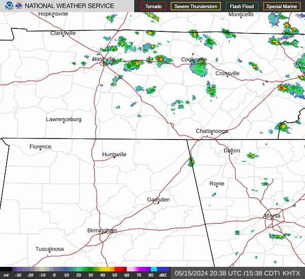
Link to Local Radar Data Link to Satellite Data

Hourly Weather Forecast

National Digital Forecast Database


