


Hazardous Weather Conditions
Current conditions at
Newport News, Newport News / Williamsburg International Airport (KPHF)
Lat: 37.13°NLon: 76.49°WElev: 43ft.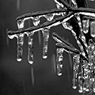
Light Freezing Rain Fog/Mist
28°F
-2°C
| Humidity | 96% |
| Wind Speed | NE 8 mph |
| Barometer | 30.30 in (1026.0 mb) |
| Dewpoint | 27°F (-3°C) |
| Visibility | 1.50 mi |
| Wind Chill | 20°F (-7°C) |
| Last update | 25 Jan 5:54 am EST |
Extended Forecast for
2 Miles ENE Newport News VA
Winter Storm Warning January 25, 06:11am until January 26, 07:00pm
NOW until 7:00pm Mon
Winter Storm Warning
Today
High: 40 °F
Rain/Sleet
then RainTonight
Low: 31 °F
Rain then
Rain/Freezing
RainMonday
High: 36 °F
Chance
Freezing Rain
then Mostly
SunnyMonday Night

Low: 15 °F
Mostly Clear
Tuesday

High: 35 °F
Sunny
Tuesday Night
Low: 20 °F
Mostly Clear
Wednesday

High: 32 °F
Mostly Sunny
Wednesday Night
Low: 18 °F
Mostly Cloudy
then Chance
Snow
Detailed Forecast
Today
Rain, possibly mixed with sleet, becoming all rain after 8am. High near 40. Northeast wind 8 to 14 mph becoming northwest in the afternoon. Winds could gust as high as 22 mph. Chance of precipitation is 100%. Total daytime sleet accumulation of less than a half inch possible.
Tonight
Rain before 1am, then a chance of drizzle between 1am and 4am, then a chance of drizzle or freezing rain after 4am. Low around 31. West wind 6 to 8 mph. Chance of precipitation is 100%. Little or no ice accumulation expected.
Monday
A chance of freezing rain before 7am. Cloudy, then gradually becoming mostly sunny, with a high near 36. Northwest wind 9 to 15 mph, with gusts as high as 24 mph. Chance of precipitation is 30%.
Monday Night
Mostly clear, with a low around 15. Northwest wind 8 to 13 mph, with gusts as high as 22 mph.
Tuesday
Sunny, with a high near 35. Southwest wind 7 to 15 mph, with gusts as high as 24 mph.
Tuesday Night
Mostly clear, with a low around 20.
Wednesday
Mostly sunny, with a high near 32.
Wednesday Night
A chance of snow after 1am. Mostly cloudy, with a low around 18. Chance of precipitation is 30%.
Thursday
Mostly sunny, with a high near 28.
Thursday Night
Mostly clear, with a low around 14.
Friday
Sunny, with a high near 30.
Friday Night
Partly cloudy, with a low around 17.
Saturday
Mostly sunny, with a high near 34.
Basemap Options
Click map to change the forecast location
Loading map...
ABOUT THIS FORECAST
Point Forecast:
2 Miles ENE Newport News VA
37.08°N 76.48°W (Elev. 3 ft)
37.08°N 76.48°W (Elev. 3 ft)
6:06 am EST Jan 25, 2026
6am EST Jan 25, 2026-6pm EST Jan 31, 2026
Additional Resources
Radar & Satellite Image


Hourly Weather Forecast


