



Severe Thunderstorms and Flash Flooding are Possible Today Across Much of the Area
Severe thunderstorms are possible this afternoon and evening in advance of a slow-moving cold front, with the primary hazard being damaging winds. An isolated tornado or two could also occur. In addition, heavy downpours from slow-moving and/or training storms could result in flash flooding. Please keep updated on the forecast and have a way to receive warnings. Remember: Turn Around, Don't Drown! Read More >

Hazardous Weather Conditions
Logan County Airport (K6L4)
Lat: 37.86°NLon: 81.92°WElev: 1667ft.
Mostly Cloudy
73°F
23°C
| Humidity | 83% |
| Wind Speed | Vrbl 6 mph |
| Barometer | 29.76 in |
| Dewpoint | 68°F (20°C) |
| Visibility | 10.00 mi |
| Last update | 2 Aug 3:15 am EDT |
5 Miles NNW Verdunville WV
Overnight

Low: 70 °F
Showers
LikelySunday
High: 80 °F
Showers
Likely then
T-stormsSunday Night
Low: 68 °F
T-storms then
Partly CloudyMonday

High: 79 °F
Showers
LikelyMonday Night

Low: 66 °F
Partly Cloudy
Tuesday
High: 82 °F
Mostly Sunny
then Chance
T-stormsTuesday Night
Low: 68 °F
Chance
T-storms then
Partly CloudyWednesday
High: 82 °F
Chance
Showers then
Showers
LikelyWednesday Night
Low: 69 °F
Showers
Likely then
Partly Cloudy
Detailed Forecast
Additional Forecasts and Information
 Forecast Area
ABOUT THIS FORECAST
37.91°N 82.1°W (Elev. 984 ft)


Additional Resources
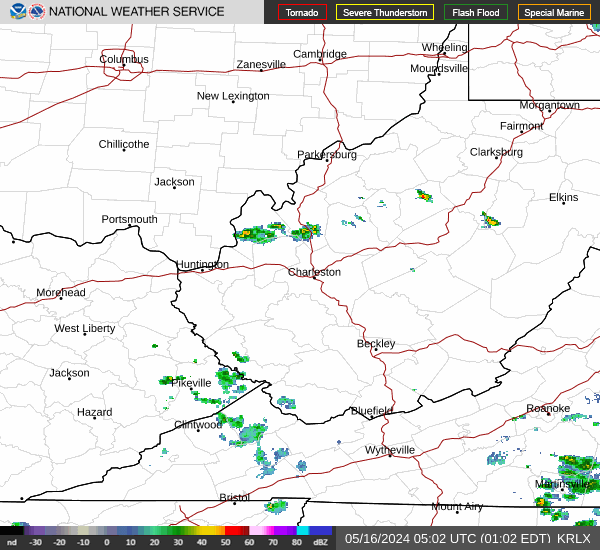
Radar & Satellite Image

Hourly Weather Forecast


