



Flash Flooding Due to Heavy Thunderstorms Remains Possible Through Monday Night
Heavy showers and storms remain possible across the region through Monday night, as high water lingers across portions of the area from prior rainfall. Heavy downpours within storms could result in additional instances of flash flooding. A Flood Watch remains in effect through Monday night. Please keep updated on the forecast and have a way to receive warnings. Remember: Turn Around, Don't Drown! Read More >

Hazardous Weather Conditions
Huntington, Tri-State Airport (KHTS)
Lat: 38.37°NLon: 82.56°WElev: 827ft.
Partly Cloudy
86°F
30°C
| Humidity | 67% |
| Wind Speed | W 8 mph |
| Barometer | 29.90 in (1011.4 mb) |
| Dewpoint | 74°F (23°C) |
| Visibility | 10.00 mi |
| Heat Index | 94°F (34°C) |
| Last update | 17 Aug 5:51 pm EDT |
3 Miles NNE Dunlow WV
NOW until 2:00am Tue
Flood Watch
Tonight
Low: 69 °F
Showers
Likely then
Isolated
Showers and
Patchy FogTuesday
High: 79 °F
Areas Fog
then Mostly
SunnyTuesday Night

Low: 64 °F
Mostly Clear
Wednesday

High: 82 °F
Mostly Sunny
Wednesday Night
Low: 67 °F
Isolated
T-storms then
Scattered
ShowersThursday

High: 80 °F
Showers
LikelyThursday Night

Low: 65 °F
Chance
T-stormsFriday
High: 78 °F
Partly Sunny
then Chance
T-storms
Detailed Forecast
Additional Forecasts and Information
 Forecast Area
ABOUT THIS FORECAST
38.06°N 82.34°W (Elev. 1178 ft)


Additional Resources
Radar & Satellite Image
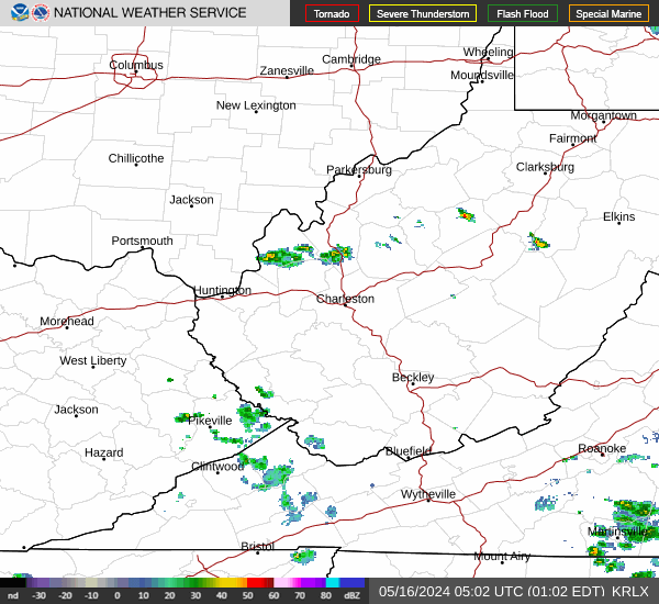

Hourly Weather Forecast


