

Showers and Thunderstorms Bring Flooding Concerns through Sunday

Rounds of heavy showers and storms are expected into Sunday night. The greatest threat will be across southern portions of the area, where the Flood Watch for Flash Flooding has been extended into Sunday night. Locally heavy rain could result in flash flooding. Please keep updated on the latest forecast and have multiple ways to receive warnings. Read More >

Hazardous Weather Conditions

Current conditions at

Elkins, Elkins-Randolph County-Jennings Randolph Field (KEKN)

Lat: 38.89°NLon: 79.85°WElev: 1985ft.

Mostly Cloudy

68°F

20°C

Humidity 100%
Wind Speed Calm
Barometer 30.10 in (1018.1 mb)
Dewpoint 68°F (20°C)
Visibility 10.00 mi
Last update 11 Jul 9:51 pm EDT
Extended Forecast for

6 Miles SW Glady WV

Flood Watch July 11, 10:46pm until July 12, 08:00am
Click here for hazard details and duration
Flood Watch
  •  
    Flood Watch July 11, 10:46pm until July 12, 08:00am

    NOW until 8:00am Sun

    Flood Watch

  • Tonight

    Low: 58 °F

    Slight Chance
    Showers

  • Sunday

    Sunday: A 50 percent chance of showers and thunderstorms, mainly after noon.  Mostly cloudy, with a high near 70. East wind 3 to 5 mph.

    High: 70 °F

    Slight Chance
    T-storms then
    Chance
    T-storms

  • Sunday Night

    Sunday Night: A 30 percent chance of showers and thunderstorms, mainly before 9pm.  Mostly cloudy, with a low around 58. Southeast wind around 7 mph.

    Low: 58 °F

    Chance
    T-storms then
    Mostly Cloudy

  • Monday

    Monday: A slight chance of showers, then a chance of showers and thunderstorms after 2pm.  Partly sunny, with a high near 70. Southeast wind around 6 mph.  Chance of precipitation is 50%.

    High: 70 °F

    Slight Chance
    Showers then
    Chance
    T-storms

  • Monday Night

    Monday Night: A 30 percent chance of showers and thunderstorms before 8pm.  Partly cloudy, with a low around 56. Southeast wind 3 to 5 mph.

    Low: 56 °F

    Chance
    T-storms then
    Partly Cloudy

  • Tuesday

    Tuesday: Sunny, with a high near 77.

    High: 77 °F

    Sunny

  • Tuesday Night

    Tuesday Night: Mostly clear, with a low around 59.

    Low: 59 °F

    Mostly Clear

  • Wednesday

    Wednesday: Sunny, with a high near 79.

    High: 79 °F

    Sunny

Detailed Forecast

Tonight
A 20 percent chance of showers before 2am. Cloudy, with a low around 58. Calm wind.
Sunday
A 50 percent chance of showers and thunderstorms, mainly after noon. Mostly cloudy, with a high near 70. East wind 3 to 5 mph.
Sunday Night
A 30 percent chance of showers and thunderstorms, mainly before 9pm. Mostly cloudy, with a low around 58. Southeast wind around 7 mph.
Monday
A slight chance of showers, then a chance of showers and thunderstorms after 2pm. Partly sunny, with a high near 70. Southeast wind around 6 mph. Chance of precipitation is 50%.
Monday Night
A 30 percent chance of showers and thunderstorms before 8pm. Partly cloudy, with a low around 56. Southeast wind 3 to 5 mph.
Tuesday
Sunny, with a high near 77.
Tuesday Night
Mostly clear, with a low around 59.
Wednesday
Sunny, with a high near 79.
Wednesday Night
Mostly clear, with a low around 62.
Thursday
Mostly sunny, with a high near 78.
Thursday Night
Mostly clear, with a low around 61.
Friday
A 40 percent chance of showers and thunderstorms. Mostly sunny, with a high near 76.
Friday Night
A 30 percent chance of showers and thunderstorms. Mostly cloudy, with a low around 61.
Saturday
A 50 percent chance of showers. Partly sunny, with a high near 74.
Basemap Options
Click map to change the forecast location
Loading map...

ABOUT THIS FORECAST

 
Point Forecast:
6 Miles SW Glady WV
 38.75°N 79.77°W (Elev. 3527 ft)
8:34 pm EDT Jul 11, 2026
10pm EDT Jul 11, 2026-6pm EDT Jul 18, 2026
 
Get as KML Get as XML

Additional Resources

Radar & Satellite Image
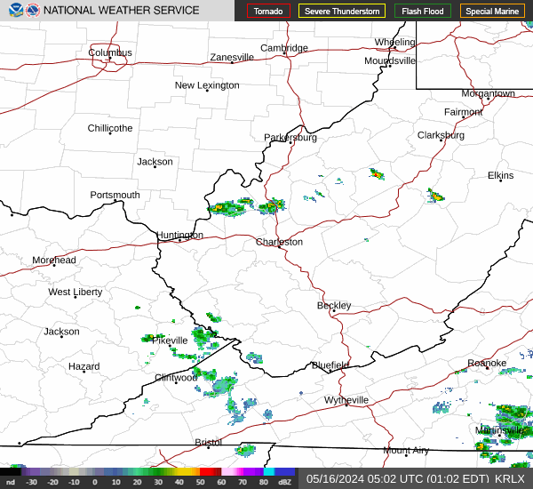
Link to Local Radar Data Link to Satellite Data

Hourly Weather Forecast

National Digital Forecast Database


