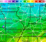
Areas of Severe Thunderstorms and Excessive Rainfall; Heat Wave Builds in the Intermountain West and Plains

A slow moving front will bring rounds of strong to severe thunderstorms and heavy rainfall to the central Plains eastward to the east-central U.S.. The first widespread significant heat wave of summer for the Intermountain West and Plains is expected to develop today and expand through next week. Dangerous heat will continue to impact portions of the Southwest and Southeast. Read More >

Hazardous Weather Conditions

Current conditions at

Effingham, Effingham County Memorial Airport (K1H2)

Lat: 39.07°NLon: 88.53°WElev: 587ft.

Fair

84°F

29°C

Humidity 77%
Wind Speed E 9 mph
Barometer 29.90 in
Dewpoint 76°F (24°C)
Visibility 10.00 mi
Heat Index93°F (34°C)
Last update 10 Jul 2:15 pm CDT
Extended Forecast for

2 Miles S Jewett IL

  • This Afternoon

    This Afternoon: A 10 percent chance of showers and thunderstorms after 5pm.  Partly sunny, with a high near 86. South southwest wind 3 to 5 mph.

    High: 86 °F

    Slight Chance
    T-storms

  • Tonight

    Tonight: Showers and thunderstorms likely, mainly between 2am and 4am, then showers likely and possibly a thunderstorm after 4am.  Mostly cloudy, with a low around 68. Light and variable wind.  Chance of precipitation is 60%. New rainfall amounts between a tenth and quarter of an inch, except higher amounts possible in thunderstorms.

    Low: 68 °F

    Chance
    T-storms then
    T-storms
    Likely

  • Saturday

    Saturday: A chance of showers and thunderstorms before noon, then showers likely and possibly a thunderstorm between noon and 4pm, then a chance of showers and thunderstorms after 4pm.  Mostly cloudy, with a high near 83. Light and variable wind.  Chance of precipitation is 60%. New rainfall amounts between a quarter and half of an inch possible.

    High: 83 °F

    Chance
    T-storms then
    Showers
    Likely

  • Saturday Night

    Saturday Night: A 30 percent chance of showers before 1am.  Mostly cloudy, with a low around 68. East wind around 5 mph becoming calm.

    Low: 68 °F

    Chance
    Showers

  • Sunday

    Sunday: A 40 percent chance of showers after 1pm.  Mostly sunny, with a high near 83. East wind 6 to 9 mph, with gusts as high as 15 mph.

    High: 83 °F

    Partly Sunny
    then Chance
    Showers

  • Sunday Night

    Sunday Night: Mostly clear, with a low around 66. East northeast wind 5 to 7 mph.

    Low: 66 °F

    Mostly Clear

  • Monday

    Monday: Sunny, with a high near 86. East northeast wind 6 to 9 mph, with gusts as high as 15 mph.

    High: 86 °F

    Sunny

  • Monday Night

    Monday Night: Mostly clear, with a low around 68.

    Low: 68 °F

    Mostly Clear

  • Tuesday

    Tuesday: Sunny, with a high near 88.

    High: 88 °F

    Sunny

Detailed Forecast

This Afternoon
A 10 percent chance of showers and thunderstorms after 5pm. Partly sunny, with a high near 86. South southwest wind 3 to 5 mph.
Tonight
Showers and thunderstorms likely, mainly between 2am and 4am, then showers likely and possibly a thunderstorm after 4am. Mostly cloudy, with a low around 68. Light and variable wind. Chance of precipitation is 60%. New rainfall amounts between a tenth and quarter of an inch, except higher amounts possible in thunderstorms.
Saturday
A chance of showers and thunderstorms before noon, then showers likely and possibly a thunderstorm between noon and 4pm, then a chance of showers and thunderstorms after 4pm. Mostly cloudy, with a high near 83. Light and variable wind. Chance of precipitation is 60%. New rainfall amounts between a quarter and half of an inch possible.
Saturday Night
A 30 percent chance of showers before 1am. Mostly cloudy, with a low around 68. East wind around 5 mph becoming calm.
Sunday
A 40 percent chance of showers after 1pm. Mostly sunny, with a high near 83. East wind 6 to 9 mph, with gusts as high as 15 mph.
Sunday Night
Mostly clear, with a low around 66. East northeast wind 5 to 7 mph.
Monday
Sunny, with a high near 86. East northeast wind 6 to 9 mph, with gusts as high as 15 mph.
Monday Night
Mostly clear, with a low around 68.
Tuesday
Sunny, with a high near 88.
Tuesday Night
Mostly clear, with a low around 69.
Wednesday
Sunny, with a high near 88.
Wednesday Night
Mostly clear, with a low around 70.
Thursday
Sunny, with a high near 88.
Basemap Options
Click map to change the forecast location
Loading map...

ABOUT THIS FORECAST

 
Point Forecast:
2 Miles S Jewett IL
 39.17°N 88.24°W (Elev. 548 ft)
1:26 pm CDT Jul 10, 2026
2pm CDT Jul 10, 2026-6pm CDT Jul 16, 2026
 
Get as KML Get as XML

Additional Resources

Radar & Satellite Image
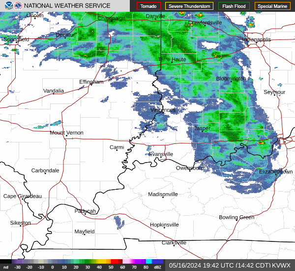
Link to Local Radar Data Link to Satellite Data

Hourly Weather Forecast

National Digital Forecast Database