

The Remnants of Isaias Bring Widespread Rain Through Sunday, Along with Gusty Winds in the Higher Terrain

The remnants of Isaias will bring widespread, but mainly beneficial rain through Sunday to the area. Rainfall totals will generally be between 0.75-2.00", but heavier bands of rain could result in locally higher amounts and the potential for isolated flooding. In addition, gusty winds up to 50 mph are expected in the higher terrain through Sunday morning. Please keep updated on the forecast. Read More >

Current conditions at

Clarksburg, Clarksburg Benedum Airport (KCKB)

Lat: 39.3°NLon: 80.22°WElev: 1201ft.

Light Rain

58°F

14°C

Humidity 90%
Wind Speed N 6 mph
Barometer 30.04 in (1016.8 mb)
Dewpoint 55°F (13°C)
Visibility 10.00 mi
Last update 11 Oct 9:53 am EDT
Extended Forecast for

Flemington WV

  • Today

    Today: Showers and possibly a thunderstorm.  High near 68. East wind 8 to 14 mph, with gusts as high as 28 mph.  Chance of precipitation is 100%. New rainfall amounts between a quarter and half of an inch possible.

    High: 68 °F

    Showers

  • Tonight

    Tonight: Showers and thunderstorms likely before 2am, then a chance of showers.  Mostly cloudy, with a low around 58. Northeast wind around 5 mph becoming calm  in the evening.  Chance of precipitation is 60%. New precipitation amounts of less than a tenth of an inch, except higher amounts possible in thunderstorms.

    Low: 58 °F

    Showers
    Likely

  • Columbus Day

    Columbus Day: A 20 percent chance of showers before 9am.  Mostly cloudy, with a high near 69. Northwest wind around 6 mph.

    High: 69 °F

    Slight Chance
    Showers then
    Mostly Cloudy

  • Monday Night

    Monday Night: Partly cloudy, with a low around 56. Light south wind.

    Low: 56 °F

    Partly Cloudy

  • Tuesday

    Tuesday: Sunny, with a high near 80. Southwest wind 6 to 11 mph.

    High: 80 °F

    Sunny

  • Tuesday Night

    Tuesday Night: A 20 percent chance of showers after 2am.  Mostly clear, with a low around 62.

    Low: 62 °F

    Mostly Clear
    then Slight
    Chance
    Showers

  • Wednesday

    Wednesday: A 40 percent chance of showers after 2pm.  Mostly sunny, with a high near 75.

    High: 75 °F

    Mostly Sunny
    then Chance
    Showers

  • Wednesday Night

    Wednesday Night: A 40 percent chance of showers.  Mostly cloudy, with a low around 56.

    Low: 56 °F

    Chance
    Showers

  • Thursday

    Thursday: A 30 percent chance of showers.  Mostly cloudy, with a high near 71.

    High: 71 °F

    Chance
    Showers

Detailed Forecast

Today
Showers and possibly a thunderstorm. High near 68. East wind 8 to 14 mph, with gusts as high as 28 mph. Chance of precipitation is 100%. New rainfall amounts between a quarter and half of an inch possible.
Tonight
Showers and thunderstorms likely before 2am, then a chance of showers. Mostly cloudy, with a low around 58. Northeast wind around 5 mph becoming calm in the evening. Chance of precipitation is 60%. New precipitation amounts of less than a tenth of an inch, except higher amounts possible in thunderstorms.
Columbus Day
A 20 percent chance of showers before 9am. Mostly cloudy, with a high near 69. Northwest wind around 6 mph.
Monday Night
Partly cloudy, with a low around 56. Light south wind.
Tuesday
Sunny, with a high near 80. Southwest wind 6 to 11 mph.
Tuesday Night
A 20 percent chance of showers after 2am. Mostly clear, with a low around 62.
Wednesday
A 40 percent chance of showers after 2pm. Mostly sunny, with a high near 75.
Wednesday Night
A 40 percent chance of showers. Mostly cloudy, with a low around 56.
Thursday
A 30 percent chance of showers. Mostly cloudy, with a high near 71.
Thursday Night
A 50 percent chance of showers after 2am. Mostly cloudy, with a low around 56.
Friday
Showers likely. Mostly cloudy, with a high near 68. Chance of precipitation is 60%.
Friday Night
A 50 percent chance of showers. Mostly cloudy, with a low around 44.
Saturday
A 30 percent chance of showers. Mostly cloudy, with a high near 54.
Basemap Options
Click map to change the forecast location
Loading map...

ABOUT THIS FORECAST

 
Point Forecast:
Flemington WV
 39.27°N 80.12°W (Elev. 1198 ft)
10:05 am EDT Oct 11, 2026
10am EDT Oct 11, 2026-6pm EDT Oct 17, 2026
 
Get as KML Get as XML

Additional Resources

Radar & Satellite Image
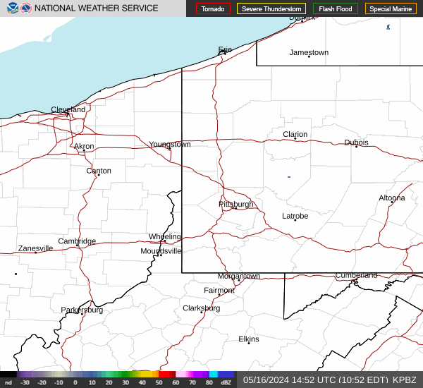
Link to Local Radar Data Link to Satellite Data

Hourly Weather Forecast

National Digital Forecast Database


