Hazardous Weather Conditions
Current conditions at
Philadelphia, Philadelphia International Airport (KPHL)
Lat: 39.87°NLon: 75.23°WElev: 7ft.
Thunderstorm
65°F
18°C
| Humidity | 68% |
| Wind Speed | SE 10 mph |
| Barometer | 29.35 in (993.9 mb) |
| Dewpoint | 54°F (12°C) |
| Visibility | 10.00 mi |
| Last update | 12 Nov 1:54 pm EST |
Extended Forecast for
Philadelphia PA
Tornado Watch until November 12, 07:00pm
Severe T-storm Warning November 12, 02:38pm until November 12, 03:15pm
NOW: Multiple hazards in effect

Click HERE for Details
This Afternoon

High: 63 °F
Severe
ThunderstormsTonight
Low: 41 °F
Chance Rain
then Rain
LikelyFriday

High: 47 °F
Rain
Friday Night
Low: 36 °F
Chance Rain
then Mostly
CloudySaturday

High: 48 °F
Partly Sunny
Saturday Night

Low: 37 °F
Mostly Clear
Sunday

High: 51 °F
Mostly Sunny
Sunday Night

Low: 36 °F
Partly Cloudy
Detailed Forecast
This Afternoon
Showers and possibly a thunderstorm, mainly before 5pm, then a chance of showers and thunderstorms after 5pm. Some of the storms could be severe and produce heavy rainfall. High near 63. Southeast wind around 5 mph becoming north. Chance of precipitation is 90%. New rainfall amounts between a tenth and quarter of an inch, except higher amounts possible in thunderstorms.
Tonight
Rain likely, mainly after 3am. Mostly cloudy, with a low around 41. Light northeast wind becoming north 5 to 10 mph in the evening. Chance of precipitation is 70%. New precipitation amounts between a tenth and quarter of an inch possible.
Friday
Rain, mainly before 3pm. High near 47. North wind around 10 mph, with gusts as high as 20 mph. Chance of precipitation is 90%. New precipitation amounts between a tenth and quarter of an inch possible.
Friday Night
A chance of rain, mainly before 10pm. Cloudy, with a low around 36. Northwest wind 5 to 10 mph. Chance of precipitation is 40%. New precipitation amounts of less than a tenth of an inch possible.
Saturday
Partly sunny, with a high near 48. Northwest wind 5 to 10 mph, with gusts as high as 20 mph.
Saturday Night
Mostly clear, with a low around 37.
Sunday
Mostly sunny, with a high near 51.
Sunday Night
Partly cloudy, with a low around 36.
Monday
Sunny, with a high near 51.
Monday Night
Mostly clear, with a low around 33.
Tuesday
Sunny, with a high near 55.
Tuesday Night
Clear, with a low around 34.
Wednesday
Sunny, with a high near 60.
Additional Forecasts and Information
Basemap Options
Click map to change the forecast location
Loading map...
 Forecast Area
ABOUT THIS FORECAST
Point Forecast:
Philadelphia PA
39.96°N 75.18°W (Elev. 98 ft)
39.96°N 75.18°W (Elev. 98 ft)
1:18 pm EST Nov 12, 2026
2pm EST Nov 12, 2026-6pm EST Nov 18, 2026


Additional Resources
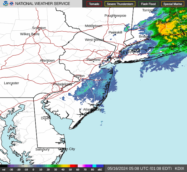
Radar & Satellite Image

Hourly Weather Forecast