Showers and Storms in the East; Dangerously Hot and Dry in the West

Scattered showers and storms are expected across portions of the Central and Eastern U.S. through the end of the week. Meanwhile, dangerous heat will intensify across the Desert Southwest and Intermountain West. Hot, dry weather and increasing winds will allow elevated wildfire conditions to return to the northern Intermountain West, where air quality issues persist from ongoing fires. Read More >

Hazardous Weather Conditions

Current conditions at

Genesee County Airport (KGVQ)

Lat: 43.03°NLon: 78.17°WElev: 914ft.

N/A

Humidity NA
Wind Speed NA
Barometer NA
Dewpoint N/A
Visibility NA
Last update *** Not a current observation ***
Extended Forecast for

3 Miles NE Varysburg NY

  • Tonight

    Tonight: A chance of showers and thunderstorms, mainly between 11pm and 2am.  Patchy fog between 4am and 5am.  Otherwise, mostly cloudy, with a low around 61. West wind 5 to 10 mph becoming light and variable. Winds could gust as high as 20 mph.  Chance of precipitation is 40%. New rainfall amounts between a tenth and quarter of an inch, except higher amounts possible in thunderstorms.

    Low: 61 °F

    Chance
    T-storms and
    Patchy Fog

  • Sunday

    Sunday: Patchy fog before 7am.  Otherwise, partly sunny, then gradually becoming sunny, with a high near 78. West wind 3 to 6 mph.

    High: 78 °F

    Patchy Fog
    then Sunny

  • Sunday Night

    Sunday Night: Increasing clouds, with a low around 62. Calm wind becoming south around 6 mph after midnight.

    Low: 62 °F

    Increasing
    Clouds

  • Monday

    Monday: Showers, with thunderstorms also possible after 11am.  High near 78. Southwest wind 9 to 11 mph, with gusts as high as 22 mph.  Chance of precipitation is 80%. New rainfall amounts between a quarter and half of an inch possible.

    High: 78 °F

    Showers

  • Monday Night

    Monday Night: Showers likely and possibly a thunderstorm before 2am, then a chance of showers and thunderstorms between 2am and 5am, then a chance of showers after 5am.  Mostly cloudy, with a low around 60. West wind 7 to 9 mph.  Chance of precipitation is 60%. New rainfall amounts of less than a tenth of an inch, except higher amounts possible in thunderstorms.

    Low: 60 °F

    Showers
    Likely

  • Tuesday

    Tuesday: A chance of showers, with thunderstorms also possible after 11am.  Partly sunny, with a high near 76. West wind around 6 mph.  Chance of precipitation is 40%. New rainfall amounts between a tenth and quarter of an inch, except higher amounts possible in thunderstorms.

    High: 76 °F

    Chance
    Showers then
    Chance
    T-storms

  • Tuesday Night

    Tuesday Night: A chance of showers and thunderstorms before 8pm, then a chance of showers between 8pm and 2am.  Mostly cloudy, with a low around 58. West wind 3 to 5 mph.  Chance of precipitation is 30%.

    Low: 58 °F

    Chance
    T-storms then
    Chance
    Showers

  • Wednesday

    Wednesday: Mostly sunny, with a high near 77. West wind around 6 mph.

    High: 77 °F

    Mostly Sunny

  • Wednesday Night

    Wednesday Night: A chance of showers after 8pm.  Mostly cloudy, with a low around 58. Chance of precipitation is 30%.

    Low: 58 °F

    Chance
    Showers

Detailed Forecast

Tonight
A chance of showers and thunderstorms, mainly between 11pm and 2am. Patchy fog between 4am and 5am. Otherwise, mostly cloudy, with a low around 61. West wind 5 to 10 mph becoming light and variable. Winds could gust as high as 20 mph. Chance of precipitation is 40%. New rainfall amounts between a tenth and quarter of an inch, except higher amounts possible in thunderstorms.
Sunday
Patchy fog before 7am. Otherwise, partly sunny, then gradually becoming sunny, with a high near 78. West wind 3 to 6 mph.
Sunday Night
Increasing clouds, with a low around 62. Calm wind becoming south around 6 mph after midnight.
Monday
Showers, with thunderstorms also possible after 11am. High near 78. Southwest wind 9 to 11 mph, with gusts as high as 22 mph. Chance of precipitation is 80%. New rainfall amounts between a quarter and half of an inch possible.
Monday Night
Showers likely and possibly a thunderstorm before 2am, then a chance of showers and thunderstorms between 2am and 5am, then a chance of showers after 5am. Mostly cloudy, with a low around 60. West wind 7 to 9 mph. Chance of precipitation is 60%. New rainfall amounts of less than a tenth of an inch, except higher amounts possible in thunderstorms.
Tuesday
A chance of showers, with thunderstorms also possible after 11am. Partly sunny, with a high near 76. West wind around 6 mph. Chance of precipitation is 40%. New rainfall amounts between a tenth and quarter of an inch, except higher amounts possible in thunderstorms.
Tuesday Night
A chance of showers and thunderstorms before 8pm, then a chance of showers between 8pm and 2am. Mostly cloudy, with a low around 58. West wind 3 to 5 mph. Chance of precipitation is 30%.
Wednesday
Mostly sunny, with a high near 77. West wind around 6 mph.
Wednesday Night
A chance of showers after 8pm. Mostly cloudy, with a low around 58. Chance of precipitation is 30%.
Thursday
A chance of showers, with thunderstorms also possible after 2pm. Partly sunny, with a high near 74. Chance of precipitation is 50%.
Thursday Night
A chance of thunderstorms. Mostly cloudy, with a low around 55. Chance of precipitation is 30%.
Friday
Mostly sunny, with a high near 71.
Friday Night
Partly cloudy, with a low around 51.
Saturday
Mostly sunny, with a high near 72.
Basemap Options
Click map to change the forecast location
Loading map...

ABOUT THIS FORECAST

 
Point Forecast:
3 Miles NE Varysburg NY
 42.77°N 78.29°W (Elev. 1601 ft)
7:55 pm EDT Aug 8, 2026
7pm EDT Aug 8, 2026-6pm EDT Aug 15, 2026
 
Get as KML Get as XML

Additional Resources

Radar & Satellite Image
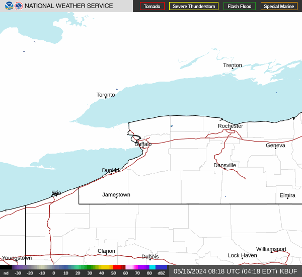
Link to Local Radar Data Link to Satellite Data

Hourly Weather Forecast

National Digital Forecast Database