Areas of Extreme Heat and Fire Weather in the Pacific Northwest; Heavy Rain in the West and South-central US

Extreme heat will continue across the Pacific Northwest into midweek before finally waning. Hot temperatures, dry, gusty conditions, and isolated dry thunderstorms will bring critical fire weather. Heavy rain and thunderstorms are expected across portions of the Southwest, the Sierras, and the central/southern Plains. A series of storms will bring heavy rain and strong winds to southern Alaska. Read More >

Current conditions at

Springfield, Hartness State Springfield Airport (KVSF)

Lat: 43.34°NLon: 72.52°WElev: 574ft.
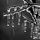
Fair

57°F

14°C

Humidity 83%
Wind Speed Calm
Barometer 29.87 in (1011.2 mb)
Dewpoint 52°F (11°C)
Visibility 10.00 mi
Last update 26 Aug 1:54 am EDT
Extended Forecast for

Hartness State Springfield Airport VT

  • Overnight

    Overnight: Patchy dense fog after 3am.  Otherwise, mostly clear, with a low around 53. Light southwest wind.

    Low: 53 °F

    Patchy Dense
    Fog

  • Tuesday

    Tuesday: Patchy dense fog before 8am.  Otherwise, sunny, with a high near 75. West wind 6 to 10 mph.

    High: 75 °F

    Patchy Dense
    Fog then
    Sunny

  • Tuesday Night

    Tuesday Night: Mostly clear, with a low around 49. West wind around 5 mph becoming calm  in the evening.

    Low: 49 °F

    Mostly Clear

  • Wednesday

    Wednesday: Mostly sunny, with a high near 73. Calm wind becoming northwest 5 to 7 mph in the afternoon.

    High: 73 °F

    Mostly Sunny

  • Wednesday Night

    Wednesday Night: Mostly clear, with a low around 47. Calm wind.

    Low: 47 °F

    Mostly Clear

  • Thursday

    Thursday: Mostly sunny, with a high near 77. Calm wind becoming southwest 5 to 8 mph in the afternoon.

    High: 77 °F

    Mostly Sunny

  • Thursday Night

    Thursday Night: A 30 percent chance of showers after 2am.  Mostly cloudy, with a low around 52. Calm wind.

    Low: 52 °F

    Partly Cloudy
    then Chance
    Showers

  • Friday

    Friday: Showers likely, with thunderstorms also possible after 2pm.  Mostly cloudy, with a high near 70. Calm wind becoming southwest around 6 mph in the morning.  Chance of precipitation is 70%.

    High: 70 °F

    Showers
    Likely

  • Friday Night

    Friday Night: A chance of showers and thunderstorms before 8pm, then a chance of showers between 8pm and 2am.  Mostly cloudy, with a low around 47. Calm wind.  Chance of precipitation is 30%.

    Low: 47 °F

    Chance
    T-storms then
    Chance
    Showers

Detailed Forecast

Overnight
Patchy dense fog after 3am. Otherwise, mostly clear, with a low around 53. Light southwest wind.
Tuesday
Patchy dense fog before 8am. Otherwise, sunny, with a high near 75. West wind 6 to 10 mph.
Tuesday Night
Mostly clear, with a low around 49. West wind around 5 mph becoming calm in the evening.
Wednesday
Mostly sunny, with a high near 73. Calm wind becoming northwest 5 to 7 mph in the afternoon.
Wednesday Night
Mostly clear, with a low around 47. Calm wind.
Thursday
Mostly sunny, with a high near 77. Calm wind becoming southwest 5 to 8 mph in the afternoon.
Thursday Night
A 30 percent chance of showers after 2am. Mostly cloudy, with a low around 52. Calm wind.
Friday
Showers likely, with thunderstorms also possible after 2pm. Mostly cloudy, with a high near 70. Calm wind becoming southwest around 6 mph in the morning. Chance of precipitation is 70%.
Friday Night
A chance of showers and thunderstorms before 8pm, then a chance of showers between 8pm and 2am. Mostly cloudy, with a low around 47. Calm wind. Chance of precipitation is 30%.
Saturday
A 30 percent chance of showers after 2pm. Partly sunny, with a high near 71. Calm wind becoming northwest around 6 mph in the afternoon.
Saturday Night
A 30 percent chance of showers. Partly cloudy, with a low around 47. Calm wind.
Sunday
Mostly sunny, with a high near 75. Calm wind becoming northwest around 6 mph in the afternoon.
Sunday Night
Mostly clear, with a low around 49. Calm wind.
Labor Day
Mostly sunny, with a high near 77. Light north wind.
Basemap Options
Click map to change the forecast location
Loading map...

ABOUT THIS FORECAST

 
Point Forecast:
Hartness State Springfield Airport VT
 43.34°N 72.52°W (Elev. 499 ft)
1:45 am EDT Aug 26, 2025
2am EDT Aug 26, 2025-6pm EDT Sep 1, 2025
 
Get as KML Get as XML

Additional Resources

Radar & Satellite Image

Link to Local Radar Data Link to Satellite Data

Hourly Weather Forecast

National Digital Forecast Database