Wind Advisory in effect for portions of the Northern Champlain Valley through this Afternoon

A Wind Advisory is in effect for portions of the northern Champlain Valley through 4 PM today for gusts up to 45 MPH. The strongest gusts will be focused on the southeast facing shores of Lake Champlain and western Chittenden county through noon today, then slowly weakening towards this evening. A few power outages may be possible with many trees still leafed out. Read More >

Hazardous Weather Conditions

Current conditions at

Rutland-Southern Vermont Regional Airport (KRUT)

Lat: 43.53°NLon: 72.95°WElev: 787ft.

Light Rain

64°F

18°C

Humidity 87%
Wind Speed S 5 mph
Barometer 29.61 in (1002.2 mb)
Dewpoint 60°F (16°C)
Visibility 10.00 mi
Last update 16 Oct 12:56 pm EDT
Extended Forecast for

5 Miles W Rochester VT

  • This Afternoon

    This Afternoon: Showers.  High near 60. Southwest wind around 15 mph, with gusts as high as 33 mph.  Chance of precipitation is 90%. New precipitation amounts between a tenth and quarter of an inch possible.

    High: 60 °F

    Showers

  • Tonight

    Tonight: Rain showers before 1am, then a chance of rain and snow showers.  Low around 31. West wind 15 to 18 mph, with gusts as high as 36 mph.  Chance of precipitation is 80%. Little or no snow accumulation expected.

    Low: 31 °F

    Showers then
    Chance
    Rain/Snow

  • Saturday

    Saturday: Mostly cloudy, then gradually becoming sunny, with a high near 36. Northwest wind 11 to 15 mph, with gusts as high as 32 mph.

    High: 36 °F

    Decreasing
    Clouds

  • Saturday Night

    Saturday Night: Mostly clear, with a low around 26. Northwest wind 5 to 7 mph becoming calm  in the evening.

    Low: 26 °F

    Mostly Clear

  • Sunday

    Sunday: Sunny, with a high near 50. Light southwest wind.

    High: 50 °F

    Sunny

  • Sunday Night

    Sunday Night: Clear, with a low around 33. Calm wind.

    Low: 33 °F

    Clear

  • Monday

    Monday: Sunny, with a high near 56. Light south wind.

    High: 56 °F

    Sunny

  • Monday Night

    Monday Night: Partly cloudy, with a low around 37. Calm wind.

    Low: 37 °F

    Partly Cloudy

  • Tuesday

    Tuesday: Mostly sunny, with a high near 58. Light north wind.

    High: 58 °F

    Mostly Sunny

Detailed Forecast

This Afternoon
Showers. High near 60. Southwest wind around 15 mph, with gusts as high as 33 mph. Chance of precipitation is 90%. New precipitation amounts between a tenth and quarter of an inch possible.
Tonight
Rain showers before 1am, then a chance of rain and snow showers. Low around 31. West wind 15 to 18 mph, with gusts as high as 36 mph. Chance of precipitation is 80%. Little or no snow accumulation expected.
Saturday
Mostly cloudy, then gradually becoming sunny, with a high near 36. Northwest wind 11 to 15 mph, with gusts as high as 32 mph.
Saturday Night
Mostly clear, with a low around 26. Northwest wind 5 to 7 mph becoming calm in the evening.
Sunday
Sunny, with a high near 50. Light southwest wind.
Sunday Night
Clear, with a low around 33. Calm wind.
Monday
Sunny, with a high near 56. Light south wind.
Monday Night
Partly cloudy, with a low around 37. Calm wind.
Tuesday
Mostly sunny, with a high near 58. Light north wind.
Tuesday Night
Mostly clear, with a low around 37. Calm wind.
Wednesday
Sunny, with a high near 56. Light north wind.
Wednesday Night
Mostly clear, with a low around 34. Calm wind.
Thursday
Sunny, with a high near 55. Light south wind.
Basemap Options
Click map to change the forecast location
Loading map...

ABOUT THIS FORECAST

 
Point Forecast:
5 Miles W Rochester VT
 43.87°N 72.91°W (Elev. 1722 ft)
8:46 am EDT Oct 16, 2026
1pm EDT Oct 16, 2026-6pm EDT Oct 22, 2026
 
Get as KML Get as XML

Additional Resources

Radar & Satellite Image
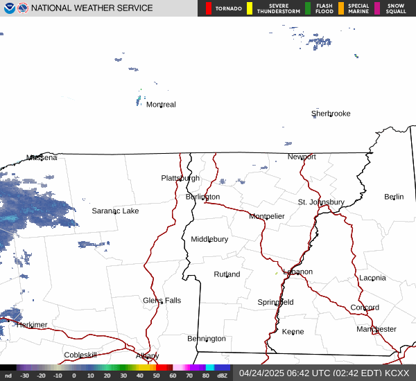
Link to Local Radar Data Link to Satellite Data

Hourly Weather Forecast

National Digital Forecast Database