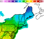
Areas of Hazardous Weather This Weekend

A series of cold fronts from North Pacific storms will bring periods of gusty winds, low elevation rainfall, and high elevation snow to the Pacific Northwest this weekend into next week. Heavy to excessive rainfall may produce areas of flooding over southern Texas this weekend. Read More >

Current conditions at

Burlington, Burlington International Airport (KBTV)

Lat: 44.47°NLon: 73.15°WElev: 331ft.
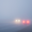
Fog/Mist

39°F

4°C

Humidity 96%
Wind Speed E 6 mph
Barometer 29.75 in (1007.7 mb)
Dewpoint 38°F (3°C)
Visibility 3.00 mi
Wind Chill35°F (2°C)
Last update 8 Nov 6:54 am EST
Extended Forecast for

Jonesville VT

  • Today

    Today: A 20 percent chance of showers before 10am.  Cloudy, then gradually becoming mostly sunny, with a high near 49. West wind 5 to 8 mph.

    High: 49 °F

    Slight Chance
    Showers then
    Mostly Cloudy

  • Tonight

    Tonight: A 50 percent chance of showers, mainly after 9pm.  Mostly cloudy, with a low around 40. Light south wind.  New precipitation amounts of less than a tenth of an inch possible.

    Low: 40 °F

    Chance
    Showers

  • Monday

    Monday: Showers likely, mainly before 11am.  Cloudy, with a high near 49. Light and variable wind becoming northwest 5 to 9 mph in the morning.  Chance of precipitation is 70%. New precipitation amounts of less than a tenth of an inch possible.

    High: 49 °F

    Showers
    Likely

  • Monday Night

    Monday Night: A 30 percent chance of showers before 10pm.  Cloudy, with a low around 36. West wind 5 to 9 mph.  New precipitation amounts of less than a tenth of an inch possible.

    Low: 36 °F

    Chance
    Showers then
    Mostly Cloudy

  • Tuesday

    Tuesday: A 50 percent chance of showers after 1pm.  Mostly cloudy, with a high near 50. Light and variable wind becoming southwest 5 to 7 mph in the morning.  New precipitation amounts of less than a tenth of an inch possible.

    High: 50 °F

    Mostly Cloudy
    then Chance
    Showers

  • Tuesday Night

    Tuesday Night: Showers, mainly before 1am.  Low around 35. West wind around 5 mph becoming calm  in the evening.  Chance of precipitation is 80%. New precipitation amounts of less than a tenth of an inch possible.

    Low: 35 °F

    Showers

  • Veterans Day

    Veterans Day: A 30 percent chance of showers before 1pm.  Mostly cloudy, with a high near 49. Northwest wind 3 to 7 mph.

    High: 49 °F

    Chance
    Showers

  • Wednesday Night

    Wednesday Night: Mostly cloudy, with a low around 28. Calm wind.

    Low: 28 °F

    Mostly Cloudy

  • Thursday

    Thursday: Partly sunny, with a high near 45. Calm wind becoming northwest around 5 mph in the afternoon.

    High: 45 °F

    Partly Sunny

Detailed Forecast

Today
A 20 percent chance of showers before 10am. Cloudy, then gradually becoming mostly sunny, with a high near 49. West wind 5 to 8 mph.
Tonight
A 50 percent chance of showers, mainly after 9pm. Mostly cloudy, with a low around 40. Light south wind. New precipitation amounts of less than a tenth of an inch possible.
Monday
Showers likely, mainly before 11am. Cloudy, with a high near 49. Light and variable wind becoming northwest 5 to 9 mph in the morning. Chance of precipitation is 70%. New precipitation amounts of less than a tenth of an inch possible.
Monday Night
A 30 percent chance of showers before 10pm. Cloudy, with a low around 36. West wind 5 to 9 mph. New precipitation amounts of less than a tenth of an inch possible.
Tuesday
A 50 percent chance of showers after 1pm. Mostly cloudy, with a high near 50. Light and variable wind becoming southwest 5 to 7 mph in the morning. New precipitation amounts of less than a tenth of an inch possible.
Tuesday Night
Showers, mainly before 1am. Low around 35. West wind around 5 mph becoming calm in the evening. Chance of precipitation is 80%. New precipitation amounts of less than a tenth of an inch possible.
Veterans Day
A 30 percent chance of showers before 1pm. Mostly cloudy, with a high near 49. Northwest wind 3 to 7 mph.
Wednesday Night
Mostly cloudy, with a low around 28. Calm wind.
Thursday
Partly sunny, with a high near 45. Calm wind becoming northwest around 5 mph in the afternoon.
Thursday Night
Mostly cloudy, with a low around 26. Calm wind.
Friday
Mostly cloudy, with a high near 43. Calm wind becoming north 5 to 8 mph in the morning.
Friday Night
A 30 percent chance of snow. Mostly cloudy, with a low around 26. North wind 3 to 5 mph.
Saturday
Mostly cloudy, with a high near 44. North wind 5 to 9 mph.
Basemap Options
Click map to change the forecast location
Loading map...

ABOUT THIS FORECAST

 
Point Forecast:
Jonesville VT
 44.4°N 72.97°W (Elev. 400 ft)
1:33 am EST Nov 8, 2026
7am EST Nov 8, 2026-6pm EST Nov 14, 2026
 
Get as KML Get as XML

Additional Resources

Radar & Satellite Image
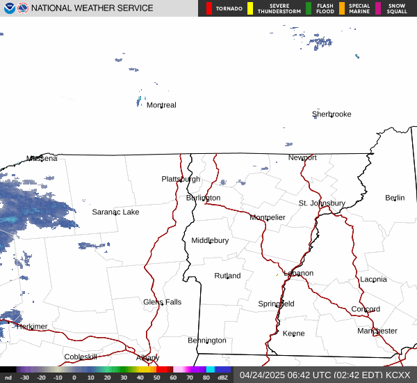
Link to Local Radar Data Link to Satellite Data

Hourly Weather Forecast

National Digital Forecast Database