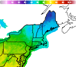
Winter Weather Advisory in Effect for the Higher Elevations of the Adirondacks and southern and central Greens through 10 AM Friday.

Over portions of the northern Adirondacks and the central and southern Greens, 2-4 inches of wet snow is expected through tomorrow morning. Plan on slippery road conditions in these areas, impacting the Thursday evening and Friday morning commutes. Minimal impacts are expected for lower elevations and valley locations will likely see little to no accumulations. Read More >

Hazardous Weather Conditions

Current conditions at

Burlington, Burlington International Airport (KBTV)

Lat: 44.47°NLon: 73.15°WElev: 331ft.

Overcast

41°F

5°C

Humidity 60%
Wind Speed N 9 mph
Barometer 29.71 in (1006.3 mb)
Dewpoint 28°F (-2°C)
Visibility 10.00 mi
Wind Chill35°F (2°C)
Last update 12 Nov 3:54 pm EST
Extended Forecast for

Burlington International Airport VT

  • This Afternoon

    This Afternoon: A chance of rain before 5pm, then a chance of rain and snow.  Mostly cloudy, with a high near 41. North wind around 7 mph.  Chance of precipitation is 30%. Little or no snow accumulation expected.

    High: 41 °F

    Chance
    Rain/Snow

  • Tonight

    Tonight: A chance of rain and snow before midnight, then a chance of snow.  Cloudy, with a low around 24. North wind around 8 mph.  Chance of precipitation is 30%. Little or no snow accumulation expected.

    Low: 24 °F

    Chance
    Rain/Snow
    then Chance
    Snow

  • Friday

    Friday: Mostly cloudy, with a high near 42. North wind 8 to 10 mph.

    High: 42 °F

    Mostly Cloudy

  • Friday Night

    Friday Night: Cloudy, with a low around 27. Northwest wind 5 to 7 mph.

    Low: 27 °F

    Cloudy

  • Saturday

    Saturday: A chance of snow showers before 9am, then a chance of rain and snow showers between 9am and 11am, then rain showers likely after 11am.  Cloudy, with a high near 42. Northwest wind 5 to 8 mph.  Chance of precipitation is 70%. Little or no snow accumulation expected.

    High: 42 °F

    Chance
    Rain/Snow
    then Showers
    Likely

  • Saturday Night

    Saturday Night: Rain showers likely before 1am, then a chance of rain and snow showers between 1am and 2am, then a chance of snow showers after 2am.  Cloudy, with a low around 28. Northwest wind 6 to 8 mph.  Chance of precipitation is 70%. New precipitation amounts of less than a tenth of an inch possible.

    Low: 28 °F

    Showers
    Likely then
    Rain/Snow
    Likely

  • Sunday

    Sunday: A chance of snow showers before 8am, then a chance of rain showers between 8am and 1pm.  Mostly cloudy, with a high near 42. Northwest wind 8 to 11 mph.  Chance of precipitation is 50%.

    High: 42 °F

    Chance
    Rain/Snow
    then Chance
    Showers

  • Sunday Night

    Sunday Night: Mostly cloudy, with a low around 30. Northwest wind 8 to 10 mph.

    Low: 30 °F

    Mostly Cloudy

  • Monday

    Monday: Partly sunny, with a high near 44. Northwest wind 5 to 8 mph.

    High: 44 °F

    Partly Sunny

Detailed Forecast

This Afternoon
A chance of rain before 5pm, then a chance of rain and snow. Mostly cloudy, with a high near 41. North wind around 7 mph. Chance of precipitation is 30%. Little or no snow accumulation expected.
Tonight
A chance of rain and snow before midnight, then a chance of snow. Cloudy, with a low around 24. North wind around 8 mph. Chance of precipitation is 30%. Little or no snow accumulation expected.
Friday
Mostly cloudy, with a high near 42. North wind 8 to 10 mph.
Friday Night
Cloudy, with a low around 27. Northwest wind 5 to 7 mph.
Saturday
A chance of snow showers before 9am, then a chance of rain and snow showers between 9am and 11am, then rain showers likely after 11am. Cloudy, with a high near 42. Northwest wind 5 to 8 mph. Chance of precipitation is 70%. Little or no snow accumulation expected.
Saturday Night
Rain showers likely before 1am, then a chance of rain and snow showers between 1am and 2am, then a chance of snow showers after 2am. Cloudy, with a low around 28. Northwest wind 6 to 8 mph. Chance of precipitation is 70%. New precipitation amounts of less than a tenth of an inch possible.
Sunday
A chance of snow showers before 8am, then a chance of rain showers between 8am and 1pm. Mostly cloudy, with a high near 42. Northwest wind 8 to 11 mph. Chance of precipitation is 50%.
Sunday Night
Mostly cloudy, with a low around 30. Northwest wind 8 to 10 mph.
Monday
Partly sunny, with a high near 44. Northwest wind 5 to 8 mph.
Monday Night
Mostly clear, with a low around 25. Calm wind becoming south around 5 mph after midnight.
Tuesday
Mostly sunny, with a high near 49. South wind 5 to 7 mph.
Tuesday Night
Partly cloudy, with a low around 29. South wind around 5 mph.
Wednesday
Mostly sunny, with a high near 52. South wind around 7 mph.
Wednesday Night
Partly cloudy, with a low around 32. South wind around 5 mph.
Thursday
Mostly sunny, with a high near 53. South wind 5 to 7 mph.
Basemap Options
Click map to change the forecast location
Loading map...

ABOUT THIS FORECAST

 
Point Forecast:
Burlington International Airport VT
 44.46°N 73.17°W (Elev. 299 ft)
1:41 pm EST Nov 12, 2026
4pm EST Nov 12, 2026-6pm EST Nov 19, 2026
 
Get as KML Get as XML

Additional Resources

Radar & Satellite Image
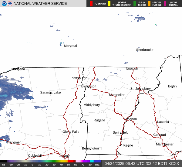
Link to Local Radar Data Link to Satellite Data

Hourly Weather Forecast

National Digital Forecast Database