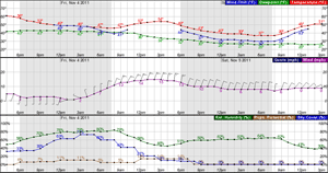
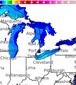
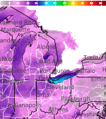
Accumulating Lake Effect Snow Continues
Accumulating lake effect snow this morning, possibly again this evening Read More >

Hazardous Weather Conditions
For More Weather Information:
Today
High: 41 °F
N 15kt
2ftTonight
Low: 38 °F
N 15kt
1-2ftSaturday

High: 44 °F
N 15kt
1ftSaturday Night
Low: 38 °F
NNW 15kt
< 1ftSunday

High: 44 °F
NNW 10kt
< 1ftSunday Night
Low: 39 °F
WSW 10kt
< 1ftMonday
High: 48 °F
SW 15kt
< 1ftMonday Night
Low: 41 °F
WSW 15kt
1ftTuesday
High: 49 °F
WSW 15kt
1ft
High and low forecast temperature values represent air temperature.
Water temperature forecast is experimental.
Associated Zone Forecast which includes this point
Last Update: 7:36 am CST Nov 13, 2026
Forecast Valid: 9am CST Nov 13, 2026-6pm CST Nov 19, 2026
View Nearby Observations
Detailed Forecast
*Notices:
- This forecast is for a single location. For safety concerns, mariners should be aware of the weather over a larger area. Forecast information for a larger area can be found within the zone forecast and the NDFD graphics.
- The forecast conditions at a particular point may not exceed the criteria of a Small Craft Advisory, Gale, Storm etc. These watches/warnings/advisories are issued for the entire zone in which the point resides and mariners should act accordingly.
Additional Forecasts and Information
 Forecast Area
ABOUT THIS FORECAST
| Point Forecast: | 45.67°N 85.49°W |
| Last Update: | 7:36 am CST Nov 13, 2026 |
| Forecast Valid: | 9am CST Nov 13, 2026-6pm CST Nov 19, 2026 |
| Forecast Discussion | |


|
RADAR & SATELLITE IMAGES