News Headlines

For More Weather Information:
This Afternoon
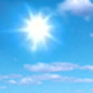
High: 66 °F
N 10kt
< 1ftTonight
Low: 54 °F
N 10kt
< 1ftFriday
High: 69 °F
Light Wind
< 1ftFriday Night
Low: 63 °F
S 10kt
< 1ftSaturday
High: 72 °F
SW 15kt
1-2ftSaturday Night
Low: 66 °F
SW 15kt
2-3ftSunday
High: 71 °F
S 10kt
2ftSunday Night
Low: 67 °F
E 10kt
2ftMonday
High: 73 °F
SE 15kt
2ft
High and low forecast temperature values represent air temperature.
Water temperature forecast is experimental.
Associated Zone Forecast which includes this point
Last Update: 4:11 pm CDT Aug 27, 2026
Forecast Valid: 4pm CDT Aug 27, 2026-6pm CDT Sep 3, 2026
View Nearby Observations
Detailed Forecast
This Afternoon
N wind around 10 kt. Sunny. Waves 1 ft or less.
Tonight
N wind 5 to 10 kt. Partly cloudy. Waves 1 ft or less.
Friday
Variable winds 5 kt or less. Sunny. Waves 1 ft or less.
Friday Night
S wind 5 to 10 kt. Partly cloudy. Waves 1 ft or less.
Saturday
SW wind 10 to 15 kt. A chance of showers after 1pm. Waves 1 to 2 ft.
Saturday Night
SW wind 10 to 15 kt. A chance of showers. Waves 2 to 3 ft.
Sunday
SSW wind around 10 kt becoming SE in the afternoon. A chance of showers, then showers likely and possibly a thunderstorm after 1pm. Waves around 2 ft.
Sunday Night
E wind around 10 kt. A chance of showers. Waves around 2 ft.
Monday
SE wind 10 to 15 kt. A chance of showers and thunderstorms. Waves around 2 ft.
See the open lakes forecast for days 3 through 5.
*Notices:
- This forecast is for a single location. For safety concerns, mariners should be aware of the weather over a larger area. Forecast information for a larger area can be found within the zone forecast and the NDFD graphics.
- The forecast conditions at a particular point may not exceed the criteria of a Small Craft Advisory, Gale, Storm etc. These watches/warnings/advisories are issued for the entire zone in which the point resides and mariners should act accordingly.
Additional Forecasts and Information
Basemap Options
Click map to change the forecast location
Loading map...
 Forecast Area
ABOUT THIS FORECAST
| Point Forecast: | 45.89°N 85.78°W |
| Last Update: | 4:11 pm CDT Aug 27, 2026 |
| Forecast Valid: | 4pm CDT Aug 27, 2026-6pm CDT Sep 3, 2026 |
| Forecast Discussion | |


|
RADAR & SATELLITE IMAGES