News Headlines
- Request for Comments: The National Weather Service is planning to modernize its Cooperative Observer Program (COOP) network by harnessing new technology, optimizing observation sites and leveraging high-quality commercial data.
- NOAA Weather Radio User Survey (Open until May 28, 2026)
- Skywarn Spotter Training - Miss our in-person training this spring? You can still watch the virtual recorded training anytime!

Hazardous Weather Conditions
Current conditions at
Ironwood, Gogebic-Iron County Airport (KIWD)
Lat: 46.53°NLon: 90.13°WElev: 1230ft.
Fair
75°F
24°C
| Humidity | 52% |
| Wind Speed | S 9 G 16 mph |
| Barometer | 29.87 in (1010.9 mb) |
| Dewpoint | 56°F (13°C) |
| Visibility | 10.00 mi |
| Last update | 25 May 9:56 pm CDT |
Extended Forecast for
5 Miles NW Montreal WI
Tonight

Low: 61 °F
Chance
ShowersTuesday

High: 82 °F
Sunny
Tuesday Night

Low: 52 °F
Partly Cloudy
Wednesday

High: 71 °F
Mostly Sunny
Wednesday Night

Low: 46 °F
Mostly Clear
Thursday

High: 72 °F
Sunny
Thursday Night

Low: 50 °F
Clear
Friday
High: 76 °F
Sunny
Friday Night
Low: 51 °F
Mostly Clear
Detailed Forecast
Tonight
A 40 percent chance of showers, mainly before 1am. Partly cloudy, with a low around 61. Southwest wind around 10 mph, with gusts as high as 20 mph.
Tuesday
Sunny, with a high near 82. West wind around 5 mph becoming north in the morning.
Tuesday Night
Partly cloudy, with a low around 52. Northeast wind around 5 mph becoming calm in the evening.
Wednesday
Mostly sunny, with a high near 71. Light northeast wind becoming north 5 to 10 mph in the morning. Winds could gust as high as 20 mph.
Wednesday Night
Mostly clear, with a low around 46. Northeast wind 5 to 10 mph, with gusts as high as 15 mph.
Thursday
Sunny, with a high near 72. East wind 5 to 10 mph becoming north in the afternoon.
Thursday Night
Clear, with a low around 50. North wind around 5 mph becoming calm.
Friday
Sunny, with a high near 76. Southwest wind around 5 mph becoming north in the afternoon.
Friday Night
Mostly clear, with a low around 51. Northeast wind around 5 mph becoming southeast after midnight.
Saturday
Sunny, with a high near 71. Southeast wind 5 to 10 mph becoming northeast in the afternoon. Winds could gust as high as 15 mph.
Saturday Night
Mostly clear, with a low around 48. Northeast wind around 5 mph becoming south after midnight.
Sunday
Sunny, with a high near 73. South wind around 5 mph becoming north in the morning.
Sunday Night
Mostly clear, with a low around 51. North wind around 5 mph becoming calm in the evening.
Monday
Sunny, with a high near 76. Southwest wind around 5 mph becoming north in the afternoon.
Basemap Options
Click map to change the forecast location
Loading map...
 Forecast Area
ABOUT THIS FORECAST
Point Forecast:
5 Miles NW Montreal WI
46.48°N 90.3°W
46.48°N 90.3°W
9:12 pm CDT May 25, 2026
10pm CDT May 25, 2026-6pm CDT Jun 1, 2026


Additional Resources
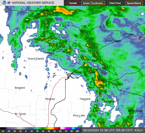
Radar & Satellite Image

Hourly Weather Forecast