

Super Typhoon Bavi to Impact Guam and the Mariana Islands; Excessive Rainfall and Flooding Threat in the Mid-Atlantic

Catastrophic Super Typhoon Bavi's eyewall has reached Rota and is expected to bring dangerous winds, heavy rainfall and storm surge to Guam, Rota, Tinian and Saipan. A Typhoon Warning remains in effect. Heavy to excessive rainfall will continue to bring a flooding threat from coastal Mid-Atlantic to southern New England through Monday. Read More >

Current conditions at

US-2 @Stateline US2 MP 667.1 (MTSTA)

Lat: 48.13764°NLon: 104.04687°WElev: 2100.0ft.

NA

70°F

21°C

Humidity 55%
Wind Speed WSW 27 MPH
Barometer NA
Dewpoint 53°F (12°C)
Visibility NA
Last update 06 Jul 01:15 AM MDT
Extended Forecast for

9 Miles N Bainville MT

  • Overnight

    Overnight: Showers likely and possibly a thunderstorm before 2am, then a slight chance of showers and thunderstorms between 2am and 3am.  Cloudy, then gradually becoming partly cloudy, with a low around 62. North northwest wind 6 to 15 mph becoming northeast. Winds could gust as high as 26 mph.  Chance of precipitation is 60%.

    Low: 62 °F

    Showers
    Likely

  • Monday

    Monday: Mostly sunny, with a high near 78. North wind 11 to 18 mph, with gusts as high as 28 mph.

    High: 78 °F

    Mostly Sunny

  • Monday Night

    Monday Night: A 20 percent chance of showers after 5am.  Increasing clouds, with a low around 57. North northeast wind 7 to 11 mph becoming east southeast after midnight.

    Low: 57 °F

    Mostly Cloudy
    then Slight
    Chance
    Showers

  • Tuesday

    Tuesday: Showers likely and possibly a thunderstorm before 4pm, then a chance of showers and thunderstorms between 4pm and 5pm.  Cloudy, with a high near 72. East southeast wind 11 to 15 mph, with gusts as high as 25 mph.  Chance of precipitation is 70%.

    High: 72 °F

    Showers
    Likely

  • Tuesday Night

    Tuesday Night: Showers likely and possibly a thunderstorm before midnight, then a chance of showers.  Cloudy, with a low around 55. East wind 9 to 15 mph, with gusts as high as 24 mph.  Chance of precipitation is 70%.

    Low: 55 °F

    Showers
    Likely

  • Wednesday

    Wednesday: Partly sunny, with a high near 76. East southeast wind 9 to 11 mph, with gusts as high as 20 mph.

    High: 76 °F

    Partly Sunny

  • Wednesday Night

    Wednesday Night: A 20 percent chance of showers and thunderstorms after midnight.  Partly cloudy, with a low around 56. East wind 11 to 13 mph, with gusts as high as 22 mph.

    Low: 56 °F

    Mostly Clear
    then Slight
    Chance
    T-storms

  • Thursday

    Thursday: A 40 percent chance of showers and thunderstorms, mainly before noon.  Mostly sunny, with a high near 82. South southeast wind around 11 mph becoming west southwest in the afternoon. Winds could gust as high as 22 mph.

    High: 82 °F

    Chance
    Showers then
    Slight Chance
    T-storms

  • Thursday Night

    Thursday Night: A 20 percent chance of showers and thunderstorms before midnight.  Partly cloudy, with a low around 56. West wind 5 to 13 mph becoming east southeast after midnight. Winds could gust as high as 20 mph.

    Low: 56 °F

    Slight Chance
    T-storms then
    Partly Cloudy

Detailed Forecast

Overnight
Showers likely and possibly a thunderstorm before 2am, then a slight chance of showers and thunderstorms between 2am and 3am. Cloudy, then gradually becoming partly cloudy, with a low around 62. North northwest wind 6 to 15 mph becoming northeast. Winds could gust as high as 26 mph. Chance of precipitation is 60%.
Monday
Mostly sunny, with a high near 78. North wind 11 to 18 mph, with gusts as high as 28 mph.
Monday Night
A 20 percent chance of showers after 5am. Increasing clouds, with a low around 57. North northeast wind 7 to 11 mph becoming east southeast after midnight.
Tuesday
Showers likely and possibly a thunderstorm before 4pm, then a chance of showers and thunderstorms between 4pm and 5pm. Cloudy, with a high near 72. East southeast wind 11 to 15 mph, with gusts as high as 25 mph. Chance of precipitation is 70%.
Tuesday Night
Showers likely and possibly a thunderstorm before midnight, then a chance of showers. Cloudy, with a low around 55. East wind 9 to 15 mph, with gusts as high as 24 mph. Chance of precipitation is 70%.
Wednesday
Partly sunny, with a high near 76. East southeast wind 9 to 11 mph, with gusts as high as 20 mph.
Wednesday Night
A 20 percent chance of showers and thunderstorms after midnight. Partly cloudy, with a low around 56. East wind 11 to 13 mph, with gusts as high as 22 mph.
Thursday
A 40 percent chance of showers and thunderstorms, mainly before noon. Mostly sunny, with a high near 82. South southeast wind around 11 mph becoming west southwest in the afternoon. Winds could gust as high as 22 mph.
Thursday Night
A 20 percent chance of showers and thunderstorms before midnight. Partly cloudy, with a low around 56. West wind 5 to 13 mph becoming east southeast after midnight. Winds could gust as high as 20 mph.
Friday
Sunny, with a high near 86. East wind 5 to 11 mph becoming south in the afternoon. Winds could gust as high as 22 mph.
Friday Night
Mostly clear, with a low around 61. Southeast wind 10 to 13 mph, with gusts as high as 21 mph.
Saturday
Sunny, with a high near 92.
Saturday Night
Mostly clear, with a low around 65.
Sunday
Sunny, with a high near 89.
Basemap Options
Click map to change the forecast location
Loading map...

ABOUT THIS FORECAST

 
Point Forecast:
9 Miles N Bainville MT
 48.28°N 104.24°W (Elev. 2198 ft)
1:01 am MDT Jul 6, 2026
1am MDT Jul 6, 2026-6pm MDT Jul 12, 2026
 
Get as KML Get as XML

Additional Resources

Radar & Satellite Image
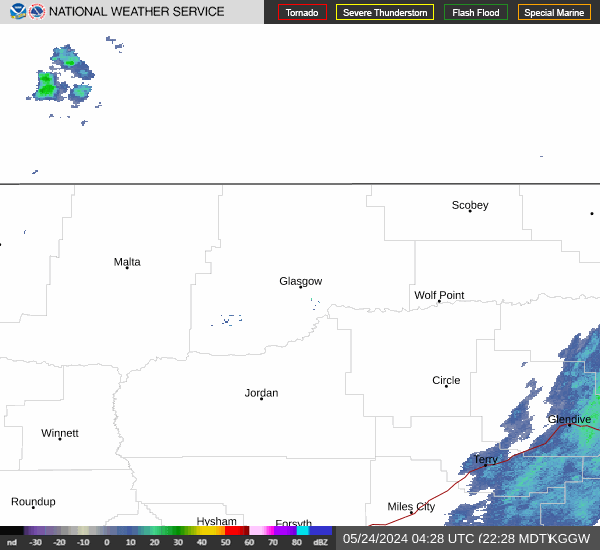
Link to Local Radar Data Link to Satellite Data

Hourly Weather Forecast

National Digital Forecast Database


