


News Headlines
- Got a new NOAA Weather Radio to receive warnings for the next Mendenhall Flood? Here are instructions for how to set it up to make sure you get the alerts!
- Warm temperatures continue into Friday with highs in the mid to upper 70s. Some low 80s possible still for inland areas, while areas by water may get a cooling afternoon sea breeze. Warmer and drier weather pattern expected to last into the weekend.
- To view the latest marine and land weather forecast graphics for southeast Alaska, click here...
- Click here to visit the Suicide Basin monitoring page. You can use this page for updates throughout the GLOF season to see what the condition are within the basin.

Hazardous Weather Conditions
Current conditions at
Ketchikan, Ketchikan International Airport (PAKT)
Lat: 55.36°NLon: 131.71°WElev: 89ft.
Fair
59°F
15°C
| Humidity | 90% |
| Wind Speed | W 5 mph |
| Barometer | 29.96 in (1014.4 mb) |
| Dewpoint | 56°F (13°C) |
| Visibility | 10.00 mi |
| Last update | 14 Aug 4:53 am AKDT |
Extended Forecast for
14 Miles SE Bell Island Hot Springs AK
Heat Advisory August 14, 06:08am until August 14, 07:00pm
NOW until 7:00pm Fri
Heat Advisory
Today
High: 79 °F
Sunny then
Slight Chance
T-stormsTonight
Low: 58 °F
Slight Chance
T-storms then
Mostly ClearSaturday
High: 76 °F
Sunny then
Slight Chance
T-stormsSaturday Night

Low: 55 °F
Mostly Clear
Sunday

High: 71 °F
Partly Sunny
Sunday Night

Low: 54 °F
Mostly Cloudy
Monday

High: 66 °F
Chance
ShowersMonday Night

Low: 53 °F
Chance
Showers
Detailed Forecast
Today
A 10 percent chance of showers and thunderstorms after 4pm. Sunny, with a high near 79. East wind 5 to 10 mph becoming light northeast in the afternoon.
Tonight
A 20 percent chance of showers and thunderstorms before 10pm. Mostly clear, with a low around 58. North wind around 5 mph becoming east in the evening.
Saturday
A 10 percent chance of showers and thunderstorms after 4pm. Sunny, with a high near 76. Calm wind becoming west around 5 mph in the afternoon.
Saturday Night
Mostly clear, with a low around 55. Southwest wind around 5 mph becoming calm in the evening.
Sunday
Partly sunny, with a high near 71. Calm wind becoming west around 5 mph in the afternoon.
Sunday Night
Mostly cloudy, with a low around 54.
Monday
A 30 percent chance of showers after 10am. Partly sunny, with a high near 66.
Monday Night
A chance of showers. Mostly cloudy, with a low around 53.
Tuesday
A chance of showers before 4pm. Cloudy, with a high near 63.
Tuesday Night
A chance of showers after 10pm. Cloudy, with a low around 52.
Wednesday
A chance of showers. Cloudy, with a high near 61.
Wednesday Night
A chance of showers. Mostly cloudy, with a low around 51.
Thursday
A chance of showers. Cloudy, with a high near 61.
Basemap Options
Click map to change the forecast location
Loading map...
 Forecast Area
ABOUT THIS FORECAST
Point Forecast:
14 Miles SE Bell Island Hot Springs AK
55.78°N 131.36°W (Elev. 1352 ft)
55.78°N 131.36°W (Elev. 1352 ft)
4:15 am AKDT Aug 14, 2026
6am AKDT Aug 14, 2026-6pm AKDT Aug 20, 2026


Additional Resources
Radar & Satellite Image
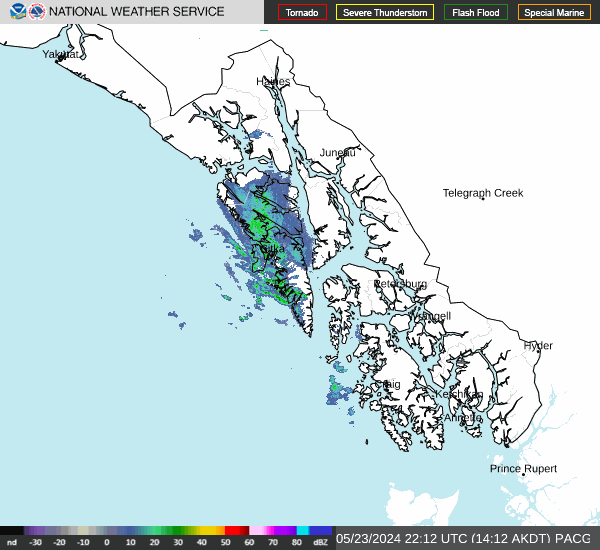

Hourly Weather Forecast


