News Headlines
- The active weather pattern remains for SE AK for the upcoming week with multiple systems pushing through. Monday will see breezy to windy conditions and moderate to heavy rain, as well as snow for the northern highways. Click here to read more...
- Curious how El Nino will potentially impact SE AK this winter? Click here to see a video breakdown of what El Nino could mean for SE AK going into the fall and winter.

Hazardous Weather Conditions
- Small Craft Advisory in effect from November 9, 12:00 AM AKST until November 9, 09:00 AM AKST
- Gale Warning in effect from November 9, 09:00 AM AKST until November 9, 06:00 PM AKST
- Gale Warning in effect from November 9, 09:00 PM AKST until November 10, 06:00 AM AKST
- Storm Warning
- Storm Warning in effect from November 9, 06:00 PM AKST until November 9, 09:00 PM AKST
For More Weather Information:
Overnight
Low: 36 °F
ENE 20kt
5ft
Small Craft AdvisoryMonday

High: 47 °F
NE 20kt
 14ft

Gale WarningMonday Night
Low: 40 °F
SE 40kt
15ft

Storm WarningTuesday
High: 47 °F
NE 25kt
11ftTuesday Night
Low: 39 °F
E 25kt⇓
6-8ftVeterans Day
High: 47 °F
E 15kt
5-6ftWednesday Night
Low: 38 °F
SSE 15kt
6ftThursday
High: 44 °F
SE 15kt
5-6ftThursday Night

Low: 33 °F
NE 15kt
5-6ft
High and low forecast temperature values represent air temperature.
Water temperature forecast is experimental.
Associated Zone Forecast which includes this point
Last Update: 7:23 pm AKST Nov 8, 2026
Forecast Valid: 12am AKST Nov 9, 2026-6pm AKST Nov 15, 2026
View Nearby Observations
Detailed Forecast
...STORM WARNING MONDAY...
Synopsis: An area of low pressure strengthening to storm force will move
from the north Pacific into the central Gulf of Alaska on
Monday. This low will move into the western gulf later Monday,
with another strong low moving into the southern gulf Tuesday.
Overnight
ENE wind around 20 kt, with gusts as high as 30 kt. A chance of rain. Seas around 5 ft.
Monday
NE wind 15 to 20 kt. Rain. Seas 9 ft building to 14 ft.
Monday Night
SE wind 30 to 40 kt, with gusts as high as 55 kt. Rain. The rain could be heavy at times. Seas 15 ft subsiding to 12 ft.
Tuesday
NE wind 20 to 25 kt. Rain likely, mainly after 3pm. Seas 11 ft subsiding to 8 ft.
Tuesday Night
E wind 20 to 25 kt decreasing to 10 to 15 kt after midnight. Rain. Seas 6 to 8 ft.
Veterans Day
E wind around 15 kt becoming SE in the afternoon. Rain. Seas 5 to 6 ft.
Wednesday Night
SSE wind around 15 kt. Rain. Seas around 6 ft.
Thursday
SE wind 10 to 15 kt becoming ENE in the afternoon. Rain. Seas 5 to 6 ft.
Thursday Night
NE wind 10 to 15 kt. Mostly cloudy. Seas 5 to 6 ft.
*Notices:
- This forecast is for a single location. For safety concerns, mariners should be aware of the weather over a larger area. Forecast information for a larger area can be found within the zone forecast and the NDFD graphics.
- The forecast conditions at a particular point may not exceed the criteria of a Small Craft Advisory, Gale, Storm etc. These watches/warnings/advisories are issued for the entire zone in which the point resides and mariners should act accordingly.
Basemap Options
Click map to change the forecast location
Loading map...
 Forecast Area
ABOUT THIS FORECAST
| Point Forecast: | 59.33°N 139.26°W |
| Last Update: | 7:23 pm AKST Nov 8, 2026 |
| Forecast Valid: | 12am AKST Nov 9, 2026-6pm AKST Nov 15, 2026 |
| Forecast Discussion | |


|
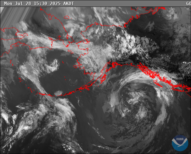
RADAR & SATELLITE IMAGES