


News Headlines
- Warm temperatures continue Saturday with highs in the mid to upper 70s. Some low 80s possible still for inland areas, while areas by water may get a cooling afternoon sea breeze. Cooler and wetter weather on tap next week.
- To view the latest marine and land weather forecast graphics for southeast Alaska, click here...

Current conditions at
Yakutat (PAYA)
Lat: 59.52°NLon: 139.67°WElev: 36ft.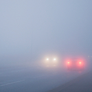
Fog/Mist
56°F
13°C
| Humidity | 100% |
| Wind Speed | W 3 mph |
| Barometer | 30.14 in (1020.7 mb) |
| Dewpoint | 56°F (13°C) |
| Visibility | 2.00 mi |
| Last update | 15 Aug 8:53 pm AKDT |
Extended Forecast for
21 Miles N Point Latouche AK
Tonight

Low: 35 °F
Cloudy
Sunday
High: 38 °F
Slight Chance
Rain/Snow
then
Rain/Snow
LikelySunday Night

Low: 35 °F
Showers
Monday
High: 38 °F
Heavy Rain
then
Rain/SnowMonday Night
Low: 31 °F
Rain/Snow
then Snow
ShowersTuesday

High: 34 °F
Snow Showers
LikelyTuesday Night

Low: 29 °F
Chance Snow
ShowersWednesday

High: 35 °F
Snow Showers
LikelyWednesday Night

Low: 31 °F
Rain/Snow
Detailed Forecast
Tonight
Cloudy, with a low around 35. Northwest wind around 5 mph.
Sunday
A slight chance of rain and snow showers between 10am and 1pm, then rain showers likely. Cloudy, with a high near 38. Calm wind. Chance of precipitation is 60%. Little or no snow accumulation expected.
Sunday Night
Showers. Low around 35. South wind around 5 mph. Chance of precipitation is 100%. New precipitation amounts between a half and three quarters of an inch possible.
Monday
Rain showers before 1pm, then rain and snow showers. The rain could be heavy at times. High near 38. South wind around 5 mph. Chance of precipitation is 100%.
Monday Night
Rain and snow showers, becoming all snow after 7pm. Low around 31. Southwest wind around 5 mph. Chance of precipitation is 90%.
Tuesday
Snow showers likely. Mostly cloudy, with a high near 34. Chance of precipitation is 60%.
Tuesday Night
A 50 percent chance of snow showers. Cloudy, with a low around 29.
Wednesday
Snow showers likely. Cloudy, with a high near 35.
Wednesday Night
Rain and snow showers. The rain could be heavy at times. Cloudy, with a low around 31.
Thursday
Snow showers. Cloudy, with a high near 34.
Thursday Night
Snow showers likely. Cloudy, with a low around 30.
Friday
Snow showers likely. Mostly cloudy, with a high near 34.
Friday Night
Snow showers likely. Mostly cloudy, with a low around 29.
Saturday
Snow showers likely. Cloudy, with a high near 34.
Basemap Options
Click map to change the forecast location
Loading map...
 Forecast Area
ABOUT THIS FORECAST
Point Forecast:
21 Miles N Point Latouche AK
60.21°N 139.64°W (Elev. 7595 ft)
60.21°N 139.64°W (Elev. 7595 ft)
6:34 pm AKDT Aug 15, 2026
9pm AKDT Aug 15, 2026-6pm AKDT Aug 22, 2026


Additional Resources
Radar & Satellite Image

Hourly Weather Forecast


