


News Headlines
- Warm temperatures continue into late week with highs in the mid to upper 70s. Some low 80s possible still for inland areas, while areas by water may get a cooling afternoon sea breeze. Warmer and drier weather pattern expected through the weekend.
- To view the latest marine and land weather forecast graphics for southeast Alaska, click here...

Current conditions at
Yakutat (PAYA)
Lat: 59.52°NLon: 139.67°WElev: 36ft.
Partly Cloudy
55°F
13°C
| Humidity | 100% |
| Wind Speed | SW 6 mph |
| Barometer | 30.04 in (1017.3 mb) |
| Dewpoint | 55°F (13°C) |
| Visibility | 9.00 mi |
| Wind Chill | 54°F (12°C) |
| Last update | 14 Aug 8:53 pm AKDT |
Extended Forecast for
5 Miles W Mount St Elias AK
Tonight

Low: 38 °F
Mostly Clear
Saturday

High: 43 °F
Increasing
CloudsSaturday Night

Low: 37 °F
Mostly Cloudy
Sunday

High: 40 °F
Showers
LikelySunday Night

Low: 37 °F
Heavy Rain
Monday
High: 39 °F
Heavy Rain
then
Rain/SnowMonday Night
Low: 32 °F
Rain/Snow
then Snow
Showers
LikelyTuesday

High: 36 °F
Chance Snow
ShowersTuesday Night

Low: 30 °F
Snow Showers
Likely
Detailed Forecast
Tonight
Mostly clear, with a low around 38. North wind 10 to 15 mph.
Saturday
Increasing clouds, with a high near 43. North wind 5 to 10 mph becoming northwest in the afternoon.
Saturday Night
Mostly cloudy, with a low around 37. East wind 5 to 10 mph becoming north after midnight.
Sunday
Showers likely, mainly after 4pm. Mostly cloudy, with a high near 40. East wind around 5 mph becoming southeast in the afternoon. Chance of precipitation is 60%.
Sunday Night
Showers. The rain could be heavy at times. Low around 37. Southeast wind 10 to 15 mph. Chance of precipitation is 90%.
Monday
Rain showers before 4pm, then rain and snow showers. The rain could be heavy at times. High near 39. Chance of precipitation is 100%.
Monday Night
Rain and snow showers, becoming all snow after 10pm. Low around 32. Chance of precipitation is 80%.
Tuesday
A chance of snow showers. Cloudy, with a high near 36.
Tuesday Night
Snow showers likely, mainly after 10pm. Cloudy, with a low around 30.
Wednesday
Snow showers likely. Cloudy, with a high near 36.
Wednesday Night
Snow showers likely. Cloudy, with a low around 30.
Thursday
Snow showers likely. Cloudy, with a high near 36.
Thursday Night
Snow showers likely. Mostly cloudy, with a low around 29.
Friday
A chance of snow showers. Mostly cloudy, with a high near 36.
Basemap Options
Click map to change the forecast location
Loading map...
 Forecast Area
ABOUT THIS FORECAST
Point Forecast:
5 Miles W Mount St Elias AK
60.31°N 141.09°W (Elev. 7385 ft)
60.31°N 141.09°W (Elev. 7385 ft)
6:10 pm AKDT Aug 14, 2026
9pm AKDT Aug 14, 2026-6pm AKDT Aug 21, 2026


Additional Resources
Radar & Satellite Image
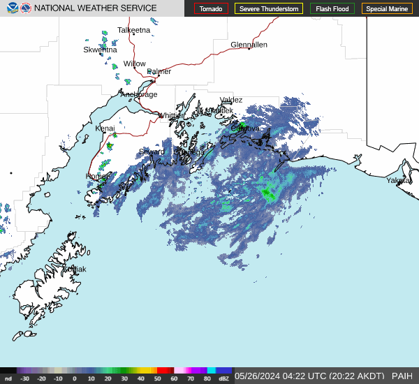

Hourly Weather Forecast


