


Hazardous Weather Conditions

Current conditions at
Jonesboro, Jonesboro Municipal Airport (KJBR)
Lat: 35.84° N Lon: 90.64° W Elev: 259 ft.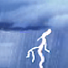
Thunderstorm in Vicinity
91°F
33°C
| Humidity | 66% |
| Wind Speed | SE 5 mph |
| Barometer | 29.89 in (1011.7 mb) |
| Dewpoint | 78°F (26°C) |
| Visibility | 10.00 mi |
| Heat Index | 106°F (41°C) |
| Last update | 20 Jul 2:53 pm CDT |
Detailed forecast for
Poinsett County
Tonight
Partly cloudy early, then clearing. Humid with lows in the upper 70s. West winds around 5 mph early, becoming light and variable, then becoming south around 5 mph after midnight. Heat index values up to 110 early through the evening.
Tuesday
Sunny with highs in the upper 90s. West winds around 5 mph. Heat index values up to 116.
Tuesday Night
Partly cloudy. A slight chance of showers and thunderstorms in the evening. Humid with lows in the mid 70s. Southwest winds around 5 mph, becoming north with gusts up to 20 mph after midnight. Chance of rain 20 percent. Heat index values up to 114 early in the evening.
Wednesday
Sunny, cooler with highs in the upper 80s. Northeast winds around 10 mph with gusts up to 20 mph.
Wednesday Night
Mostly clear. Lows in the upper 60s. Northeast winds 5 to 10 mph.
Thursday
Sunny. Highs in the mid 80s.
Thursday Night
Mostly clear. Lows in the upper 60s.
Friday
Mostly sunny. Highs in the mid 80s.
Friday Night
Partly cloudy. A slight chance of showers and thunderstorms after midnight. Lows in the lower 70s. Chance of rain 20 percent.
Saturday
Mostly sunny with a slight chance of showers and thunderstorms. Highs around 90. Chance of rain 20 percent.
Saturday Night
Partly cloudy in the evening, then clearing. A slight chance of showers and thunderstorms. Lows in the lower 70s. Chance of rain 20 percent.
Sunday
Sunny. Highs in the mid 90s. Heat index values up to 110.
Sunday Night
Clear. Lows in the mid 70s. Heat index values up to 105 early in the evening.
Monday
Sunny. Highs in the upper 90s. Heat index values up to 110.
Additional Forecasts and Information
Basemap Options
Click map to change the forecast location
Loading map...
Additional Resources
Radar & Satellite Image


Hourly Weather Forecast


