News Headlines
- Prepare for an Active Severe Weather Season! Sign Up for an Upcoming SKYWARN Training Class
- Increased Potential for Well Above Normal Rainfall and Severe Weather This Upcoming Dry Season (Nov 2026 - Apr 2027)
- El Nino and Its Influence on East Central Florida Weather
- Seven Day Graphical Hazardous Weather Outlook
Hazardous Weather Conditions
- Rip Current Statement until October 26, 08:00 PM EDT
- Coastal Flood Advisory until October 25, 02:00 AM EDT
- Wind Advisory in effect from October 24, 02:00 PM EDT until October 25, 08:00 AM EDT
- Coastal Flood Warning in effect from October 25, 02:00 AM EDT until October 26, 08:00 PM EDT
- High Surf Advisory in effect from October 24, 11:00 AM EDT until October 26, 08:00 PM EDT
- Flood Warning

Current conditions at
Daytona Beach International Airport (KDAB)
Lat: 29.17° N Lon: 81.07° W Elev: 23 ft.
Partly Cloudy
79°F
26°C
| Humidity | 61% |
| Wind Speed | N 17 G 26 mph |
| Barometer | 30.14 in |
| Dewpoint | 64°F (18°C) |
| Visibility | 10.00 mi |
| Heat Index | 81°F (27°C) |
| Last update | 24 Oct 12:53 pm EDT |
Detailed forecast for
Coastal Volusia
Today
Partly sunny with a chance of showers. A slight chance of thunderstorms late in the morning, then a chance of thunderstorms late in the afternoon and towards sunset. Windy. Highs in the upper 70s. North winds 20 to 25 mph becoming northeast 25 to 30 mph with gusts up to 40 mph late in the afternoon and towards sunset. Chance of rain 50 percent.
Tonight
Partly cloudy. Showers likely and a chance of thunderstorms in the late evening and early morning, then a chance of showers and a slight chance of thunderstorms after midnight. Windy. Lows in the lower 70s. Northeast winds 20 to 25 mph with gusts up to 40 mph. Chance of rain 70 percent.
Sunday
Partly sunny late in the morning then considerable cloudiness. A slight chance of thunderstorms. A chance of showers late in the morning, then showers likely late in the afternoon and towards sunset. Windy. Highs in the upper 70s. Northeast winds 20 to 25 mph increasing to 25 to 30 mph late in the afternoon and towards sunset. Chance of rain 60 percent.
Sunday Night
Partly cloudy. Showers likely and a slight chance of thunderstorms in the late evening and early morning, then a chance of showers after midnight. Windy. Lows in the lower 70s. Northeast winds 25 to 30 mph. Chance of rain 60 percent.
Monday
Partly sunny with a chance of showers. Windy. Highs in the upper 70s. Northeast winds 25 to 30 mph with gusts up to 40 mph. Chance of rain 50 percent.
Monday Night
Mostly clear. A slight chance of showers in the late evening and early morning. Windy. Lows in the lower 70s. Chance of rain 20 percent.
Tuesday
Mostly sunny. Windy. Highs in the upper 70s.
Tuesday Night
Partly cloudy. A slight chance of showers in the late evening and early morning. Windy. Lows in the lower 70s. Chance of rain 20 percent.
Wednesday
Partly sunny with a slight chance of showers. Windy. Highs in the upper 70s. Chance of rain 20 percent.
Wednesday Night
A slight chance of thunderstorms in the late evening and early morning. Partly cloudy with a slight chance of showers. Windy. Lows in the lower 70s. Chance of rain 20 percent.
Thursday
Partly sunny with a chance of showers. Windy. Highs in the upper 70s. Chance of rain 40 percent.
Thursday Night
Partly cloudy. Breezy. Lows around 70.
Friday
Partly sunny. A slight chance of showers late in the morning, then a chance of showers late in the afternoon and towards sunset. Breezy. Highs in the upper 70s. Chance of rain 30 percent.
Additional Forecasts and Information
Basemap Options
Click map to change the forecast location
Loading map...
 Forecast Area
Additional Resources
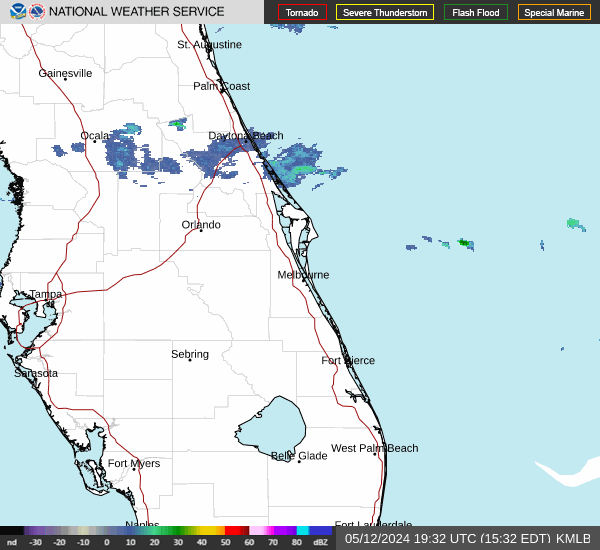
Radar & Satellite Image

Hourly Weather Forecast