Localized Flooding through the Weekend followed by a Moderate Nor'easter and Tidal Flooding Next Week
Tropical moisture will fuel high chances for rain through the weekend and then along a stalling cold front next week. Several inches of rain are expected to fall over the next several days that will increase the risk for localized flooding each day. A Moderately Strong Nor'easter will develop Tuesday and bring gusty winds, dangerous surf/rip currents, and potential for moderate tidal flooding. Read More >
Hazardous Weather Conditions

Current conditions at
Suwannee County Airport (K24J)
Lat: 30.3° N Lon: 83.02° W Elev: 104 ft.
Mostly Cloudy
82°F
28°C
| Humidity | 84% |
| Wind Speed | Vrbl 3 mph |
| Barometer | 30.06 in |
| Dewpoint | 77°F (25°C) |
| Visibility | 10.00 mi |
| Heat Index | 90°F (32°C) |
| Last update | 4 Oct 1:35 pm EDT |
Detailed forecast for
Western Hamilton
Today
Mostly cloudy. Patchy fog this morning. A slight chance of showers and thunderstorms this morning, then showers likely with a chance of thunderstorms this afternoon. Some thunderstorms may produce heavy rainfall this afternoon. Highs in the mid 80s. Light and variable winds, becoming southwest around 5 mph this afternoon. Chance of rain 70 percent.
Tonight
Showers with a chance of thunderstorms in the evening, then showers likely after midnight. Some thunderstorms may produce heavy rainfall in the evening. Lows around 70. Light and variable winds. Chance of rain 90 percent.
Monday
Showers likely with a chance of thunderstorms in the morning, then showers with a chance of thunderstorms in the afternoon. Some thunderstorms may produce heavy rainfall in the morning. Highs in the upper 70s. Light and variable winds, becoming northeast around 5 mph in the afternoon. Chance of rain 90 percent.
Monday Night
Showers likely with a chance of thunderstorms in the evening, then showers with a slight chance of thunderstorms after midnight. Lows in the upper 60s. Northeast winds around 5 mph. Chance of rain 80 percent.
Tuesday
Showers. A slight chance of thunderstorms in the morning, then a chance of thunderstorms in the afternoon. Highs in the upper 70s. Northeast winds 5 to 10 mph with gusts up to 25 mph. Chance of rain 90 percent.
Tuesday Night
Mostly cloudy. Showers with a chance of thunderstorms in the evening, then a chance of showers with a slight chance of thunderstorms after midnight. Lows in the mid 60s. Chance of rain 90 percent.
Wednesday And Wednesday Night
Mostly cloudy with a chance of showers with a slight chance of thunderstorms. Highs around 80. Lows in the lower 60s. Chance of rain 40 percent.
Thursday And Thursday Night
Mostly cloudy. A slight chance of showers and thunderstorms. Highs in the lower 80s. Lows in the lower 60s. Chance of rain 20 percent.
Friday And Friday Night
Mostly cloudy with a chance of showers with a slight chance of thunderstorms. Highs in the lower 80s. Lows in the upper 60s. Chance of rain 50 percent.
Saturday
Showers likely. A chance of thunderstorms in the afternoon. Highs in the lower 80s. Chance of rain 70 percent.
Additional Forecasts and Information
Basemap Options
Click map to change the forecast location
Loading map...
 Forecast Area
Additional Resources
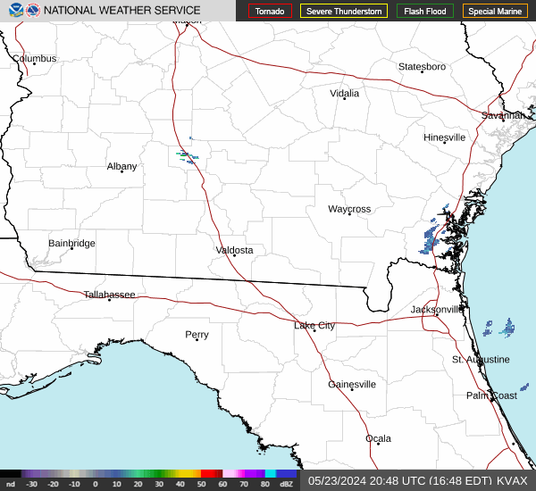
Radar & Satellite Image

Hourly Weather Forecast