News Headlines
- 🌪️ SCHEDULE: 2026 SkyWarn Storm Spotter Classes (FREE!)
- 🌴 Beach Bound? Learn More About RIP CURRENTS - The #1 Weather Related Killer Along Gulf Coast Beaches.
- 🌊 BEACH FORECAST Page for Rip Current Risk & UV Indices
- 🌀 NWS Mobile/Pensacola 2026 Hurricane Preparedness Guide
- 🌀 Hurricane Season One-Stop-Shop

Hazardous Weather Conditions
Last Update: 301 PM CST Tue Nov 17 2026
For More Weather Information:
45NM SSW Destin FL
Marine Zone Forecast
Tonight
East winds 25 to 30 knots. Seas 9 to 11 feet, occasionally to 14 feet. Wave detail: east 11 feet at 8 seconds. A slight chance of showers until early morning.
Wednesday
East winds 25 to 30 knots. Seas 9 to 12 feet, occasionally to 15 feet. Wave detail: east 11 feet at 9 seconds. A slight chance of showers in the afternoon.
Wednesday Night
East winds 25 to 30 knots. Seas 8 to 11 feet, occasionally to 14 feet. Wave detail: east 11 feet at 9 seconds. A slight chance of showers.
Thursday
East winds 25 to 30 knots. Seas 7 to 10 feet, occasionally to 13 feet. Wave detail: east 10 feet at 8 seconds. A slight chance of showers in the morning, then a chance of showers in the afternoon.
Thursday Night
East winds 20 to 25 knots with gusts up to 30 knots. Seas 6 to 9 feet, occasionally to 11 feet. Wave detail: east 9 feet at 7 seconds. A chance of showers. A slight chance of thunderstorms after midnight.
Friday
East winds around 25 knots with gusts up to 30 knots. Seas 6 to 8 feet, occasionally to 10 feet. Wave detail: east 8 feet at 7 seconds. A chance of thunderstorms. A chance of showers in the morning, then showers likely in the afternoon.
Friday Night
East winds 20 to 25 knots with gusts up to 35 knots. Seas 6 to 8 feet, occasionally to 10 feet. Wave detail: east 8 feet at 7 seconds. A chance of showers and thunderstorms.
Saturday
East winds 15 to 20 knots. Seas 5 to 6 feet, occasionally to 8 feet, subsiding to 3 to 5 feet, occasionally to 6 feet in the afternoon. Wave detail: east 6 feet at 7 seconds, becoming east 5 feet at 7 seconds. A slight chance of showers and thunderstorms.
Saturday Night
Northeast winds 10 to 15 knots. Seas 2 to 4 feet, occasionally to 5 feet. Wave detail: east 4 feet at 6 seconds.
Sunday
Northeast winds 10 to 15 knots, becoming north 5 to 10 knots in the afternoon. Seas around 2 feet. Wave detail: east 2 feet at 5 seconds.
Sunday Night
North winds 5 to 10 knots. Seas 1 foot or less, then 2 to 4 feet, occasionally to 5 feet after midnight. Wave detail: northeast 1 foot at 4 seconds.
winds and seas higher in and near thunderstorms.
winds and seas higher in and near thunderstorms.
Winds and seas higher in and near thunderstorms.
Additional Forecasts and Information
Basemap Options
Click map to change the forecast location
Loading map...
 Forecast Area
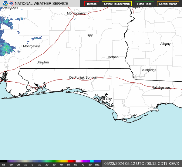
RADAR & SATELLITE IMAGES