


Hazardous Weather Conditions
- Hazardous Weather Outlook
- Heat Advisory in effect from July 25, 12:00 PM CDT until July 26, 12:00 PM CDT
- Extreme Heat Watch in effect from July 26, 09:00 PM CDT until July 27, 10:00 PM CDT
- Extreme Heat Warning in effect from July 26, 12:00 PM CDT until July 26, 09:00 PM CDT
- Dense Fog Advisory until July 25, 10:00 AM CDT

Current conditions at
Perry Municipal Airport (KPRO)
Lat: 41.83° N Lon: 94.16° W Elev: 1013 ft.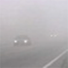
Fog/Mist
74°F
23°C
| Humidity | 97% |
| Wind Speed | SE 5 mph |
| Barometer | 29.93 in |
| Dewpoint | 73°F (23°C) |
| Visibility | 2.50 mi |
| Last update | 25 Jul 9:15 am CDT |
Detailed forecast for
Dallas County
Rest Of Today
Areas of dense fog early this morning. Partly sunny. Warmer with highs in the lower 90s. South winds around 5 mph. Heat index values up to 104 this afternoon.
Tonight
Partly cloudy. Humid with lows in the lower 70s. South winds around 5 mph. Heat index values up to 106 early in the evening.
Sunday
Partly sunny. Hot with highs in the mid 90s. Southwest winds 10 to 15 mph. Heat index values up to 113.
Sunday Night
Partly cloudy. A slight chance of showers and thunderstorms after midnight. Humid with lows in the mid 70s. South winds around 10 mph with gusts up to 20 mph. Chance of rain 20 percent. Heat index values up to 112 early in the evening.
Monday
Sunny, hot with highs in the mid 90s. Southwest winds 5 to 10 mph, becoming northwest in the afternoon. Heat index values up to 106.
Monday Night
Mostly clear in the evening, then becoming partly cloudy. Lows in the lower 70s. Heat index values up to 105 early in the evening.
Tuesday
Mostly sunny. Highs in the lower 90s.
Tuesday Night
Partly cloudy in the evening, then becoming mostly clear. Lows in the upper 60s.
Wednesday
Sunny. Highs in the lower 90s.
Wednesday Night
Mostly clear in the evening, then partly cloudy with a slight chance of showers and thunderstorms after midnight. Lows around 70. Chance of rain 20 percent.
Thursday
Mostly sunny with a slight chance of showers and thunderstorms. Highs around 90. Chance of rain 20 percent.
Thursday Night
Partly cloudy. A slight chance of showers and thunderstorms in the evening, then a chance of showers and thunderstorms after midnight. Lows in the upper 60s. Chance of rain 30 percent.
Friday
Sunny. A slight chance of showers and thunderstorms in the morning. Highs around 90. Chance of rain 20 percent.
Additional Forecasts and Information
Basemap Options
Click map to change the forecast location
Loading map...
Additional Resources
Radar & Satellite Image


Hourly Weather Forecast


