


Hazardous Weather Conditions

Current conditions at
Fergus Falls Municipal Airport-Einar Mickel (KFFM)
Lat: 46.29° N Lon: 96.15° W Elev: 1178 ft.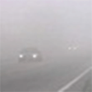
Fog/Mist
72°F
22°C
| Humidity | 100% |
| Wind Speed | Calm |
| Barometer | 29.87 in |
| Dewpoint | 72°F (22°C) |
| Visibility | 3.00 mi |
| Last update | 25 Jul 9:15 am CDT |
Detailed forecast for
West Otter Tail
Rest Of Today
Sunny. Patchy smoke this afternoon. Highs in the mid 90s. Northwest winds around 5 mph shifting to the southwest this afternoon.
Tonight
Partly cloudy. Lows in the mid 70s. South winds 5 to 15 mph.
Sunday
Mostly sunny. Highs in the mid 90s. South winds 5 to 15 mph.
Sunday Night
Clear. Lows 70 to 75.
Monday
Sunny. Highs in the mid 90s.
Monday Night
Partly cloudy. Lows 65 to 70.
Tuesday And Tuesday Night
Mostly clear. Highs in the mid 90s. Lows 70 to 75.
Wednesday And Wednesday Night
Mostly clear. A slight chance of showers and thunderstorms. Highs in the mid 90s. Lows 70 to 75.
Thursday
Mostly sunny. A slight chance of showers and thunderstorms. Highs in the mid 90s.
Thursday Night
Mostly clear. A slight chance of showers and thunderstorms. Lows 65 to 70.
Friday
Sunny. Highs 90 to 95.
Basemap Options
Click map to change the forecast location
Loading map...
Additional Resources
Radar & Satellite Image


Hourly Weather Forecast


