


Hazardous Weather Conditions
Current conditions at
Altoona - Blair County Airport (KAOO)
Lat: 40.3°NLon: 78.32°WElev: 1467ft.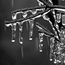
Light Freezing Rain
30°F
-1°C
| Humidity | 88% |
| Wind Speed | SE 9 mph |
| Barometer | 30.37 in (1030.4 mb) |
| Dewpoint | 27°F (-3°C) |
| Visibility | 8.00 mi |
| Wind Chill | 22°F (-6°C) |
| Last update | 3 Mar 4:53 am EST |
Extended Forecast for
Roaring Spring PA
Winter Weather Advisory March 3, 05:35am until March 3, 01:00pm
NOW until 1:00pm Tue

Winter Weather Advisory
Overnight

Low: 26 °F
Freezing Rain
LikelyTuesday
High: 41 °F
Rain/Freezing
Rain then
RainTuesday Night
Low: 40 °F
Rain then
Chance RainWednesday
High: 53 °F
Slight Chance
Rain then
Chance RainWednesday Night

Low: 45 °F
Rain
Thursday

High: 64 °F
Rain
Thursday Night
Low: 51 °F
Rain
Friday

High: 69 °F
Partly Sunny
Detailed Forecast
Overnight
Freezing rain likely. Cloudy, with a low around 26. Southeast wind around 7 mph. Chance of precipitation is 60%. Total nighttime ice accumulation of around a 0.1 of an inch possible.
Tuesday
Rain or freezing rain, becoming all rain after 11am. High near 41. South wind around 7 mph. Chance of precipitation is 100%. New ice accumulation of less than a 0.1 of an inch possible.
Tuesday Night
Rain, mainly before 2am. Low around 40. South wind around 5 mph becoming calm in the evening. Chance of precipitation is 90%. New precipitation amounts between a tenth and quarter of an inch possible.
Wednesday
A chance of rain, mainly after 1pm. Cloudy, with a high near 53. Calm wind. Chance of precipitation is 50%. New precipitation amounts of less than a tenth of an inch possible.
Wednesday Night
Rain. Low around 45. Calm wind. Chance of precipitation is 80%. New precipitation amounts between a quarter and half of an inch possible.
Thursday
Rain, with thunderstorms also possible after 4pm. High near 64. Chance of precipitation is 80%. New rainfall amounts between a tenth and quarter of an inch, except higher amounts possible in thunderstorms.
Thursday Night
Rain. Low around 51. Chance of precipitation is 80%.
Friday
Partly sunny, with a high near 69.
Friday Night
Mostly cloudy, with a low around 51.
Saturday
Rain likely after 1pm. Mostly cloudy, with a high near 74. Chance of precipitation is 60%.
Saturday Night
Rain likely. Mostly cloudy, with a low around 52. Chance of precipitation is 70%.
Sunday
A chance of rain. Partly sunny, with a high near 67. Chance of precipitation is 30%.
Sunday Night
Mostly cloudy, with a low around 50.
Monday
Partly sunny, with a high near 69.
Additional Forecasts and Information
Basemap Options
Click map to change the forecast location
Loading map...
ABOUT THIS FORECAST
Point Forecast:
Roaring Spring PA
40.34°N 78.4°W (Elev. 1198 ft)
40.34°N 78.4°W (Elev. 1198 ft)
4:26 am EST Mar 3, 2026
5am EST Mar 3, 2026-6pm EDT Mar 9, 2026
Additional Resources
Radar & Satellite Image


Hourly Weather Forecast


