Severe Thunderstorms and Heavy Rain in the Central U.S.

A broad threat of scattered severe thunderstorms and heavy showers will exist across the central and southern High Plains into Sunday, including areas well off to the east into the Mid-South and Tennessee Valley. Smoke from Canadian wildfires will continue to bring unhealthy air quality conditions to portions of the Great Lakes and the central Plains. Read More >

Hazardous Weather Conditions

Current conditions at

Charlotte/Douglas International Airport (KCLT)

Lat: 35.21°NLon: 80.96°WElev: 726ft.
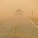
Fog/Mist

67°F

19°C

Humidity 93%
Wind Speed Calm
Barometer 29.99 in (1016.5 mb)
Dewpoint 65°F (18°C)
Visibility 6.00 mi
Last update 6 Jun 4:52 am EDT
Extended Forecast for

3 Miles NNW Charlotte NC

  • Today

    Today: Patchy fog before 9am.  Otherwise, mostly sunny, with a high near 90. Light west northwest wind.

    High: 90 °F

    Patchy Fog
    then Mostly
    Sunny

  • Tonight

    Tonight: A 20 percent chance of showers and thunderstorms before 1am.  Mostly cloudy, with a low around 70. Calm wind.

    Low: 70 °F

    Slight Chance
    T-storms

  • Saturday

    Saturday: A slight chance of showers between noon and 2pm, then a chance of showers and thunderstorms after 2pm.  Mostly sunny, with a high near 90. West southwest wind 3 to 8 mph.  Chance of precipitation is 40%. New rainfall amounts of less than a tenth of an inch, except higher amounts possible in thunderstorms.

    High: 90 °F

    Mostly Sunny
    then Chance
    T-storms

  • Saturday Night

    Saturday Night: A chance of showers and thunderstorms.  Mostly cloudy, with a low around 70. West southwest wind around 5 mph becoming calm  in the evening.  Chance of precipitation is 50%. New precipitation amounts of less than a tenth of an inch, except higher amounts possible in thunderstorms.

    Low: 70 °F

    Chance
    T-storms then
    Chance
    Showers

  • Sunday

    Sunday: A chance of showers and thunderstorms before 4pm, then showers likely and possibly a thunderstorm between 4pm and 5pm, then showers and thunderstorms likely after 5pm.  Partly sunny, with a high near 87. West southwest wind 6 to 10 mph, with gusts as high as 21 mph.  Chance of precipitation is 60%.

    High: 87 °F

    Chance
    Showers then
    T-storms
    Likely

  • Sunday Night

    Sunday Night: Showers and thunderstorms likely, mainly before 10pm.  Mostly cloudy, with a low around 67. Chance of precipitation is 60%.

    Low: 67 °F

    T-storms
    Likely then
    Mostly Cloudy

  • Monday

    Monday: Mostly sunny, with a high near 89.

    High: 89 °F

    Mostly Sunny

  • Monday Night

    Monday Night: A 30 percent chance of showers after 2am.  Mostly cloudy, with a low around 70.

    Low: 70 °F

    Mostly Cloudy
    then Chance
    Showers

  • Tuesday

    Tuesday: A chance of showers, then showers likely and possibly a thunderstorm after 2pm.  Mostly cloudy, with a high near 86. Chance of precipitation is 60%.

    High: 86 °F

    Showers
    Likely

Detailed Forecast

Today
Patchy fog before 9am. Otherwise, mostly sunny, with a high near 90. Light west northwest wind.
Tonight
A 20 percent chance of showers and thunderstorms before 1am. Mostly cloudy, with a low around 70. Calm wind.
Saturday
A slight chance of showers between noon and 2pm, then a chance of showers and thunderstorms after 2pm. Mostly sunny, with a high near 90. West southwest wind 3 to 8 mph. Chance of precipitation is 40%. New rainfall amounts of less than a tenth of an inch, except higher amounts possible in thunderstorms.
Saturday Night
A chance of showers and thunderstorms. Mostly cloudy, with a low around 70. West southwest wind around 5 mph becoming calm in the evening. Chance of precipitation is 50%. New precipitation amounts of less than a tenth of an inch, except higher amounts possible in thunderstorms.
Sunday
A chance of showers and thunderstorms before 4pm, then showers likely and possibly a thunderstorm between 4pm and 5pm, then showers and thunderstorms likely after 5pm. Partly sunny, with a high near 87. West southwest wind 6 to 10 mph, with gusts as high as 21 mph. Chance of precipitation is 60%.
Sunday Night
Showers and thunderstorms likely, mainly before 10pm. Mostly cloudy, with a low around 67. Chance of precipitation is 60%.
Monday
Mostly sunny, with a high near 89.
Monday Night
A 30 percent chance of showers after 2am. Mostly cloudy, with a low around 70.
Tuesday
A chance of showers, then showers likely and possibly a thunderstorm after 2pm. Mostly cloudy, with a high near 86. Chance of precipitation is 60%.
Tuesday Night
Showers likely and possibly a thunderstorm before 9pm, then a chance of showers and thunderstorms between 9pm and 2am, then a chance of showers after 2am. Mostly cloudy, with a low around 68. Chance of precipitation is 60%.
Wednesday
A 40 percent chance of showers and thunderstorms. Mostly cloudy, with a high near 84.
Wednesday Night
A 30 percent chance of showers and thunderstorms. Mostly cloudy, with a low around 67.
Thursday
A 30 percent chance of showers and thunderstorms. Partly sunny, with a high near 87.
Basemap Options
Click map to change the forecast location
Loading map...

ABOUT THIS FORECAST

 
Point Forecast:
3 Miles NNW Charlotte NC
 35.23°N 80.87°W (Elev. 650 ft)
3:08 am EDT Jun 6, 2025
5am EDT Jun 6, 2025-6pm EDT Jun 12, 2025
 
Get as KML Get as XML

Additional Resources

Radar & Satellite Image

Link to Local Radar Data Link to Satellite Data

Hourly Weather Forecast

National Digital Forecast Database