Heavy Rainfall and Severe Thunderstorms in the Midwest and Ohio Valley Tuesday

Multiple rounds of severe thunderstorms appear likely Tuesday across the Midwest and Ohio Valley, with severe wind gusts in excess of 75 mph as the primary threat. Heavy to excessive rainfall may lead to considerable flash and urban flooding impacts Tuesday across portions of the Ohio Valley. A Moderate Risk (level 3 of 4) of excessive rainfall has been issued. Read More >

Current conditions at

082W04010RWS1RHS at Cemetry Ln Aspen (CO100)

Lat: 39.19571°NLon: 106.83597°WElev: 7936.0ft.

NA

71°F

22°C

Humidity 38%
Wind Speed E 2 MPH
Barometer NA
Dewpoint 44°F (7°C)
Visibility 12.43 mi
Last update 10 Aug 09:11 PM MDT
Extended Forecast for

6 Miles WNW Crested Butte CO

  • Tonight

    Tonight: A 20 percent chance of showers before midnight.  Partly cloudy, with a low around 49. North northeast wind around 5 mph becoming calm  after midnight.

    Low: 49 °F

    Slight Chance
    Showers then
    Partly Cloudy

  • Tuesday

    Tuesday: A 30 percent chance of showers and thunderstorms, mainly after 3pm.  Mostly sunny, with a high near 63. Calm wind becoming west northwest around 5 mph in the afternoon.

    High: 63 °F

    Mostly Sunny
    then Chance
    T-storms

  • Tuesday Night

    Tuesday Night: A 30 percent chance of showers and thunderstorms before midnight.  Partly cloudy, with a low around 49. Northwest wind around 5 mph becoming east northeast after midnight.

    Low: 49 °F

    Chance
    T-storms then
    Partly Cloudy

  • Wednesday

    Wednesday: Showers and possibly a thunderstorm after noon.  High near 60. Calm wind becoming west around 5 mph.  Chance of precipitation is 90%.

    High: 60 °F

    Mostly Sunny
    then T-storms

  • Wednesday Night

    Wednesday Night: A chance of showers and thunderstorms before midnight, then a slight chance of showers.  Mostly cloudy, with a low around 46. South wind around 5 mph becoming calm  in the evening.  Chance of precipitation is 50%.

    Low: 46 °F

    Chance
    T-storms then
    Slight Chance
    Showers

  • Thursday

    Thursday: A chance of showers before 9am, then a chance of showers and thunderstorms between 9am and noon, then showers and possibly a thunderstorm after noon.  High near 53. Chance of precipitation is 80%.

    High: 53 °F

    Chance
    Showers then
    T-storms

  • Thursday Night

    Thursday Night: Showers and possibly a thunderstorm before midnight, then a chance of showers.  Low around 45. Chance of precipitation is 80%.

    Low: 45 °F

    Showers then
    Chance
    Showers

  • Friday

    Friday: Showers and thunderstorms likely, mainly after noon.  Mostly cloudy, with a high near 53.

    High: 53 °F

    Chance
    Showers then
    T-storms
    Likely

  • Friday Night

    Friday Night: A chance of showers and thunderstorms before midnight.  Mostly cloudy, with a low around 44.

    Low: 44 °F

    Chance
    T-storms then
    Mostly Cloudy

Detailed Forecast

Tonight
A 20 percent chance of showers before midnight. Partly cloudy, with a low around 49. North northeast wind around 5 mph becoming calm after midnight.
Tuesday
A 30 percent chance of showers and thunderstorms, mainly after 3pm. Mostly sunny, with a high near 63. Calm wind becoming west northwest around 5 mph in the afternoon.
Tuesday Night
A 30 percent chance of showers and thunderstorms before midnight. Partly cloudy, with a low around 49. Northwest wind around 5 mph becoming east northeast after midnight.
Wednesday
Showers and possibly a thunderstorm after noon. High near 60. Calm wind becoming west around 5 mph. Chance of precipitation is 90%.
Wednesday Night
A chance of showers and thunderstorms before midnight, then a slight chance of showers. Mostly cloudy, with a low around 46. South wind around 5 mph becoming calm in the evening. Chance of precipitation is 50%.
Thursday
A chance of showers before 9am, then a chance of showers and thunderstorms between 9am and noon, then showers and possibly a thunderstorm after noon. High near 53. Chance of precipitation is 80%.
Thursday Night
Showers and possibly a thunderstorm before midnight, then a chance of showers. Low around 45. Chance of precipitation is 80%.
Friday
Showers and thunderstorms likely, mainly after noon. Mostly cloudy, with a high near 53.
Friday Night
A chance of showers and thunderstorms before midnight. Mostly cloudy, with a low around 44.
Saturday
A chance of showers and thunderstorms, mainly after noon. Partly sunny, with a high near 54.
Saturday Night
Mostly cloudy, with a low around 44.
Sunday
A chance of showers and thunderstorms. Mostly sunny, with a high near 56.
Sunday Night
Partly cloudy, with a low around 45.
Monday
A chance of showers and thunderstorms. Partly sunny, with a high near 57.
Basemap Options
Click map to change the forecast location
Loading map...

ABOUT THIS FORECAST

 
Point Forecast:
6 Miles WNW Crested Butte CO
 38.91°N 107.08°W (Elev. 11198 ft)
6:56 pm MDT Aug 10, 2026
9pm MDT Aug 10, 2026-6pm MDT Aug 17, 2026
 
Get as KML Get as XML

Additional Resources

Radar & Satellite Image
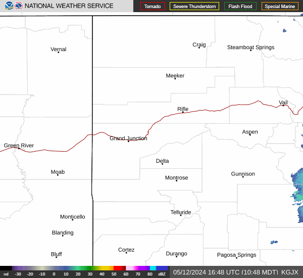
Link to Local Radar Data Link to Satellite Data

Hourly Weather Forecast

National Digital Forecast Database