Extreme Heat and Tropical Storm Bertha Impacts

Dangerous heat will expand from the Gulf Coast into the Southern Plains and Desert Southwest through week's end. Additional extreme heat impacting the Pacific Northwest will shift to the northern Plains by the weekend. Tropical Storm Bertha is expected to continue to impact portions of the northern Gulf Coast from the western Florida Panhandle to southeastern Louisiana through tonight. Read More >

Hazardous Weather Conditions

Current conditions at

082W04010RWS1RHS at Cemetry Ln Aspen (CO100)

Lat: 39.19571°NLon: 106.83597°WElev: 7936.0ft.

NA

62°F

17°C

Humidity 87%
Wind Speed S 4 MPH
Barometer NA
Dewpoint 58°F (14°C)
Visibility 3.80 mi
Last update 22 Jul 09:22 PM MDT
Extended Forecast for

6 Miles NE Mount Crested Butte CO

Flood Watch July 22, 09:40pm until July 23, 03:00am
Click here for hazard details and duration
Flood Watch
  •  
    Flood Watch July 22, 09:40pm until July 23, 03:00am

    NOW until 3:00am Thu

    Flood Watch

  • Tonight

    Low: 48 °F

    Showers
    Likely

  • Thursday

    Thursday: Showers and possibly a thunderstorm before 3pm, then showers and thunderstorms likely, mainly between 3pm and 5pm.  High near 58. West wind 5 to 10 mph.  Chance of precipitation is 80%.

    High: 58 °F

    Showers
    Likely then
    T-storms

  • Thursday Night

    Thursday Night: A 40 percent chance of showers and thunderstorms before midnight.  Partly cloudy, with a low around 47. North northwest wind 5 to 10 mph.

    Low: 47 °F

    Chance
    T-storms then
    Partly Cloudy

  • Friday

    Friday: A 30 percent chance of showers and thunderstorms after noon.  Mostly sunny, with a high near 64. Northwest wind 5 to 10 mph.

    High: 64 °F

    Sunny then
    Chance
    T-storms

  • Friday Night

    Friday Night: A slight chance of showers and thunderstorms before 9pm, then a slight chance of showers between 9pm and midnight.  Partly cloudy, with a low around 50. Northwest wind 5 to 10 mph becoming south in the evening.  Chance of precipitation is 20%.

    Low: 50 °F

    Slight Chance
    T-storms then
    Partly Cloudy

  • Saturday

    Saturday: Showers and thunderstorms likely after noon.  Mostly sunny, with a high near 66. Chance of precipitation is 60%.

    High: 66 °F

    Sunny then
    T-storms
    Likely

  • Saturday Night

    Saturday Night: A 20 percent chance of showers and thunderstorms before midnight.  Mostly cloudy, with a low around 51.

    Low: 51 °F

    Slight Chance
    T-storms then
    Partly Cloudy

  • Sunday

    Sunday: Showers and thunderstorms likely after noon.  Mostly sunny, with a high near 67.

    High: 67 °F

    Sunny then
    T-storms
    Likely

Detailed Forecast

Tonight
Showers likely and possibly a thunderstorm before 1am, then a chance of showers and thunderstorms between 1am and 3am, then a chance of showers after 3am. Mostly cloudy, with a low around 48. Southwest wind 5 to 10 mph. Chance of precipitation is 60%.
Thursday
Showers and possibly a thunderstorm before 3pm, then showers and thunderstorms likely, mainly between 3pm and 5pm. High near 58. West wind 5 to 10 mph. Chance of precipitation is 80%.
Thursday Night
A 40 percent chance of showers and thunderstorms before midnight. Partly cloudy, with a low around 47. North northwest wind 5 to 10 mph.
Friday
A 30 percent chance of showers and thunderstorms after noon. Mostly sunny, with a high near 64. Northwest wind 5 to 10 mph.
Friday Night
A slight chance of showers and thunderstorms before 9pm, then a slight chance of showers between 9pm and midnight. Partly cloudy, with a low around 50. Northwest wind 5 to 10 mph becoming south in the evening. Chance of precipitation is 20%.
Saturday
Showers and thunderstorms likely after noon. Mostly sunny, with a high near 66. Chance of precipitation is 60%.
Saturday Night
A 20 percent chance of showers and thunderstorms before midnight. Mostly cloudy, with a low around 51.
Sunday
Showers and thunderstorms likely after noon. Mostly sunny, with a high near 67.
Sunday Night
A chance of showers and thunderstorms before midnight. Mostly cloudy, with a low around 50.
Monday
Showers and thunderstorms likely after noon. Partly sunny, with a high near 66.
Monday Night
Showers likely and possibly a thunderstorm. Mostly cloudy, with a low around 50.
Tuesday
Showers and possibly a thunderstorm. Partly sunny, with a high near 64.
Tuesday Night
Showers likely and possibly a thunderstorm. Mostly cloudy, with a low around 48.
Wednesday
Showers and thunderstorms likely. Partly sunny, with a high near 64.
Basemap Options
Click map to change the forecast location
Loading map...

ABOUT THIS FORECAST

 
Point Forecast:
6 Miles NE Mount Crested Butte CO
 38.97°N 106.89°W (Elev. 12841 ft)
4:59 pm MDT Jul 22, 2026
9pm MDT Jul 22, 2026-6pm MDT Jul 29, 2026
 
Get as KML Get as XML

Additional Resources

Radar & Satellite Image
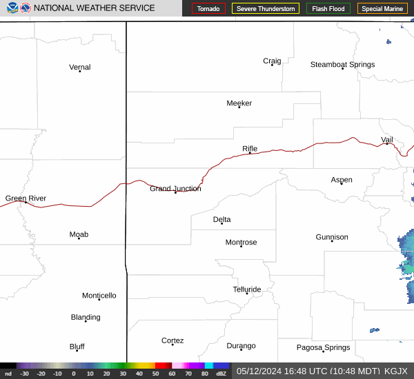
Link to Local Radar Data Link to Satellite Data

Hourly Weather Forecast

National Digital Forecast Database