


Hazardous Weather Conditions

Current conditions at
Cherry Capital Airport (KTVC)
Lat: 44.74° N Lon: 85.57° W Elev: 604 ft.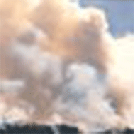
Smoke
84°F
29°C
| Humidity | 65% |
| Wind Speed | SW 5 mph |
| Barometer | 29.85 in (1010.5 mb) |
| Dewpoint | 71°F (22°C) |
| Visibility | 2.00 mi |
| Heat Index | 89°F (32°C) |
| Last update | 17 Jul 7:53 pm EDT |
Detailed forecast for
Benzie County
Tonight
Patchy smoke early. Partly cloudy early, then mostly cloudy with rain showers likely and slight chance of thunderstorms after midnight. Lows in the lower 70s. Southwest winds 10 to 15 mph with gusts to around 25 mph. Chance of precipitation 60 percent.
Saturday
Partly sunny. Patchy smoke through the day. Highs in the mid 70s. North winds 10 to 20 mph with gusts to around 30 mph.
Saturday Night
Mostly clear. Cooler, smoke. Lows in the upper 50s. North winds up to 10 mph. Gusts up to 25 mph early.
Sunday
Mostly sunny. Smoke early. Highs around 80. Northwest winds up to 10 mph.
Sunday Night
Mostly clear. Lows in the lower 60s. South winds up to 10 mph. Gusts up to 20 mph after midnight.
Monday
Light rain showers likely and chance of thunderstorms. Highs in the lower 80s. Chance of precipitation 70 percent.
Monday Night
Rain showers and chance of thunderstorms. Lows in the mid 60s.
Tuesday
Partly sunny with chance of rain showers. Highs in the upper 70s. Chance of showers 30 percent.
Tuesday Night
Partly cloudy with chance of rain showers. Lows in the upper 50s. Chance of showers 30 percent.
Wednesday
Mostly sunny. Highs in the lower 70s.
Wednesday Night
Mostly clear. Lows in the upper 50s.
Thursday
Mostly sunny. Highs in the upper 70s.
Thursday Night
Mostly clear. Lows around 60.
Friday
Mostly sunny. Highs in the upper 70s.
Basemap Options
Click map to change the forecast location
Loading map...
Additional Resources
Radar & Satellite Image


Hourly Weather Forecast


